Moab outfitters adapt as low Colorado River exposes rocks and hazards
Moab guides say the Colorado River is so low people can stand on the river bottom, forcing smaller boats, slower runs and tougher booking decisions.

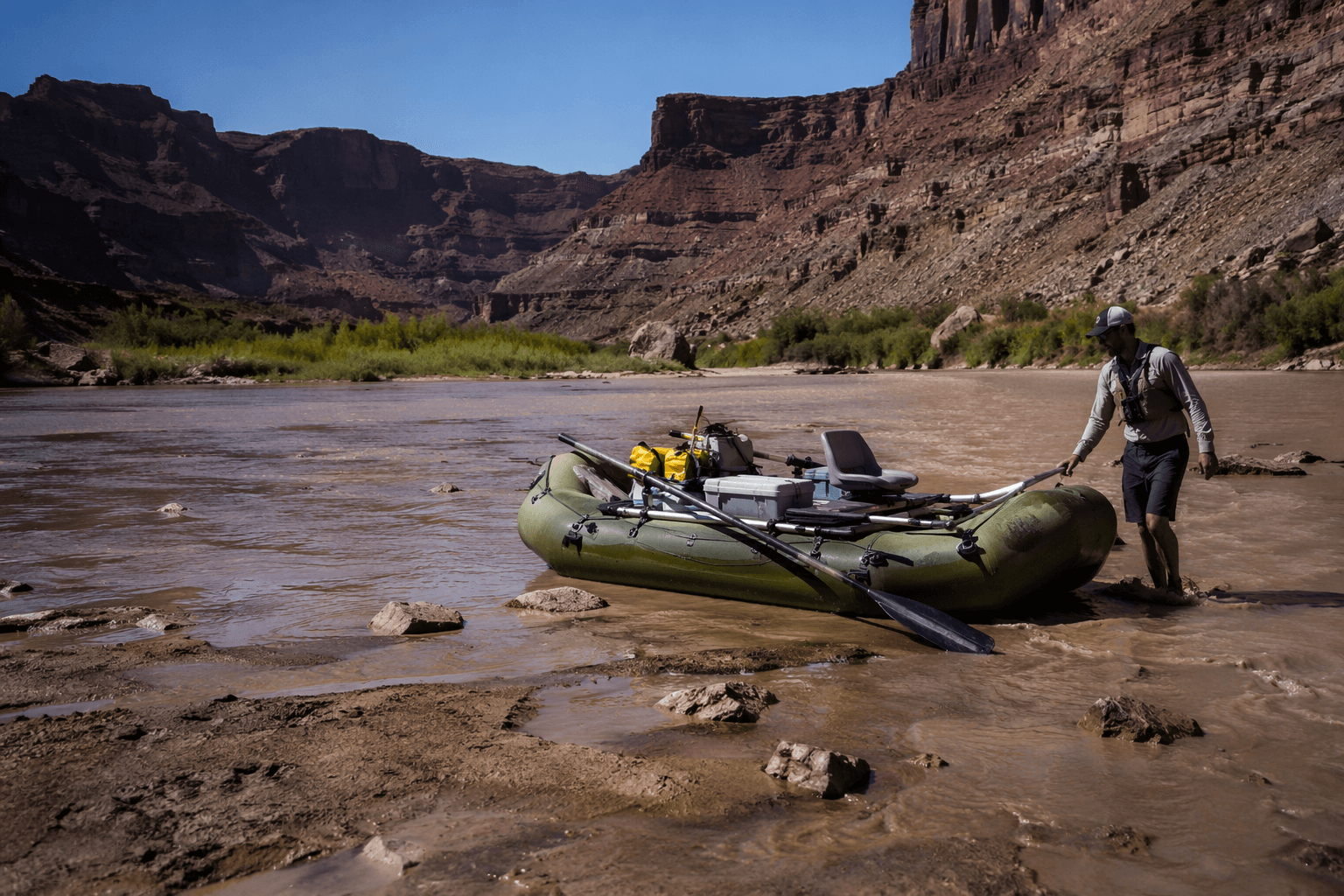
People can stand in places on the Colorado River near Moab where water should be moving around them, and guides say that is changing everything about a day on the water.
Jaidyn Thomas, who returned to river guiding in April 2026, said the river was at the lowest levels she has seen in her lifetime and described it as “a lot more rocky.” She warned that one of the biggest dangers now is standing on the river bottom itself, where exposed rocks and shallow channels can turn a routine float into a harder, rougher run. For outfitters, that means more cautious route choices, slower travel, different launch and landing decisions, and more time spent explaining hazards that were not part of the trip in higher-water years.
Moab City Councilor Jason Taylor, who is operations manager for Western River Expeditions, said outfitters are in a holding pattern over what boats to use. At lower water, smaller boats may be needed, and that can mean more guides on a trip. For visitors booking rafting or paddle trips, the practical questions have changed: ask what craft the company is using, whether the route has been shortened or slowed by rocks, whether portages are likely, and whether the trip still fits younger paddlers, first-timers, or anyone who is uncomfortable in technical water. A classic Moab river day can still happen, but it may not look the way it did in a higher-flow season.
The low water is part of a much bigger drought picture across the Colorado River Basin. NOAA’s Colorado Basin River Forecast Center listed Cataract Canyon at about 7,900 cfs and the Colorado River at Westwater at about 3,200 cfs on May 27, 2026. Drought.gov reported that as of May 19, 2026, 95.18% of the basin was in drought, including 46.28% in severe drought and 27.82% in extreme drought. In April, the Bureau of Reclamation said Colorado River system storage had fallen to about 36% of capacity, after the basin’s lowest snowpack on record and record-breaking March heat.
Reclamation also said key Colorado River operating documents and agreements are set to expire at the end of 2026, which makes the river’s low, rocky run near Moab part of a larger management test. For anyone heading out this season, the signal is simple: the river is still open, but the trip you booked may need to match the river that is actually there.
This article was produced by Prism’s automated news system from verified source data, official records, and press releases, then run through automated quality and moderation checks before publishing. The system is built and supervised by the people who set the standards it runs under. Read our full AI policy.
Know something we missed? Have a correction or additional information?
Submit a Tip