AllTrails maps Arizona’s tough Highline Trail, a Rim Country challenge
AllTrails maps the Highline as a serious Rim Country traverse, 63.9 miles of heat, water planning, and shuttle logistics for hikers who want solitude over bragging rights.

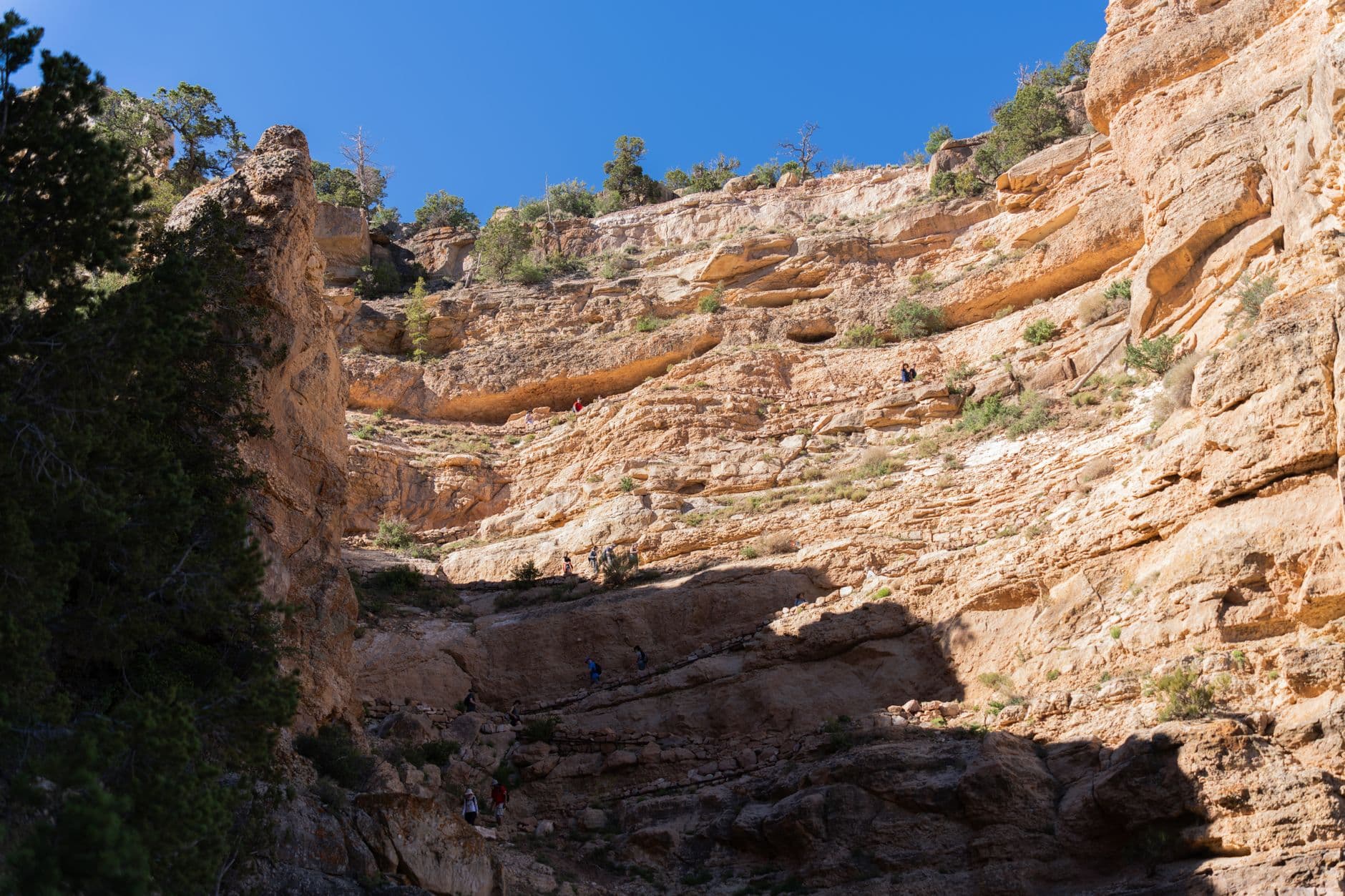
If you want Arizona long-distance hiking without the marquee-name crowds, the Highline Trail asks you to show up prepared. AllTrails places the route at 63.9 miles, 6,069 feet of elevation gain, a hard difficulty rating, and 24 hours or more of estimated time, which makes this a backpacking route or endurance effort, not a casual out-and-back. The real consequence is simple: on the Highline, your fitness, your water math, and your shuttle plan matter as much as your map.
A Rim Country route that feels remote on purpose
The Highline runs through Arizona’s Rim Country beneath the Mogollon Rim, a landscape the Forest Service describes as a roughly 200-mile-long cliff and rim system that rises and falls between about 5,000 and 7,000 feet. That elevation range gives the trail its character, with ponderosa pine forests, juniper and manzanita brush, rugged rock formations, and long views that can feel surprisingly far from the state’s better-known travel corridors. The Payson Ranger District, just outside the Phoenix metro area, includes the East Verde River and the Highline Trail, and the Tonto National Forest says the whole forest holds nearly 900 miles of National Forest System trails.
That scale is exactly why adventure travelers keep coming back to Rim Country. The Highline is not trying to be a celebrity route, and that is part of the appeal. If you want solitude, a genuine backcountry rhythm, and a trip that feels stitched into the geography instead of marketed around it, this trail delivers the kind of immersion that the bigger-name Arizona hikes often cannot.
What the trail demands from you
AllTrails’ numbers tell the story before the scenery does. A 63.9-mile point-to-point route with more than 6,000 feet of climbing asks for multi-day conditioning, steady pacing, and a real plan for resupply or water carry strategy. The page also notes perennial creeks and springs along the route, and those water sources are a major part of why the Highline can be done safely in warm weather, but only if you know where they are and do not assume every source will be flowing the same way from one season to the next.
Most hikers tackle the Highline east to west, starting at the Two-Sixty Trailhead and finishing near Pine. That direction gives the route a strong point-to-point feel and pushes shuttle logistics into the foreground. You are not just picking a trailhead and turning around when you feel like it, you are planning vehicle support, timing, and a finish in or near Pine before you ever leave home.
The terrain is part forest walk, part endurance test
The appeal of the Highline comes from the contrast built into the corridor. The route passes through dense ponderosa forest, then slides into sections of juniper, manzanita, and rocky ground shaped by geology and fire. It also offers wildflowers, wildlife, forests, rivers, and Rim Country views, which is why it reads like a scenic route on paper even though the day-to-day reality can be hot, dry, and unforgiving.
That mix is also what makes the trail such a serious test. A hiker can be surrounded by classic Arizona beauty and still be dealing with long mileage, exposed sections, and trail conditions that shift with recent fire activity and seasonal dryness. The Highline does not reward impatience. It rewards restraint, patience, and the ability to keep moving when the landscape looks inviting enough to fool you into underestimating it.
A trail with a long local backstory
The Highline’s history gives it a different feel from many modern recreation routes. Wild Arizona says it began as a roughly 51-mile path used to travel between homesteads and attend school in Pine, which explains why it still carries the feeling of a working corridor rather than a purely scenic one. In the 1930s, the Civilian Conservation Corps built Forest Road 64, and that shift reduced the trail’s day-to-day utility before the route was later designated the Highline National Recreation Trail in 1978.
That evolution matters because it shows the trail is not just a product of recreation branding. It is a piece of Rim Country transportation history that was later adapted for hikers, runners, and backpackers. Arizona Trail materials add another layer to that story: Passage 26 follows the Highline National Recreation Trail for 17 miles, crossing numerous drainages and springs through juniper, manzanita, oak, pine, and fir. The route’s place in the Arizona Trail system helps explain why experienced desert travelers keep it on the list.
Stewardship is part of the Highline story
The trail is also an active management project, not a frozen legacy path. In September 2021, Tonto National Forest officials announced plans, with the Rim Country Trails Working Group, to reroute portions of the Highline and nearby stretches of the Arizona National Scenic Trail and Pine and Strawberry trails onto more sustainable alignments. Local reporting at the time said community groups and stakeholders had been pushing for those improvements, especially around the Payson area.
That work is a reminder that the Highline’s future depends on erosion control, safety, and long-term trail health. The route may feel wild, but it is being shaped by a mix of public agency decisions and local trail advocacy from groups like the Arizona Trail Association and the Rim Country Mountain Biking Association. For hikers, that means the corridor you step onto is both historic and evolving.
How to plan the trip now
The practical starting points are clear. The Two-Sixty Trailhead and Pine Trailhead are both listed as open on the Payson Ranger District trail pages, and the Forest Service says recreation conditions can change quickly, so checking current conditions before departure is part of responsible planning. As of mid-May 2026, Tonto National Forest listed Stage 1 fire restrictions in effect, which reinforces how important it is to think about heat, ignition risk, and water before a summer attempt.
For travelers looking beyond the state’s most famous routes, that is exactly what makes the Highline compelling. It is long enough to feel like a real expedition, remote enough to reward self-sufficiency, and rooted enough in Rim Country history to feel meaningful beyond the mileage. The crowded trailhead energy of better-known Arizona destinations disappears quickly here, replaced by the practical work of moving through ponderosa shade, spring to spring, from the Two-Sixty Trailhead toward Pine.
This article was produced by Prism’s automated news system from verified source data, official records, and press releases, then run through automated quality and moderation checks before publishing. The system is built and supervised by the people who set the standards it runs under. Read our full AI policy.
Did this article answer your question?


