Leave No Trace Backcountry Planning Tips for Southwest Colorado and Utah
Running out of water on a Southwest backpacking trip isn't bad luck; it's a math problem you can solve before you leave the trailhead. Here's the exact planning framework for three classic multi-day routes.
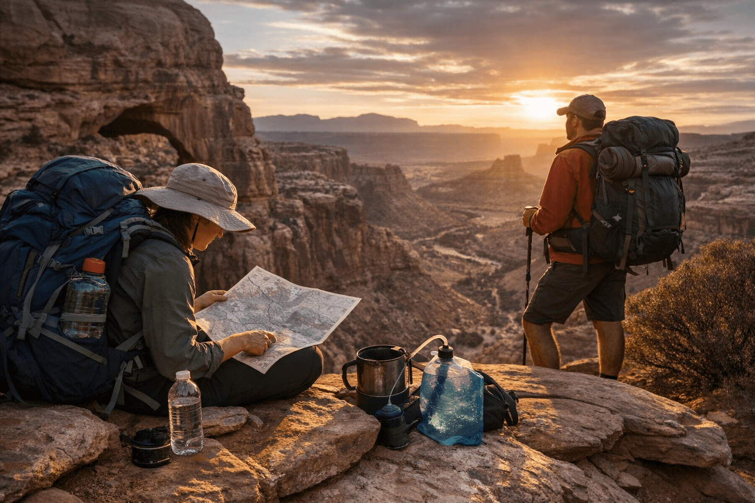
Three miles into a mid-July canyon descent, your water bottle hits half-empty and the next marked source is six miles out. That moment, more than any gear failure, is where Southwest backcountry trips go sideways. The good news is that moment is entirely preventable with honest pre-trip math, a firm grip on Leave No Trace fundamentals, and a planning process calibrated to the specific terrain you're walking into.
This guide builds that process around three archetypes that cover most multi-day routes across Southwest Colorado and Utah: the canyon backpack, the desert traverse, and the high-elevation shoulder-season loop. Each has its own water calculus, its own permit rhythm, and its own set of bailout realities.
The Water Reality Check
Before you touch an itinerary, run the numbers. In desert conditions, at least 1 liter per hour is a solid baseline for active hiking. But that number shifts sharply with season and elevation. In warm months at inner-canyon elevations, each hiker should plan on roughly a gallon (4 liters) of water per day at minimum, and that's a floor, not a target. For shoulder-season and alpine travel, the math is different: fall and spring backpacking typically requires 2-3 quarts per day; hot-weather backpacking pushes to 3-4 quarts; winter backpacking requires 4 or more quarts; and at altitude, add at least 1 additional quart per day.
Here's how that breaks down into a practical planning table:
Water Reality Check: Liters Per Person Per Day
| Route Type | Spring (50-70°F) | Summer (85-100°F) | Fall (40-65°F) | Winter/High Snow |
|---|---|---|---|---|
| Inner canyon (under 4,000 ft) | 4-5L | 6L+ | 4-5L | 3-4L |
| Mid-elevation desert (4,000-7,000 ft) | 3-4L | 5-6L | 3-4L | 2-3L |
| High elevation (above 10,000 ft) | 4L+ | 4L+ | 3-4L | 3-4L+ |
The research notes from the Leave No Trace Center and NPS reinforce this: carry at least one extra liter per person for every 2-3 hours of expected exertion in hot, dry canyons, and confirm the status of every trailhead or park tap before departure. NPS notices regularly flag which water stations are offline during drought or infrastructure repairs.
Chlorine dioxide is effective against bacteria, viruses, and Cryptosporidium, though it requires up to four hours to inactivate Cryptosporidium; plan on treating approximately 0.5 liters per hour per person when using this method. Always stack treatment methods: carry a filter as primary and chemical tabs as backup. In Southwest springs and potholes, particulate matter can clog a filter without warning.
Itinerary 1: The Canyon Backpack (Coyote Gulch / Escalante, Utah)
A classic 4-5 day loop through the Grand Staircase-Escalante National Monument covers roughly 35-40 miles and drops you through slot canyons, arches, and sandstone benches. The Coyote Gulch drainage holds reliable water through most of spring and fall, but summer stretches between sources can hit 8-10 miles of exposed sandstone.
*Planning math:* With a 1-liter-per-hour baseline and 6-8 hours of daily hiking in summer, your carry load should be 7-10 liters between sources. That's not practical to carry all day. The fix is a source-by-source segment plan: map every known spring, pothole, and creek crossing before departure, note which are seasonal (and likely dry by July), and build your mileage targets around water availability rather than distance preference.
*Permits and logistics:* Grand Staircase-Escalante requires no overnight backcountry permit for most areas (check current BLM regulations, as management plans evolve), but group size restrictions apply. File a self-registration form at the trailhead. Bailout options are limited: once inside Coyote Gulch, the nearest road access is Hurricane Wash or Red Well Trailhead. Know both, and carry a satellite communicator because cell coverage is non-existent.
*LNT focus:* Desert sandstone crusts (biological soil crust, or "cryptobiotic crust") take decades to recover from footsteps. Walk on rock or sand, never on the dark, bumpy crust. Set camps on established sandy sites, not on vegetated benches.
Itinerary 2: The Desert Traverse (Grand Canyon Inner-Canyon Corridor)
A point-to-point inner-canyon route from the South Rim to the North Rim covers 21-24 miles depending on your line, with nearly all of it below the rim at elevations between 2,500 and 8,000 feet. This is the most water-critical terrain in the Southwest.
*Planning math:* In warm months, each hiker should carry and drink about a gallon (4 liters) of water per day, but in peak summer that number climbs fast. Rangers recommend pre-hydrating, hiking before 10 a.m. and after 4 p.m., and treating this as a multi-day effort with mandatory midday rest. Plan 3-liter carry capacity minimum between Bright Angel Creek and Indian Garden (now Havasupai Gardens), two reliable sources, with backup chemical treatment for side canyon seeps.
*Permits and logistics:* Grand Canyon backcountry permits are required for all overnight use and are obtained through the Backcountry Information Center. Applications open four months before your trip month and fill quickly. The corridor zone (Bright Angel, North and South Kaibab, River Trail) is the most accessible for bailout: ranger stations at Phantom Ranch and Havasupai Gardens offer emergency support. The Tonto Trail network provides alternate routing but dramatically reduces bailout access.
*LNT focus:* The inner canyon is a pack-out zone for human waste along many off-corridor routes. Carry a WAG bag system and know the local rules before you descend. Catholes are only permitted where the soil layer is deep enough, which is rare in canyon-bottom geology.
Itinerary 3: The High-Elevation Shoulder-Season Loop (Weminuche Wilderness, Colorado)
The Weminuche is Colorado's largest wilderness area, with most routes running above 11,000 feet. A 5-7 day loop through the Needle Mountains or the Chicago Basin area covers 40-55 miles of alpine terrain with significant snow potential in May-June and September-October.
*Planning math:* At altitude, add at least 1 quart per day above standard consumption estimates to account for increased respiratory moisture loss. Shoulder-season shoulder-season travel here often means crossing snowfields that can be water sources if you have a stove for melting, but those same snowfields hide trails and cairns. GPS waypoints are non-negotiable.
*Permits and logistics:* No overnight permit is required for the Weminuche (as of current USFS policy, though this is evolving for high-use drainages like Chicago Basin). Group size is limited to 15 people/livestock. The Durango and Silverton Narrow Gauge Railroad offers a seasonal trailhead drop at Needleton and Elk Park, making a linear traverse practical. This also creates a built-in bailout: the train stops on flag request at both stations.
*LNT focus:* Alpine tundra above treeline is as fragile as desert crust. Camp on snow or bare rock when possible; avoid camping on tundra vegetation. Fires are prohibited above 11,500 feet in the Weminuche; a stove is required for all cooking.
Trip Preparation: The Planning Sequence
Regardless of which route you're running, the Leave No Trace principle of "Plan Ahead and Prepare" is the highest-leverage step. Here's the sequence that applies to every Southwest multi-day trip:
1. Pull the current land-management page (NPS, BLM, or USFS) for your specific route and check for closures, water station status, and fire restrictions within 2 weeks of departure.
2. Confirm permit requirements and deadlines. Many Southwest permits (Grand Canyon, Coyote Buttes, Havasupai) require lottery entries months in advance.
3. Map your water sources with seasonal reliability ratings and calculate your carry volume for each segment.
4. Identify at least two bailout options per day of travel, and share your full itinerary with an emergency contact who knows when to call for help.
5. Carry a satellite communicator or Personal Locator Beacon. Cell coverage is intermittent across most Southwest backcountry corridors, and a PLB may be the difference in a real emergency.
Packing and Permits Checklist (Reusable)
Print this before every trip and update it based on your specific route's land-management rules.
- Planning (6-12 weeks out):*
- Permits secured (lottery, first-come, or advance reservation as required)
- Land-management page checked for closures and water advisories
- Group size confirmed at or below area maximum
- Emergency contact briefed with full itinerary and check-in schedule
- Water and waste:*
- Primary water filter plus backup chemical treatment
- Carry capacity calculated per segment (use table above)
- WAG bags or cathole plan confirmed against local regulations
- Trowel (for catholes where permitted: 6-8 inches deep, 200 feet from water/trails/campsites)
- Toilet paper packed out in double-sealed bags
- Navigation and safety:*
- Downloaded offline maps plus paper topo for key segments
- GPS device or satellite communicator (charged and tested)
- First-aid kit with blister care, electrolyte packets, and SAM splint
- Bailout routes marked and memorized for each day
- Camp and LNT:*
- Camp stove and fuel (fires prohibited in many Southwest zones)
- Bear canister or approved hang system where required
- All food and scented items secured overnight and during rest stops
- Leave-no-trace sweep of campsite before departure
Why This Matters Now
Visitation to iconic Southwest routes is at record levels. When groups arrive unprepared for water scarcity or waste management, the ripple effects are real: contaminated springs, damaged soils, and the accelerating likelihood of permit caps, timed entries, and seasonal closures that restrict access for everyone. Rigorous pre-trip planning isn't just a personal safety measure; it's the most direct contribution any individual traveler can make to keeping these corridors open.
The math isn't complicated. The planning isn't glamorous. But showing up to a canyon rim with the right water capacity, the right permits, and a clear bailout plan is the single most consequential choice you'll make on any Southwest backcountry trip.
This article was produced by Prism’s automated news system from verified source data, official records, and press releases, then run through automated quality and moderation checks before publishing. The system is built and supervised by the people who set the standards it runs under. Read our full AI policy.
Did this article answer your question?


