White River approves access plan for south Tenmile Range trailheads
South Tenmile’s busiest trailheads now have a federal plan for parking, restrooms and trail fixes as annual visits top 237,000.

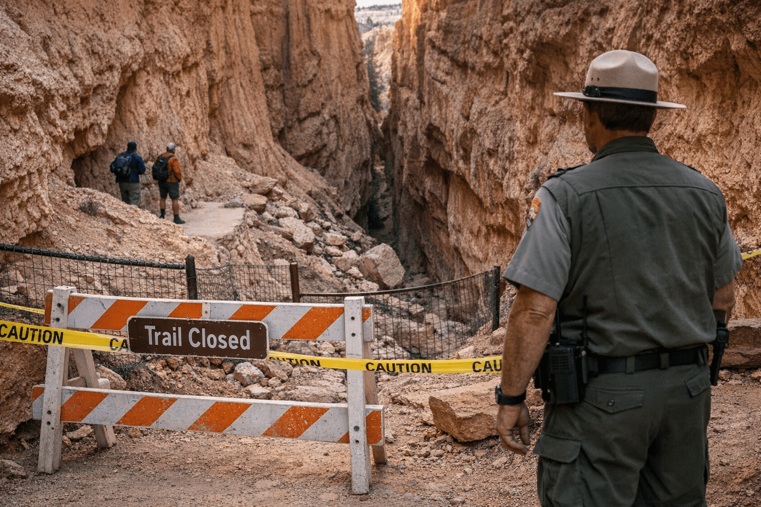
Hikers heading for Quandary Peak, McCullough Gulch, Blue Lakes and Spruce Creek got a new access blueprint on April 14, when White River National Forest approved the Southern Tenmile Recreation Access Plan for the south side of Breckenridge. The first changes are aimed at the basics that matter on a busy trail day: parking lots, restrooms and trail connections at the area’s most crowded entry points.
The Forest Service said the plan was built over two years with Summit County and the Town of Breckenridge, with input from Colorado Springs Utilities, the Town of Blue River, the McDill neighborhood and the Spruce Creek neighborhood. The agency said the southern Tenmile area gets about 237,000 annual visits, a number that has kept climbing, and that most trailheads there are still, in Dillon District Ranger David Ilse’s words, basically “wide spots in the road” without bathrooms or other facilities built for that level of use.
That is why the approval matters on the ground. The first phase could begin as soon as summer 2026, and it focuses on the places most hikers already know by name: Blue Lakes, Quandary Peak, McCullough Gulch and Spruce Creek. The plan calls for improved recreation infrastructure, including parking lots and restrooms, plus trail work meant to repair damaged segments and create a more logical system connecting trails, trailheads and nearby neighborhoods. For people planning a single-day hike, a peak bagging push or a shoulder-season scramble, that should translate into clearer access patterns and less guesswork at the trailhead.
The management side of the story is just as important. Summit County adopted a pilot parking reservation and shuttle system for Quandary Peak and McCullough Gulch in 2021 after big visitation spikes created public-safety problems, including illegal roadside parking that blocked emergency access. The latest planning process drew pushback from some residents and recreation users over the idea of extending shuttle and reservation management, with more than 10 comments at an Aug. 27, 2025 open house expressing discontent. Paige Money said she supported most of the plan but opposed turning access into “a gated experience.”
The southern Tenmile plan also sits inside the larger Camp Hale Continental Divide National Monument landscape, where visitor access and resource protection have to coexist. The Forest Service has said the area is also an important water source for Colorado Springs and Summit County, which helps explain why this approval is more than a trailhead upgrade. It is a long-term reset for one of the busiest alpine access corridors in the Breckenridge backcountry.
Know something we missed? Have a correction or additional information?
Submit a Tip