How to use Alamance County GIS map and tax records
A house search, fence-line dispute, or vacant lot check can start in Alamance County’s GIS map, which ties parcel records, tax data, and historic aerials together.
The fastest way to answer a property question in Alamance County is often the GIS map, not a phone call. If you are checking a house before buying, trying to verify a neighbor dispute, or wondering who owns a vacant lot down the street, the county’s parcel tools can pull together ownership, address, tax, and boundary details in a few clicks.
Start with the parcel search
The county’s default parcel search is built for the questions residents ask first. It can look up owner name, parcel ID, NCPIN, and property address, which makes it useful whether you start with a person, a number, or a street. The search page also gives you room for deed reference book and page, school name, and street name, so you can move from a basic lookup to a more precise property-history check without leaving the map.
That matters for more than simple identification. The site also includes an advanced parcel search, a parcel sales search, a results list, a details panel, and a buffer tool, which turns the map into a working records system rather than a static image. A resident comparing two lots, a buyer checking the chain of ownership, or a neighbor measuring what sits near a property line can use the same platform for different questions.
Use the map like the county expects you to
Alamance County’s GIS help page is plain about how to navigate the site. It tells users to rely on the map’s own navigation instead of the browser back button, and it offers basic controls that make the tool easier to handle once you know them. Drag to pan. Use Shift-click to recenter. Roll the mouse wheel to zoom. Use the arrow keys to pan, and click features on the map to identify them.
The county GIS office is at 124 W. Elm St. in Graham, which gives the system a local anchor that is easy to miss if you only use the online map. The help page also names who to contact for different questions: Dale Jackan for parcel questions, Emily Jones for zoning questions, Katie Harper for addressing questions, and Marlena Isley if you need the director. For a county map that touches taxes, addresses, and land use, that division of labor is part of how the tool actually works.
Read the disclaimer as part of the record
The map carries a clear warning: “THIS WEBSITE IS NOT A LEGAL DOCUMENT.” That line matters because it tells you how far to trust the screen and where to be careful. The county also says it assumes no liability for errors, omissions, or inaccuracies, which is another reminder that the map is a public reference tool, not a substitute for deeds, surveys, or formal legal filings.
That does not make the GIS map less useful. It makes it more honest. The map can show you how the county has organized its parcel data, but if a line looks off, a sale seems missing, or a boundary question could affect a closing or a dispute, the disclaimer is telling you to treat the map as a starting point and not the final word.
Understand how tax records fit into the picture
The Alamance County Tax Department is where assessed values become tax bills. The department assesses real and personal property and vehicles, conducts revaluation of real property, and assures the validity of assessed values of taxable property. It also handles homestead exemptions, business listing and discovery services, nonprofit exemptions, and permits, including mobile home moving permits.
That work is closely tied to the GIS side of county government. GIS manages and maintains online GIS services, works with the Tax Department to keep parcel mapping geospatially accurate, and handles E911 address and street-centerline management across the county and most municipalities. In practice, that means the map is not just showing land. It is helping keep addresses, parcel lines, and tax records aligned so county offices are working from the same geography.
Use the archive to see how the county changed
The public GIS file tree gives the map an archival depth that is rare in a local government tool. It includes aerial imagery from 1938, 1955, 1974, 1984, 1989, 1995, 2000, 2005, 2010, 2014, and 2018. It also includes 1968 and 1970 topographic maps, which add another layer for tracing terrain, roads, and development patterns over time.
For older land-history work, the file tree includes historic tax maps such as Map_1893.pdf and Map_1928.pdf. That makes the system useful for much more than today’s parcel lookup. It can help show how a neighborhood grew, when a lot was subdivided, or how roads and fields gave way to the built landscape that now surrounds them.
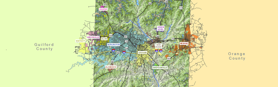
Know what happens at the county line
Boundary questions can turn into tax questions fast, especially where Alamance County meets Guilford County. The county’s 2018 county-line update spells out how those parcels are handled: properties wholly in Alamance are taxed in full by Alamance, properties wholly in Guilford do not receive an Alamance tax bill, and split parcels are billed by both counties for the portion in each county.
That is exactly the kind of issue the GIS system is meant to clarify. Marlena Isley, the county’s Geographic Information Systems Director, is the contact named for county-line GIS questions, which is a useful detail when a parcel sits near a jurisdictional edge or when a resident needs to understand why two counties may both appear in the paperwork.
A practical county records tool
Used well, the GIS map and tax records let you answer questions that come up in everyday county life: who owns a parcel, how it is assessed, where it sits, what surrounds it, and how the land has changed over time. Between the parcel search, the sales and buffer tools, the tax records, and the archive of aerials and historic maps, Alamance County has built a public-records system that can settle a lot of questions before they become disputes.
This article was produced by Prism’s automated news system from verified source data, official records, and press releases, then run through automated quality and moderation checks before publishing. The system is built and supervised by the people who set the standards it runs under. Read our full AI policy.
Did this article answer your question?