Laramie Planning Commission Delays Westside Urban Renewal Plan Amid Blight Concerns
A public fight over blight, eagles, and flood risk has stalled Laramie's Westside urban renewal plan, pushing the commission's next vote to April 27.
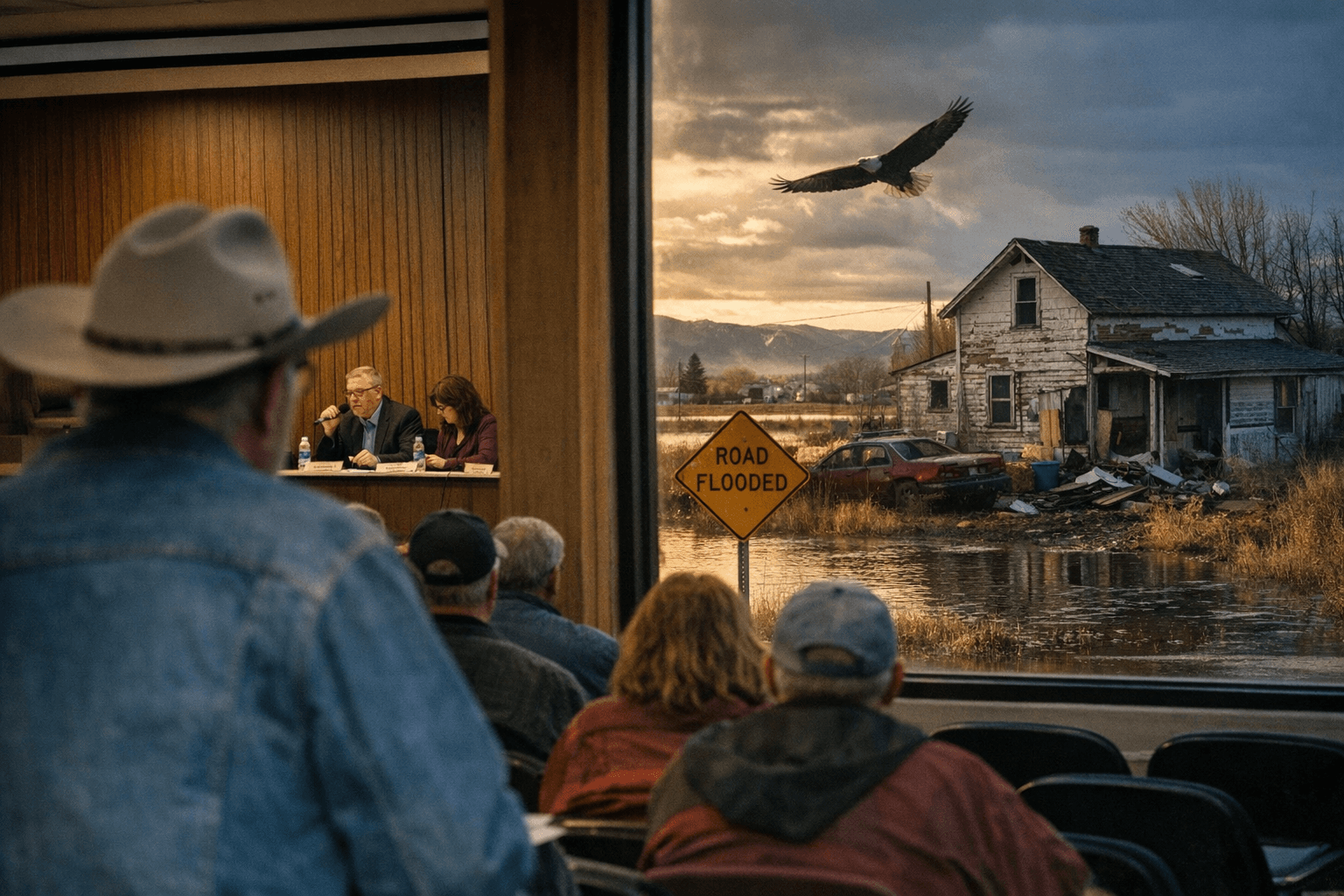
The Laramie Planning Commission voted on March 23 to postpone Resolution 2026-04, the Westside Urban Renewal Plan and Project, after public comment challenged the plan's legal foundation, raised environmental alarms about the Laramie River Greenbelt, and questioned whether tax increment financing should be deployed in the area at all.
The postponement moves the item to the commission's April 27 meeting, where a pending City Council action on a statutory blight designation must align with commission review before the plan can advance. Planning staffer Derek Taney made the recommendation from the floor. "Instead of requesting that you advance or do anything with this item, our recommendation at this point is gonna be to recommend that you postpone this item to the second meeting in April," Taney told commissioners.
At the center of the dispute is whether the Westside area, roughly bounded by Snowy Range Road and West Garfield Street, legally qualifies as blighted under Wyoming law, a threshold that must be cleared before the city can establish an urban renewal district and unlock tax increment financing. TIF allows a municipality to capture future property tax growth within a designated area and redirect it toward redevelopment costs, but it first requires a formal blight finding.
Resident Brett Glass directly challenged that finding. "It is not blighted according to Wyoming law, and hence does not qualify as an urban renewal area," Glass told the commission. The Laramie Urban Renewal Agency had advanced the Westside proposal earlier this spring as a way to encourage redevelopment and add housing units to the West Side, an area that was rezoned in recent months to permit greater residential density.
Conservation advocates added a separate layer of opposition. The Albany County Conservancy and other speakers pressed the commission for species-level wildlife surveys and engineered flood mitigation plans before any blight designation moves forward. Commenters warned that the plan area sits near the Laramie River Greenbelt, a corridor that functions as both wildlife habitat and a buffer against downstream flood risk, and noted that eagle-habitat protections and potential litigation had already been brought to the city's attention.
The postponement effectively freezes the TIF mechanism for the Westside until both the legal and ecological questions are resolved. Developers and the Laramie Urban Renewal Agency will need to hold on project timelines until the City Council acts on the blight designation and the commission has the chance to weigh additional environmental data. April 27 is now the earliest that alignment can occur.
This article was produced by Prism’s automated news system from verified source data, official records, and press releases, then run through automated quality and moderation checks before publishing. The system is built and supervised by the people who set the standards it runs under. Read our full AI policy.
Did this article answer your question?
