WYDOT Imposes Wind-Related Weight Restrictions on I-80 Through Albany County
WYDOT posted wind-related weight closures on multiple I-80 and nearby corridors, restricting high-profile vehicles and potentially disrupting freight and local travel.
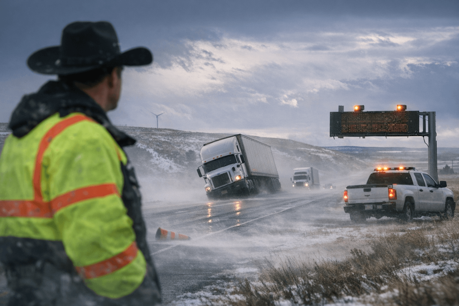
WYDOT’s District 1 live route page listed multiple I-80 segments as “Dry with Dangerous Winds” and warned of an “Extreme Blow Over Risk,” posting that certain stretches are “Closed to all high profile vehicles under 20000 GVW due to gusting winds” with the latest WYOROAD entries timestamped Jan 30, 2026, 01:54 PM.
The National Weather Service in Cheyenne is maintaining a high wind warning for central Laramie County, and Cap City News quoted the office saying forecast gusts are “between 70 and 80 mph in wind-prone areas.” Cap City also cited city-level west winds “between 35–45 mph, with gusts of up to 75 mph,” and cautioned that “Drivers, particularly those with campers and tractor-trailers, are advised to use extreme caution, delay travel or consider an alternate route until the warning expires at 5 p.m.”
WYOROAD records show the wind-related restrictions apply to several named stretches. On I-80 the following exit blocks are listed as “Dry with Dangerous Winds” with “Extreme Blow Over Risk” and the 20,000 GVW closure language: Exit 235 (Walcott Jct) to Exit 255 (WY 72); Exit 255 (WY 72) to Exit 267 (Wagonhound Rd); Exit 279 (Cooper Cove Rd) to Exit 290 (Quealy Dome); and Exit 290 (Quealy Dome) to Laramie. WYOROAD also lists US 30/287 segments from I-80 Walcott Jct through Rock River under the same condition and restriction text. By contrast, WYOROAD shows I-80 from Laramie to Exit 323 (Happy Jack Rd) and Exit 323 to Exit 335 (Buford) as “Dry” with no advisories or restrictions; WY 72 between I-80 and Hanna Jct is likewise listed as “Dry” in a WYOROAD entry timestamped Jan 30, 2026, 04:26 PM.
Secondary outlets reported different weight thresholds and coverage. Driveweatherapp’s Jan 28 summary stated: “Vehicle restriction: I-80 Rawlins to Laramie-area segments, high-profile vehicles under 35,000 GVW restricted (as posted across segments beginning Rawlins → Exit 235 (Walcott Jct) and continuing through Exit 290 (Quealy Dome)).” Driveweatherapp also noted an I-80 eastbound construction zone at mileposts 141–149 (Patrick Draw → Wamsutter) that “expect[s] congestion, slower speeds, and delays.” Cap City News reported a separate figure, saying “the closure affects high-profile vehicles under 50,000 pounds gross vehicle weight on I-80 between Exit 335 and Exit 359 and the entire stretch of I-25 from the Colorado state line to Exit 29 just north of Cheyenne.”
Those three different thresholds, WYOROAD’s 20,000 GVW, Driveweatherapp’s 35,000 GVW, and Cap City’s 50,000‑lb figure, are reported from their respective sources; WYOROAD is the state DOT’s live route page and provides the timestamped postings that drivers should treat as the primary DOT guidance for Albany County corridors. Local implications include potential freight rerouting, delays for RVs and tractor-trailers, and hazard exposure on exposed stretches such as Quealy Dome and Walcott Junction.
For motorists in Albany County, check WYDOT WYOROAD/WYDOT 511 and National Weather Service Cheyenne forecasts before travel, avoid high-profile vehicles on the named I-80 and US 30/287 segments if subject to the posted restrictions, and heed local advisories for Happy Jack Road and Highway 85 between Cheyenne and Meriden. Expect evolving conditions; WYOROAD timestamps indicate the restrictions were active on Jan. 30 and may change with weather and DOT updates.
This article was produced by Prism’s automated news system from verified source data, official records, and press releases, then run through automated quality and moderation checks before publishing. The system is built and supervised by the people who set the standards it runs under. Read our full AI policy.
Did this article answer your question?
