Wyoming Snowpack Sits Well Below Median, Raising Spring Water Supply Concerns
The Laramie River basin's snowpack sat at a record low as of March 31, with the Snowy Range peaking weeks early and Albany County's irrigation and fire seasons already under pressure.

The Laramie River basin carried less snow on March 31 than in any year on record, positioning Albany County at the sharpest edge of what state water officials are calling Wyoming's most severe spring water supply situation in the history of the measurement network.
The Laramie basin was one of 11 of Wyoming's 19 primary river basins that registered all-time record-low snowpack as of that date, according to an analysis by State Climatologist Tony Bergantino. Statewide, the federal SNOTEL telemetry network reported roughly 53% of median snow water equivalent for the water year, but that average obscured how severe local conditions had become. "Only three basins didn't fall into the bottom three," Bergantino said.
The Snowy Range, the mountain wall 32 miles west of Laramie that normally builds its snowpack through the first week of April, hit its seasonal peak one to two months ahead of schedule. By the time the Natural Resources Conservation Service released Snow Report No. 16 for Water Year 2026 on March 30, the melt in some Wyoming basins had already run its course entirely.
Jeff Coyle, hydrologist for the NRCS Wyoming office, identified three overlapping causes: going into the season with an already-depleted snowpack, then absorbing a stretch of record-high temperatures in March, then watching precipitation fall short. "It was horrible," Coyle said of March precipitation. "Absolutely horrible."
The compressed timeline reshapes what Albany County faces in the weeks ahead. A typical snowpack feeds the Laramie River and its tributaries gradually from April into June, filling reservoirs and agricultural diversions at a pace ranchers and municipalities can absorb. An early, thin melt concentrates runoff in a narrow window, delivers less total volume, and leaves streamflows declining sharply by the time summer demand peaks for irrigated agriculture, municipal water systems, and recreation operators in the county.
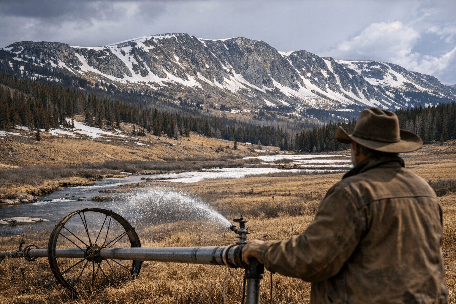
Ranchers and irrigators drawing from the Laramie River system should watch for curtailment notices from irrigation districts if SNOTEL indices remain depressed through early April. Residential well owners in areas that rely on shallow aquifer recharge from Snowy Range snowmelt should monitor water levels closely as the season progresses. Burn bans on public lands across Albany County, particularly in the foothills below the Snowy Range and across the lower Laramie Range, could arrive earlier than normal: dry conditions and premature grass-curing are already compressing the start of fire season. A grass fire ignited in Uinta County on March 29, underscoring how quickly the landscape has become fuel-ready across southeast Wyoming.
State and federal water managers are expected to release updated spring runoff forecasts in April, using final SNOTEL readings and early streamflow observations to shape reservoir operations and irrigation allocations. The NRCS Wyoming office and the University of Wyoming's Water Resources Data System remain the primary data sources for Albany County water planners, the Albany County Conservation District, and emergency management officials building their spring response.
The snowpack is now melting, not accumulating. The trajectory for Albany County's 2026 water year is largely fixed.
This article was produced by Prism’s automated news system from verified source data, official records, and press releases, then run through automated quality and moderation checks before publishing. The system is built and supervised by the people who set the standards it runs under. Read our full AI policy.
Did this article answer your question?