Fire weather threat rises across Apache County as winds gust to 50 mph
Dry air, gusts to 50 mph and new forest restrictions put Greer, South Fork and other White Mountains communities in the danger zone.

Apache County’s fire danger is rising fast as afternoon humidity drops to 5% to 15% and southwest winds build to 30 to 50 mph from Sunday through Tuesday, after near-critical conditions were expected Saturday. Apache-Sitgreaves National Forests will move into Stage 1 Fire Restrictions at 6 a.m. Tuesday, May 19, banning campfires, stove fires, charcoal and briquettes outside approved fire structures and sharply limiting smoking on forest land.
The communities most exposed sit in the southern White Mountains corridor, especially Greer, South Fork, Eagar and Springerville, where forest roads, dry fuels and limited escape routes leave little margin once the wind picks up. Apache County spans 11,127 square miles, and the Sheriff’s Office says it handles routine and 911 dispatch for Apache County while also working with three police departments, seven fire departments and the U.S. Forest Service. The county’s population was estimated at 64,445 on July 1, 2025, and 72.6% of residents identify as American Indian or Alaska Native, underscoring how much of the county’s risk sits on rural and tribal land.
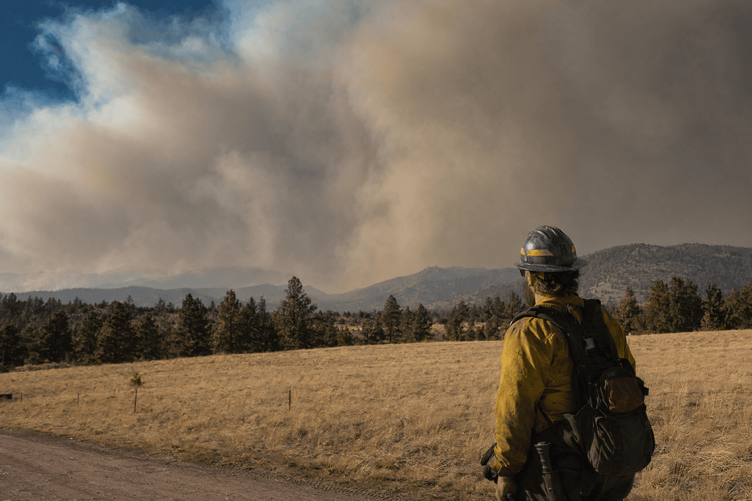
For ranchers, homeowners and travelers, the immediate rule is simple: do not burn anything that can light dry grass or brush. On Apache-Sitgreaves lands, that means no open campfires, no charcoal or briquettes, and no smoking except in the narrow situations allowed by the order. Travelers crossing the forest should expect fast-changing conditions and closures; the Forest Service says restricted areas can have very limited escape routes, and Apache County Emergency Management urges residents to use the 3-1-1 public information line from a mobile phone or 928-333-3412 from a land line for up-to-date information.
The county is also trying to harden its long-term playbook. Apache County Emergency Management is updating the 2017 Hazard Mitigation Plan, which FEMA says helps communities understand hazards, develop mitigation strategies and stay eligible for certain non-emergency grants. Residents can submit comments or request copies by contacting Haley Nicoll at 928-551-8024.
The warning carries heavy local memory. On May 14, 2025, the Apache County Board of Supervisors declared a state of emergency in southern Apache County as the Greer Fire was estimated at 3,500 acres and 0% contained, threatening homes, campsites and communities. InciWeb reported evacuations, Stage 2 restrictions and closures on Apache-Sitgreaves National Forest lands. The Wallow Fire, driven by heavy winds in 2011, grew to 538,049 acres and remains the largest wildfire in Arizona history, a reminder of how quickly wind and low humidity can turn dry fuels into a countywide crisis.
Know something we missed? Have a correction or additional information?
Submit a Tip