Flood watch remains in effect for Atchison County until Thursday morning
Atchison County stayed under a flood watch through 7 a.m. Thursday as storms threatened heavy rain, tornadoes and very large hail, while the Missouri River stayed below flood stage.
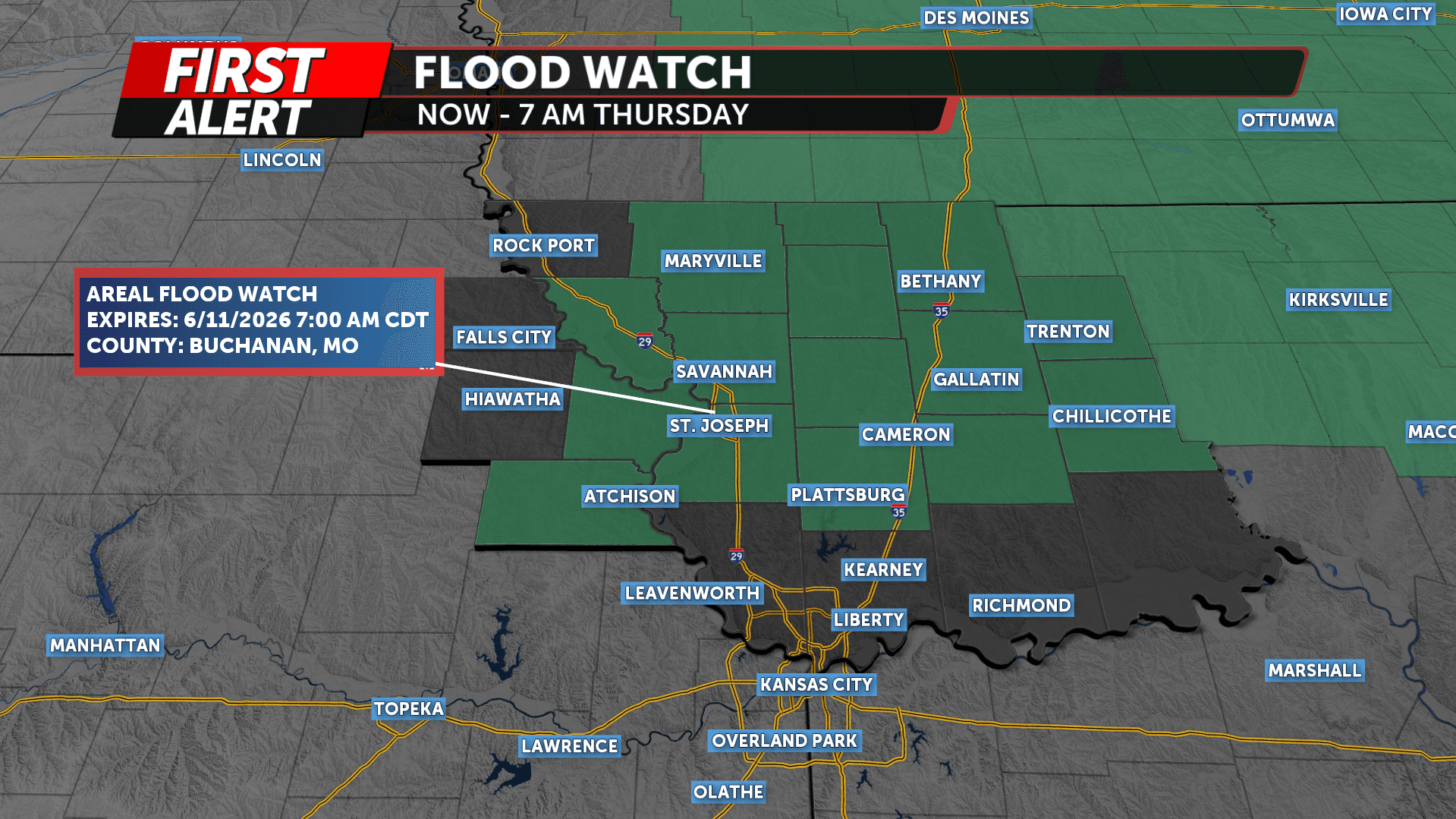
Atchison County stayed under a flood watch through 7 a.m. Thursday as storms moved across northeast Kansas and northwest Missouri, adding another layer of risk for families trying to get home, reach work or make medical trips. The same weather pattern also put the county under a tornado watch, underscoring how quickly conditions could change around Atchison and along the Missouri River.
The National Weather Service said some of the storms could produce heavy rainfall. Its regional outlook also called conditions favorable for severe weather, including a few tornadoes and very large hail. That combination matters in a river town like Atchison, where intense rain can overwhelm low-lying drainage areas even before a river reaches flood stage.
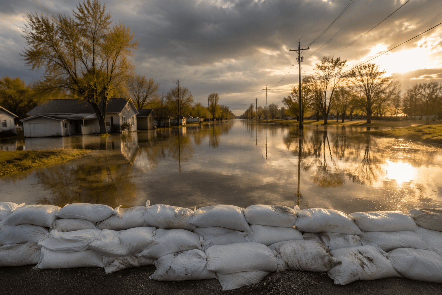
Hydrologic data showed the Missouri River at Atchison at 18.3 feet at noon Friday, June 5, below flood stage of 22.0 feet. Forecasters expected the river to crest at 20.8 feet at 1 a.m. Saturday, June 6, leaving the river below flood stage but high enough to keep officials and residents watching for changes if more rain fell upstream. In a community built around the river, even a stage below flood level can raise concern for access, travel and nearby property.
The flood watch came amid a broader stretch of severe weather alerts in the area. KMBC 9 News had issued a tornado watch for Atchison County and neighboring counties in northeast Kansas and northwest Missouri, with Katie Horner and the station’s First Alert coverage flagging the potential for rapid updates as storms developed. For residents, the practical message was simple: keep weather alerts on, watch the sky, and be ready for sudden changes overnight and before Thursday morning.
The stakes are not just local inconvenience. The U.S. Geological Survey says floods in Kansas have caused millions of dollars in damage and loss of life, and the agency monitors flood conditions at more than 180 streamgages across the state to help the National Weather Service make forecasts. USGS also describes the 1951 floods as the greatest catastrophe in the Kansas River Basin in reliable record, a reminder that severe water events can turn dangerous fast in Kansas.
This article was produced by Prism’s automated news system from verified source data, official records, and press releases, then run through automated quality and moderation checks before publishing. The system is built and supervised by the people who set the standards it runs under. Read our full AI policy.
Did this article answer your question?