Baker County firefighter describes grueling Frontage Fire near Huntington
Gusts above 40 mph pushed the Frontage Fire through dry sagebrush south of Huntington, forcing I-84 shutoffs and evacuation notices up to Level 3.

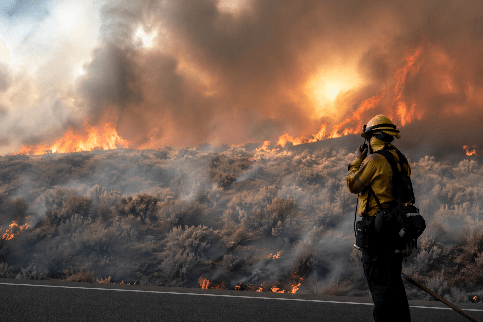
When wind gusts climbed above 40 mph and fire hit sagebrush and drought-dried grass south of Huntington, Buzz Harper said the night turned miserable fast. The Baker County firefighter’s account is a warning for anyone living along the Snake River corridor: in those conditions, flames can move faster than road access can be secured, evacuation levels can rise in minutes, and crews have very little margin to hold a line.
The Frontage Fire was reported around 8:24 p.m. Saturday, June 6, south of Huntington and was managed by the Bureau of Land Management’s Vale District. It started on private land and spread rapidly under gale-force winds, first burning about 1,000 acres before growing to roughly 1,500 acres and then nearly 1,938 to 1,980 acres as firefighters worked through the night and into Sunday.
The fire’s spread forced emergency managers to move quickly. Evacuation notices reached Level 1, Level 2 and Level 3 in areas including southeast Huntington and Farewell Bend State Park, where residents and visitors were told to prepare for the worst. Interstate 84 was closed for hours, cutting off one of the region’s main travel corridors just as crews were trying to track shifting fire behavior and protect structures and road access near the town.
By Sunday morning, June 7, all evacuation alerts had been lowered to Level 1, and Huntington Mayor Chuck Guerri said the town was “in good shape.” Even so, the fire had already shown how quickly a wind-driven blaze can threaten Baker County communities that sit in open country with heavy sagebrush and grass fuels.
The Frontage Fire was the second wildfire in two years to threaten Huntington. In 2024, a fire there burned about 4,500 acres during far hotter weather, with temperatures near 110 degrees. This time, temperatures were in the 50s and 60s, but the wind still pushed flames across the landscape and kept crews adjusting throughout the night.

The cause remained under investigation, and no lightning was reported in the area that night. The BLM’s Vale District, which manages 5.1 million acres of public land in eastern Oregon, once again had to marshal resources across a broad stretch of country where fire can escape containment quickly and put whole communities on alert.
This article was produced by Prism’s automated news system from verified source data, official records, and press releases, then run through automated quality and moderation checks before publishing. The system is built and supervised by the people who set the standards it runs under. Read our full AI policy.
Did this article answer your question?