Baker County snowpack remains thin, raising water and fire concerns
Bare ground and buttercups were already showing on Marble Creek Pass Road, while Baker County’s high-country snowpack still lagged badly. The mismatch is feeding water worries and early fire anxiety.
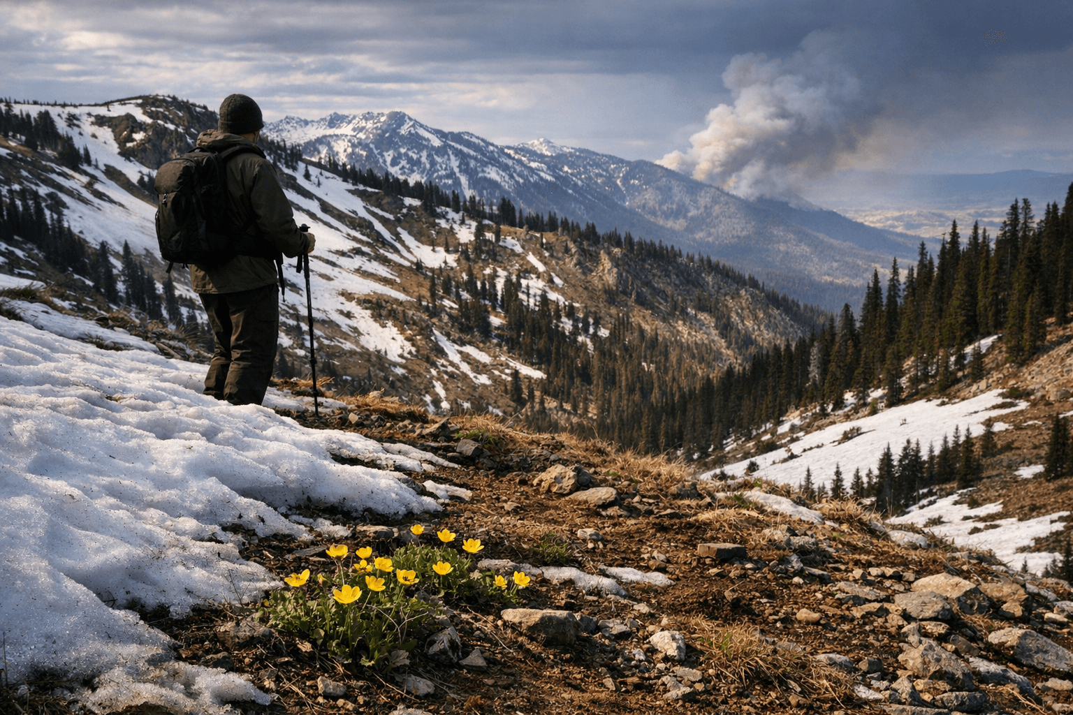
Scabs on his shins from a hike up Marble Creek Pass Road west of Baker City told part of the story: the road was open in early April, but the snowpack Baker County depends on was already badly out of balance.
At lower elevations, familiar mountain spots were showing bare ground and even buttercups where a foot or more of spring snow is usually still sitting. Higher up, above about 5,500 feet, the Baker City watershed remained snowbound in places, a reminder that the county’s main water reservoir is shrinking unevenly, not disappearing all at once.
That contrast matters because the watershed is about 10,000 acres and closed to public entry to protect water quality. Marble Creek Pass Road is the only public route through it, and snowdrifts usually keep it blocked until June or early July. City officials have long worried that a major wildfire there could send mud and ash into streams and force construction of a filtration plant that could cost more than $10 million.
The winter that set up this spring was unusually warm and dry. Baker City Airport recorded the warmest December on record going back to 1943, and January 2026 brought only 0.18 inches of precipitation, the second-lowest January total in that same record. That has helped push Baker County’s snowpack and runoff outlook into the severe range, even with some lingering snow in the Elkhorns.
State and federal agencies have already moved into drought response mode. Baker County commissioners declared a local drought emergency on February 18, 2026. Gov. Tina Kotek followed on March 26 with Executive Order 26-05, declaring drought emergencies in Baker, Deschutes and Umatilla counties through December 31, 2026. The governor’s office said persistent moderate drought has gripped Baker County since June 2025 and could affect farm and ranch operations, recreation, tourism, drinking water, fish and wildlife, and wildfire risk.
The Natural Resources Conservation Service said on March 1 that spring and summer water supply would be generally below normal west of the Cascades and well below normal east of them because of exceptionally poor snowpack. In the Crooked River Basin, snow water equivalent was just 2% of normal on February 27, the third-lowest reading in 89 years of records. By April 10, several southeastern Oregon basin stations still showed near-zero snow water equivalent.
For Baker County, the practical effect over the next 60 to 90 days is straightforward: less runoff, tighter irrigation expectations, stressed streams and a faster climb toward fire season. The high country still has a few pockets of snow. The valley below already looks like spring, and that may be the problem.
This article was produced by Prism’s automated news system from verified source data, official records, and press releases, then run through automated quality and moderation checks before publishing. The system is built and supervised by the people who set the standards it runs under. Read our full AI policy.
Did this article answer your question?