Boulder Blocks Highway 245 south of Baker City in rockfall scare
A boulder blocked Highway 245 south of Baker City after breaking loose from a roadcut, raising the risk of delays on the Dooley Mountain route. No injuries were reported.

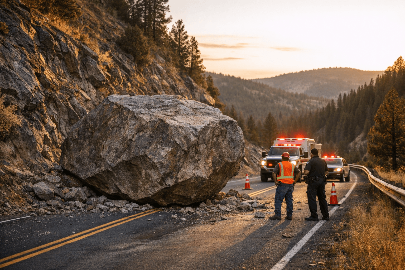
A boulder dropped into the middle of Highway 245 south of Baker City on the morning of Saturday, April 18, forcing attention onto one of Baker County’s most exposed mountain routes. The rock came loose from a roadcut along the Dooley Mountain Highway, the kind of sudden blockage that can stop traffic, slow deliveries and complicate access for anyone relying on the south county corridor.
No injuries were reported in the incident, which mattered as much as the obstruction itself. A rockfall in the travel lane could easily have turned into a crash if a vehicle had been in the wrong place at the wrong moment, especially on a highway people use for travel south of Baker City and across the rough ground around Dooley Mountain.
Allen Jensen was not surprised that a rock had fallen there, even if the size and position of this boulder were not what he expected. That reaction fit a broader local understanding of Highway 245: the slope above the road is not just scenic country, it is active terrain where roadcuts, spring weather and freeze-thaw changes can loosen material without warning.
The hazard also reached beyond a single blocked lane. Highway 245 over Dooley Mountain has long been described as a steep, winding pass that can become impassable in winter without regular plowing, and a Baker City Herald editorial in July 2025 singled it out as one of the secondary highways especially prone to heavy snowfall. A March 2026 column described the Dooley Mountain ridge as the watershed divide between the Powder and Burnt rivers, a reminder that this route cuts through rugged uplands rather than forgiving country.
ODOT added another camera and weather station at Dooley Mountain Summit in 2025 as part of a northeastern Oregon project that cost $4.3 million and included 18 cameras and weather stations. The agency says TripCheck is the place to check live traffic incidents, closures and cameras, and travelers can also dial 511 for road and weather information by highway, mountain pass or major city. For Highway 245, the new technology may help drivers see trouble sooner, but the rockfall showed that the road itself still carries the risks of mountain geology.
This article was produced by Prism’s automated news system from verified source data, official records, and press releases, then run through automated quality and moderation checks before publishing. The system is built and supervised by the people who set the standards it runs under. Read our full AI policy.
Did this article answer your question?


