Experts Say West’s Snow Drought Threatens Baker County Water, Fire Season
NOAA/NIDIS webinar Feb. 11 warned many SNOTEL sites in Oregon and Idaho show near‑record low snow water equivalent, risking Baker County water supplies and an earlier fire season.

A NOAA/NIDIS hour‑long webinar on Feb. 11 gathered climate and hydrology experts from Oregon, Idaho and Washington to warn that a winter “snow drought” is unfolding across much of the West and poses direct threats to Baker County’s water and wildfire outlook. Speakers including David Hoekema of the Idaho Department of Water Resources and Oregon state climatologist Larry O’Neill presented SNOTEL and SWE data showing many stations well below historical medians.
NIDIS and USDA NRCS maps valid Jan. 4, 2026 show snow water equivalent below the 20th percentile at many SNOTEL stations, with record or near‑record lows across Oregon, Idaho, Utah, Colorado, Arizona and New Mexico. O’Neill said average temperatures across Oregon were about 7 degrees above normal from Nov. 1, 2025 through Jan. 31, 2026, a figure he called “eye‑popping.” Idaho’s Hoekema described the situation as “what we call a wet snow drought,” and explained the limiting factor has been warm storms that delivered rain except generally above 7,000 feet.
Presenters linked the shortfall to circulation patterns and warm atmospheric river storms that delivered high precipitation totals but too much of it as rain to build a lasting snowpack. O’Neill said positions of the jet stream “caused the major differences in weather from the west side of America to the east,” and local reporting noted south winds in December followed by a high‑pressure ridge off the Oregon Coast in January that shunted storms northward. NASA Earth Observatory imagery from mid‑ to late January showed Western mountains “sporting thin winter coats,” reinforcing the analysis from Weather West and NIDIS.
The implications for Baker County are acute because regional water managers rely on snowmelt as a natural reservoir. Research cited at the webinar notes a U.S. Geological Survey estimate that up to 75 percent of the region’s annual water supply depends on snowmelt. Panelists warned of impacts to farmers, ranchers, fisheries and recreation; The Conversation and AP reporting noted delayed ski openings and strains on winter tourism. Daniel McEvoy of the Western Regional Climate Center cautioned that “Snow disappearing earlier than average leaves the ground exposed to warmer weather in the spring and summer, which dries soils and vegetation quicker,” heightening the risk of an earlier wildfire season.
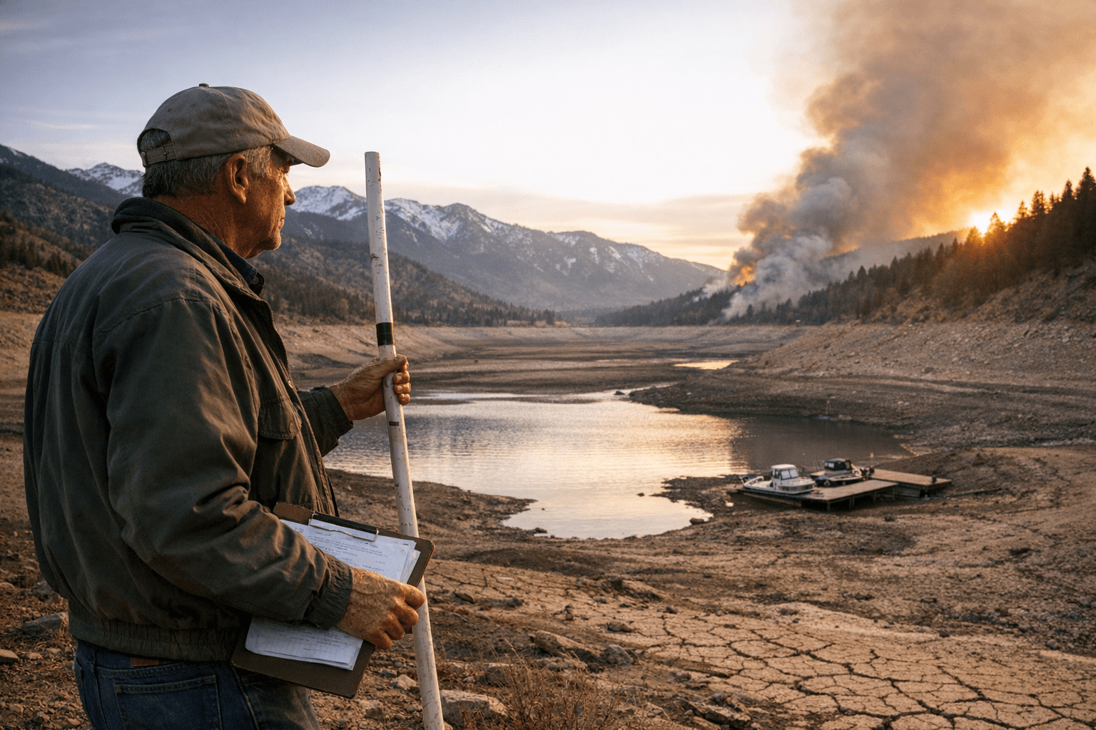
Speakers and reporters at the Feb. 11 event were skeptical the shortfall will be erased before spring runoff. Local experts at the webinar said it is highly unlikely the snowpack will reach average before spring melt begins, and AP quoted Schumacher saying, “I don’t think there’s any way we’re going to go back up to, you know, average or anywhere close to that.” That said, commentary from Coyote Gulch and The Conversation notes the main accumulation window runs through March, so additional cold, wet systems could still add snow in some basins.
For Baker County the immediate monitoring priorities are SNOTEL SWE at eastern Oregon stations, reservoir inflows and streamflow forecasts for watersheds that feed local irrigation and municipal supplies. NIDIS issues snow drought updates every four weeks from December through June; NRCS SNOTEL products and NSIDC and NASA snow imagery were cited at the webinar and will be essential to tracking changes as the region moves into late winter and spring.
This article was produced by Prism’s automated news system from verified source data, official records, and press releases, then run through automated quality and moderation checks before publishing. The system is built and supervised by the people who set the standards it runs under. Read our full AI policy.
Did this article answer your question?