Fire Damage Maps Now Available for Bonita Road, Cow Valley, Durkee Landowners
Free OSU-developed maps showing vegetation recovery status from the 2024 Cow Valley, Bonita Road, and Durkee fires are now available at no cost to affected landowners.
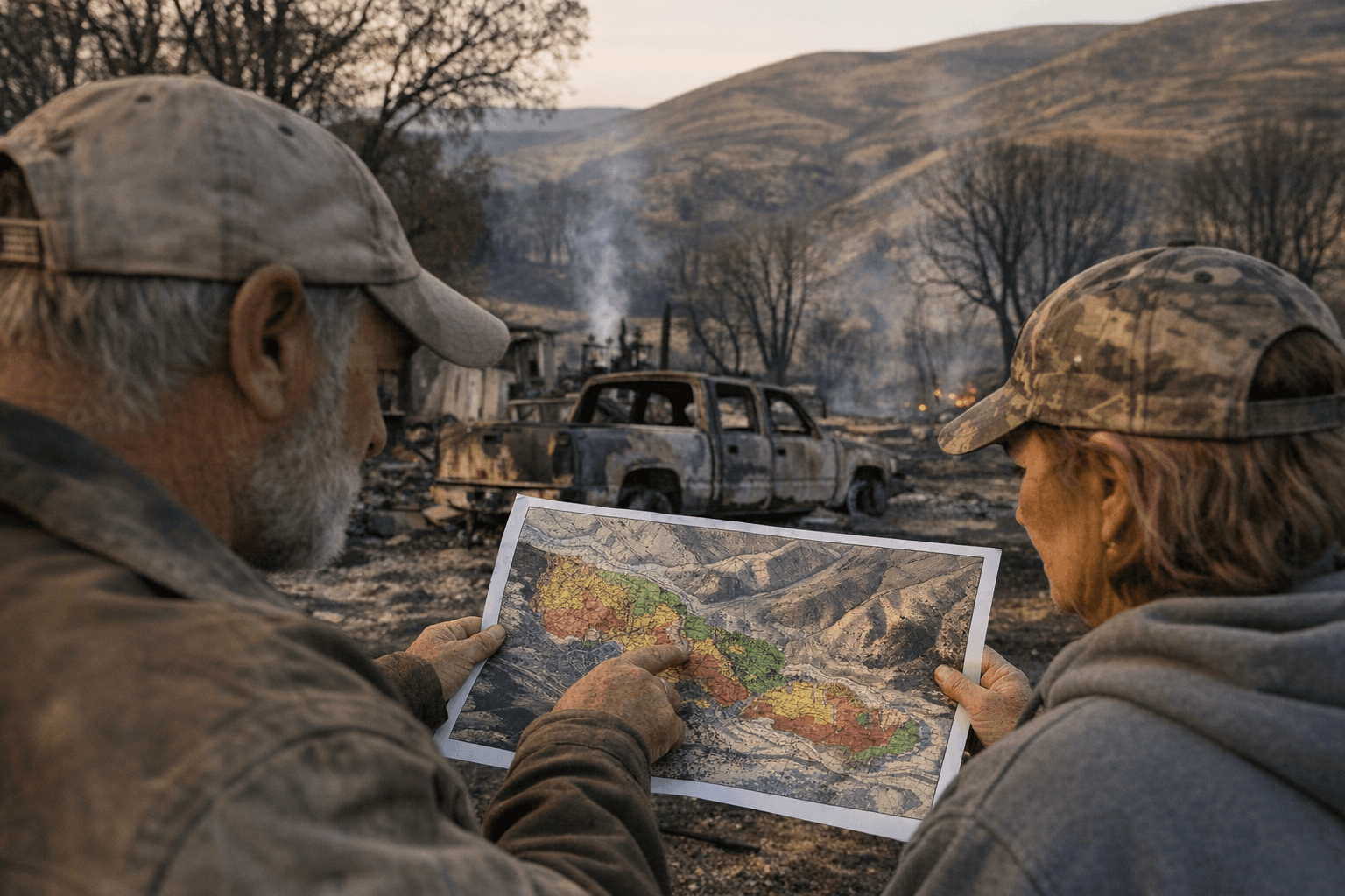
Landowners who lost vegetation to the 2024 Cow Valley, Bonita Road, and Durkee fires can now obtain free, detailed maps of their property's post-fire conditions through a program developed by Oregon State University and coordinated by the Malheur Rangeland Partnership.
The maps describe each property's vegetation conditions and recovery status. Officials said the maps can "help guide grazing decisions, restoration planning, and potential post-fire recovery projects" for landowners across both Baker and Malheur counties who were hit by the three fires.
The Baker County Sage-grouse LIT has been relaying news of the program to affected landowners in the county. Under the program, OSU will develop a draft Emergency Stabilization and Recovery map for each participating landowner, showing current vegetation conditions and recovery risks specific to that property. OSU representatives will then travel to each property to review and refine the draft map with the landowner in person. The Malheur Rangeland Partnership described the intended result plainly: "The final product will reflect both science-based data, and, most importantly, your firsthand knowledge of the land."
That on-the-ground review process distinguishes the maps from purely remote-sensing products. The program is designed so that OSU's science-based data is refined with what each landowner already knows about their acreage, the history of their grazing patterns, and the condition of their range before the fires swept through.
Participation is entirely voluntary, and the maps are free to landowners. Interested landowners or those with questions can contact Megan Wright at the Malheur Rangeland Partnership by phone at (208) 329-4156 or by email at malheurrpcoordinator@gmail.com.
This article was produced by Prism’s automated news system from verified source data, official records, and press releases, then run through automated quality and moderation checks before publishing. The system is built and supervised by the people who set the standards it runs under. Read our full AI policy.
Did this article answer your question?