Record March Heat Erases Snowpack Across Baker County Watersheds
Baker County hit 81°F on March 20, a record since 1943, and left zero snow at the Bourne and Tipton Snotels on March 25 — an unprecedented first at Tipton since 1981.
The thermometer at Baker City Airport hit 81 degrees on March 20, the highest March reading recorded there since 1943. The record-breaking heatwave thinned a snowpack that was already the skimpiest, in places, in more than 40 years.
That 81-degree reading broke a record set just a day earlier, when the high at the airport was 80. Previously, the warmest March day on record at the airport was 78 degrees, set on March 29, 1978. March can be the snowiest month, especially at elevations above 6,000 feet. This year, it stripped what little remained.
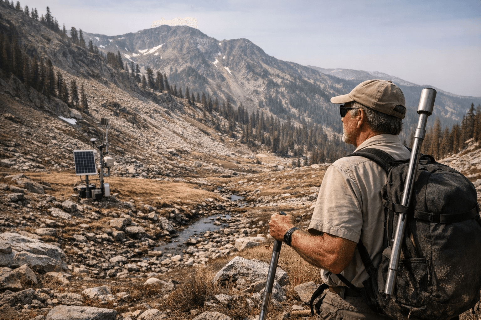
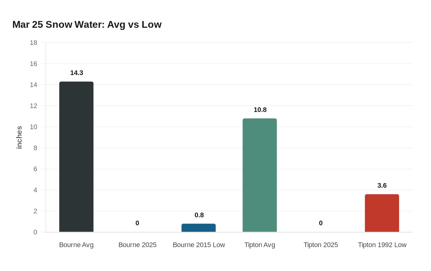
The consequences at the county's snow monitoring sites were stark. At the Bourne Snotel, there was no snow on March 25, a first in the station's history. The previous minimum for that date was 0.8 of an inch, recorded in 2015. Only one other year, 2005 with 3.8 inches, had posted less than 6 inches of water content on March 25. The Bourne station sits near the mining ghost town of Bourne on the west side of the Elkhorn Mountains, about 6 miles north of Sumpter, and has been maintained by the U.S. Natural Resources Conservation Service since its installation in 1979. The average water content there for March 25 over the 47 years since installation is 14.3 inches.
The situation at Tipton, along Highway 7 at the mountain pass marking the boundary between Baker and Grant counties near Austin Junction, was equally grim. There was no snow there on March 25, unprecedented for that date since the Snotel was built in 1981. The previous low water content for the date was 3.6 inches, set in 1992. The long-term average for March 25 at Tipton is 10.8 inches.
Conditions are better, although still well short of average, in a few places. The Anthony Lake survey course, just east of Anthony Lake, offers some context for how rare this year's deficit truly is. That survey course has records dating to 1936. At the start of March, water content there was 13 inches, the fourth-lowest for that time during the 90 years of records. The record low, by more than 7 inches, was set in 1977 at 4.8 inches.
The broader picture is no less alarming. Baker County was among five Oregon counties that made local drought declarations by mid-March. Oregon's snowpack typically peaks around April 1, but the state's snow-water equivalent stood at just 15 percent of the 1991-2020 median as of March 26, a new record low for the date. The outlook for spring and summer water supply is poor across much of the state, particularly east of the Cascades, where communities depend heavily on snowmelt for reliable runoff. Even with additional storms this spring, existing deficits are likely too large to overcome. Without a robust snowpack to melt gradually through late spring and early summer, rivers and reservoirs will have little replenishment when water demand is highest.
Phillips Reservoir in Baker County is among the reservoirs described as quite low. With the county entering spring at this kind of snowpack deficit, the summer water picture for Baker County farms, ranches, and communities will depend heavily on whatever storms arrive between now and peak runoff season.
This article was produced by Prism’s automated news system from verified source data, official records, and press releases, then run through automated quality and moderation checks before publishing. The system is built and supervised by the people who set the standards it runs under. Read our full AI policy.
Did this article answer your question?