Winter Outlook Jan. 7-11: I-84 Mountain Passes Continue Hazard
A regional weather outlook for Jan. 7-11, 2026 forecasts variable winter conditions across Oregon, with ongoing winter-hazard potential on mountain passes including sections of Interstate 84. Baker County residents should expect a mix of rain at lower elevations and snow at higher elevations, and plan travel with potential hazardous road conditions in mind.
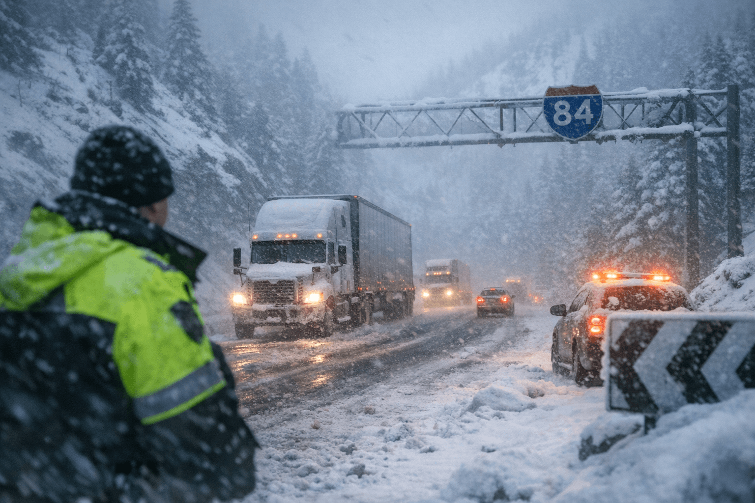
A regional weather outlook covering Jan. 7-11, 2026 shows continuing winter hazards across Oregon that are especially relevant to northeastern Oregon and Baker County. Mountain passes, including sections of Interstate 84 that serve local commuters and freight, are expected to experience conditions that make travel difficult at times during the period. The situation is ongoing as of Jan. 8 and may affect travel plans, school transportation, and local deliveries.
Forecasters expect variable precipitation types across elevation zones: lower valleys and the city of Baker City are likely to see periods of rain or mixed precipitation while higher terrain and mountain passes will receive accumulating snow. Mid-elevation routes may see transitions between rain, sleet, and snow, raising the risk of slick pavement, reduced visibility, and sudden changes in road surfaces. Overnight temperatures are expected to hover near or below freezing in valleys, with colder conditions at higher elevations, increasing the chance of icing on untreated surfaces.
The outlook highlights I-84 as a corridor of concern. Sections that cross higher terrain can experience quickly changing winter conditions that slow commercial traffic and local travel. Residents who rely on I-84 for commuting or regional trips should anticipate delays and intermittent closures, and allow extra time for essential travel. Local agencies and transportation crews will be monitoring passes and responding as conditions change.
For Baker County communities, the forecast affects everyday routines and public services. School bus routes, emergency response times, and supply deliveries can be disrupted by heavy snow or ice on remote roads. Outdoor workers and recreational users should plan around periods of heavier precipitation and colder mountain temperatures. Property owners in higher elevations should expect snow accumulation that may require clearing and monitoring for drifting or localized impacts.
Staying informed and prepared will reduce risk during the Jan. 7-11 period. Residents are advised to check current road and weather conditions before travel, adjust schedules to avoid peak hazard windows, and ensure vehicles are equipped for winter driving in mountainous terrain. Local officials and transportation crews will continue to assess conditions and respond to hazards as they develop.
This outlook underscores the seasonal variability that affects northeastern Oregon every winter and the particular vulnerability of mountain corridors that connect Baker County to the rest of the state. Advance planning and situational awareness will be the most effective tools for minimizing disruption and maintaining safety over the coming days.
This article was produced by Prism’s automated news system from verified source data, official records, and press releases, then run through automated quality and moderation checks before publishing. The system is built and supervised by the people who set the standards it runs under. Read our full AI policy.
Did this article answer your question?