Strong thunderstorms threaten Bamberg County with wind, hail, lightning early Thursday
A fast-moving storm brought 50 mph gusts, half-inch hail and frequent lightning to east central Bamberg County before sunrise, with conditions easing by 7 a.m.
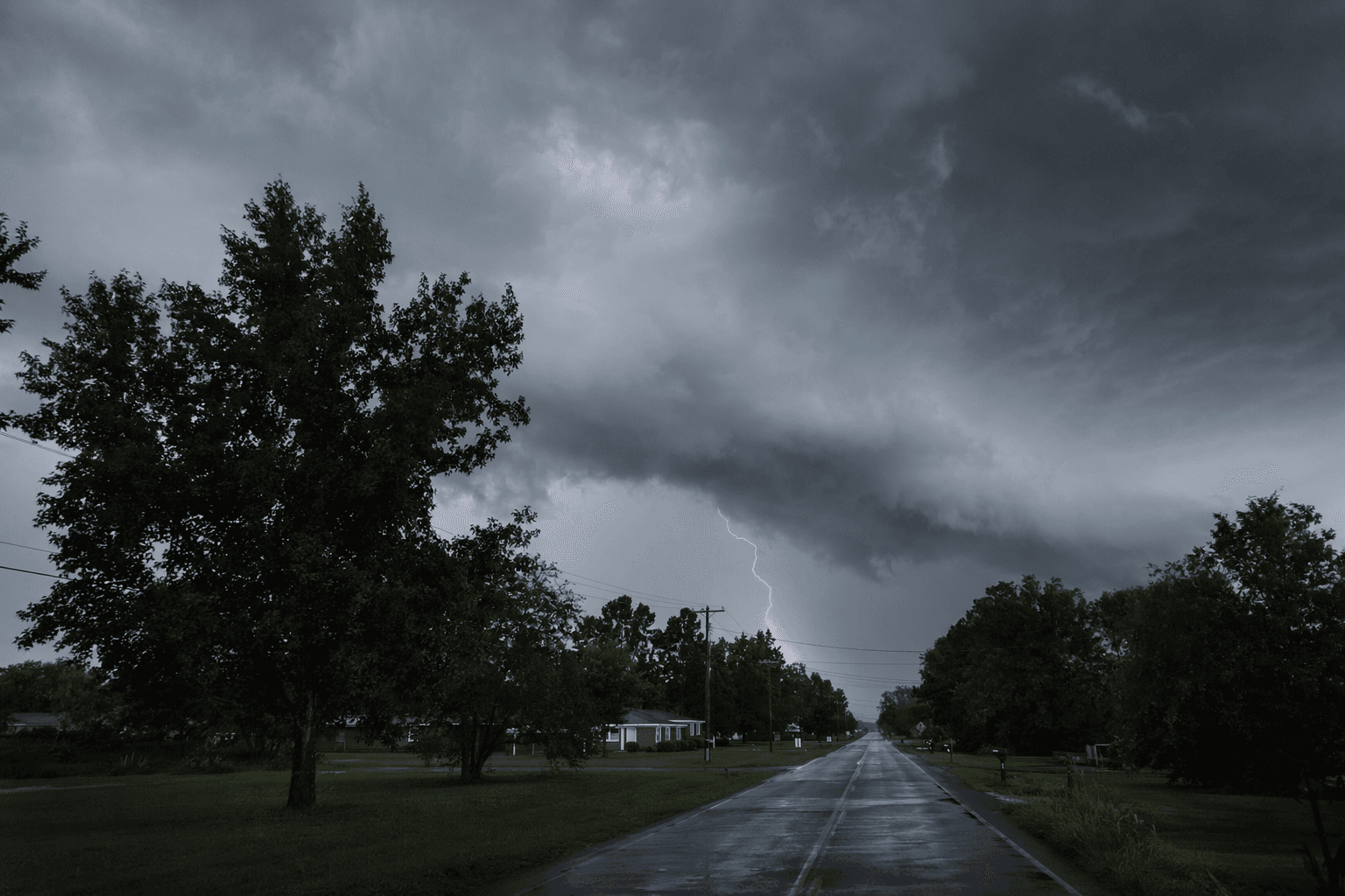
Bamberg County faced a brief but potentially damaging burst of severe weather early Thursday, with the National Weather Service warning that wind gusts could reach 50 mph and hail could reach half an inch across the eastern part of the county before conditions improved near 7 a.m. EDT.
The special weather statement, issued at 6:35 a.m. EDT, covered Bamberg County along with central and southeastern Orangeburg County. Doppler radar showed the storm over Branchville, about 13 miles west of Saint George, moving east at 40 mph. The National Weather Service said the storm would affect east central Bamberg County and south central Orangeburg County through 7 a.m., with Branchville and Bowman among the places in the path.
The main threats were the kind that can turn a routine commute into a hazard in minutes. The bulletin warned of downed tree limbs, unsecured objects being blown around, and minor damage to outdoor items. It also said frequent cloud-to-ground lightning was occurring. Drivers on Interstate 26 between mile markers 161 and 169 and Interstate 95 between mile markers 85 and 88 were included in the affected area, making road conditions especially dangerous during the storm’s passage.
Edisto Electric Cooperative, which serves portions of Bamberg, Barnwell and Orangeburg counties, reported no members without power in the counties it serves when its outage map was checked. The cooperative lists 3,531 members in Bamberg County, 5,101 in Barnwell County and 4,056 in Orangeburg County.
The alert came during South Carolina’s peak tornado season, which runs from March through May, a stretch when thunderstorms can escalate quickly across the state’s central counties. Even when storms stay below warning criteria, the National Weather Service tracks them closely because severe weather can still cause injury, property damage and business disruption. The NOAA Storm Events Database documents those impacts as part of the broader record of damaging weather across the country.
This article was produced by Prism’s automated news system from verified source data, official records, and press releases, then run through automated quality and moderation checks before publishing. The system is built and supervised by the people who set the standards it runs under. Read our full AI policy.
Did this article answer your question?

