MyRadar warns of possible strong tornado near Bemidji and Bagley
MyRadar put Bemidji, Bagley and Fosston in a possible strong-tornado corridor as heat index values topped 100 degrees. Beltrami County is watching after last year’s 120-mph derecho.
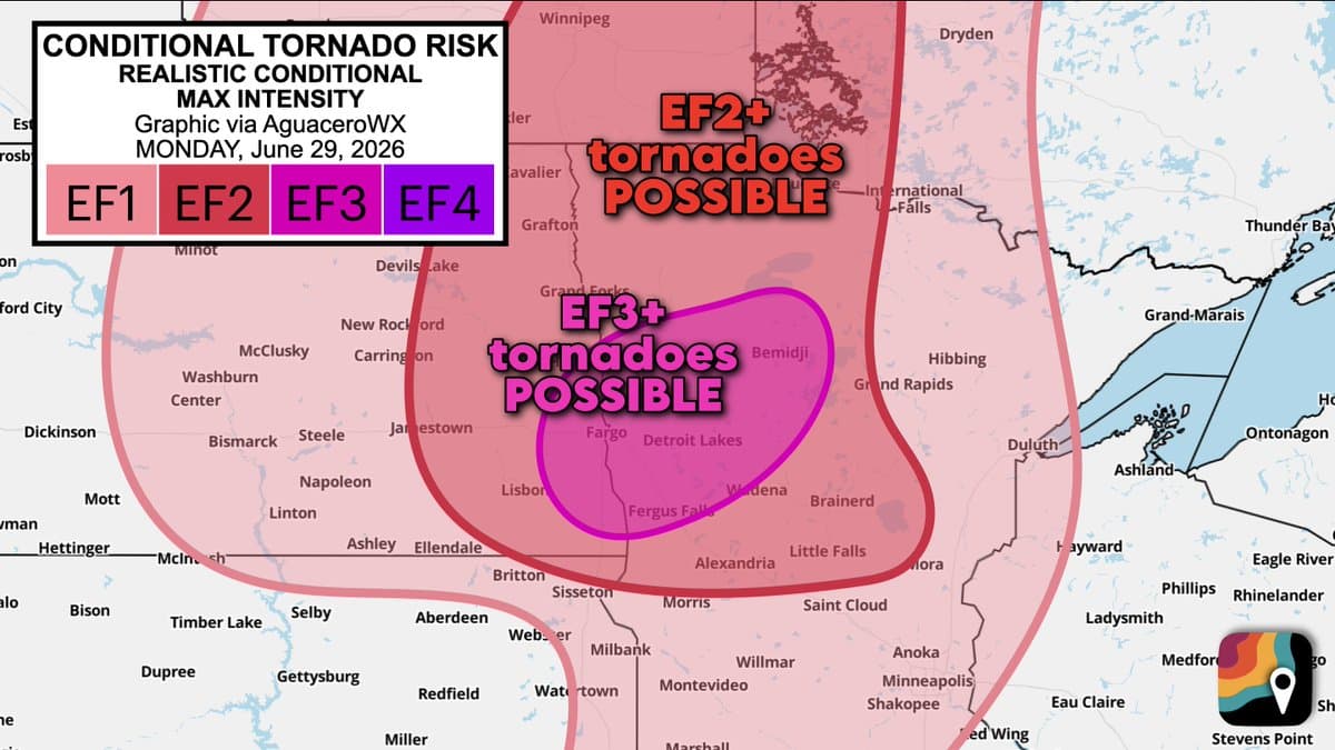
MyRadar's conditional strong-tornado corridor stretches from Fargo, North Dakota, to Bemidji, Minnesota, with Bagley and Fosston inside the zone, as heat index values climbed above 100 degrees across the region.
Severe weather watches and warnings were active through the National Weather Service Twin Cities hazards page on June 30, 2026, while its forecast called for highs in the 90s and dew points in the 70s. The office also flagged extreme heat warning and heat advisory conditions.

Gov. Tim Walz declared a peacetime emergency on June 27, 2025, after storms that damaged property and critical infrastructure, brought hurricane-force winds and left thousands without power. Craig Gaasvig declared a state of emergency on June 21, 2025, and the City of Bemidji followed as destructive thunderstorms and possible embedded tornadoes swept the area. Minnesota’s Department of Public Safety later estimated top winds at 120 mph and several hundred thousand trees downed by the June 21 derecho.
Beltrami County transitioned to Everbridge in 2026, giving residents opt-in alerts by text, phone call, email, mobile app and TTY or TDD, while also using Wireless Emergency Alerts and the Emergency Alert System through IPAWS. Outdoor warning sirens activate for tornado warnings, destructive severe thunderstorms with winds greater than 70 mph, or when emergency managers believe conditions could become life-threatening, and there is no all-clear siren.
Beltrami County opened a Red Cross emergency shelter at the Sanford Convention Center, 1111 Events Center Dr NE in Bemidji, and several thousand customers were still without power as crews brought in mutual aid. The NWS Twin Cities archive and NOAA’s Storm Events Database track tornadoes and other severe-weather impacts back to 1950.
This article was produced by Prism’s automated news system from verified source data, official records, and press releases, then run through automated quality and moderation checks before publishing. The system is built and supervised by the people who set the standards it runs under. Read our full AI policy.
Did this article answer your question?