Storm warning issued southwest of Bemidji amid rotation concerns
Rotation west of Bemidji triggered a tornado warning as spotters tracked a discrete cell, and the Weather Service had already flagged afternoon storms.
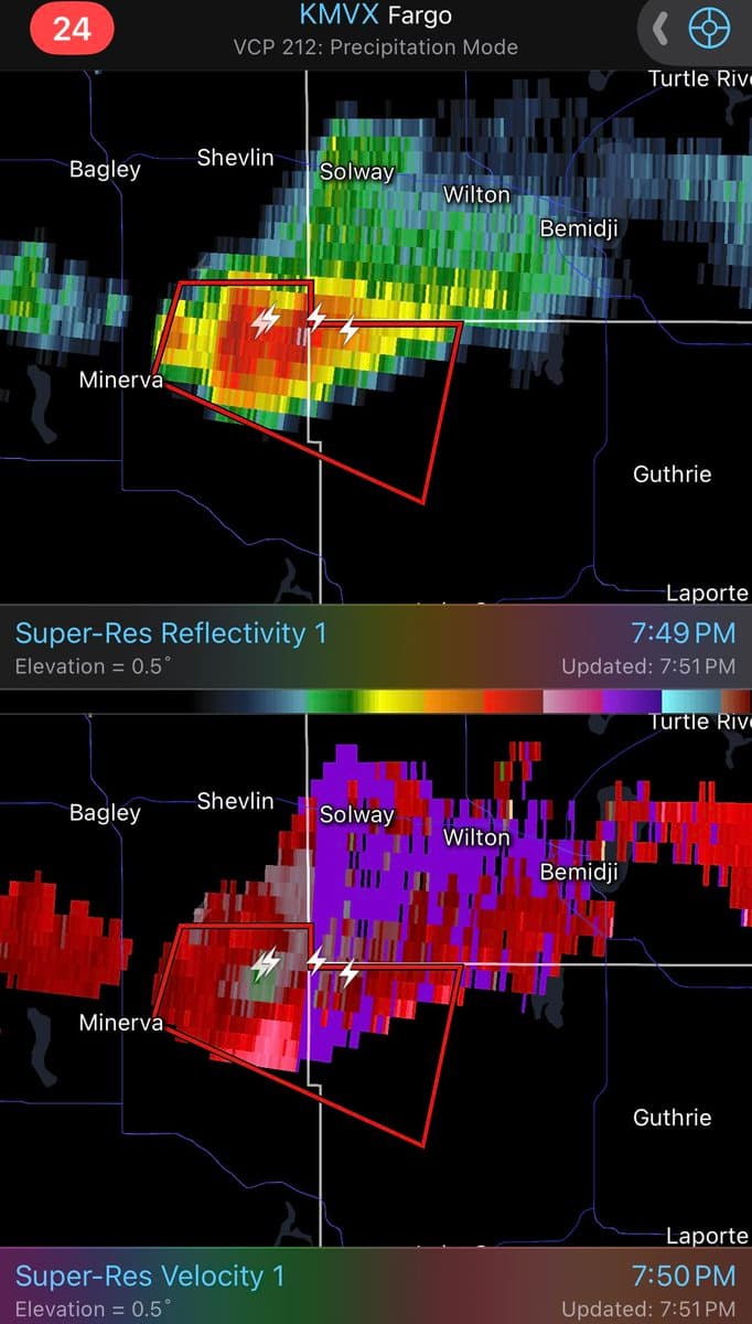
A tornado warning went up southwest of Bemidji after weather spotters flagged a discrete thunderstorm cell with possible rotation in Beltrami County. The warning came after the National Weather Service’s Twin Cities office had already told forecasters and spotters to watch for strong storms during the afternoon and evening of June 23.
At 11:47 a.m. CDT, the office issued a hazardous weather outlook for parts of east-central, south-central and southeast Minnesota and western Wisconsin, saying thunderstorms were likely later in the day and that SKYWARN spotter activation may be needed. The Chanhassen forecast office is staffed 24 hours a day, 7 days a week, 365 days a year, and it remains the agency responsible for forecasts and warnings across Minnesota and western Wisconsin. Sirens, however, are not triggered by the Weather Service itself. Counties and cities decide when to activate them.

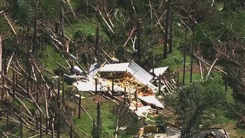
That distinction matters when storms develop quickly. A preliminary local storm report from the same office placed a funnel cloud 4 miles west of Kenyon in Rice County at 6:27 p.m. CDT on June 23, based on delayed video from a trained spotter sent through NWSChat. The report said the funnel cloud lined up with rotation on radar, a sign of the kind of storm structure forecasters and spotters were watching for elsewhere in the state.
Beltrami County’s tornado history can be checked through NOAA’s Storm Events Database, the official archive of severe weather reports collected by the National Weather Service. The database includes tornado records dating to 1950, and NOAA says finalized storm reports are generally available 90 to 120 days after an event. The Twin Cities forecast office also maintains a year-by-year Minnesota tornado statistics page, which places the June 23 warning in the broader context of an active severe-weather season.
For Bemidji and the rural area southwest of town, the warning served as a reminder that rotating storms can sharpen fast once spotters and radar line up. If new warnings develop, residents should follow National Weather Service updates closely and treat local sirens as a county or city decision, not a federal one.
This article was produced by Prism’s automated news system from verified source data, official records, and press releases, then run through automated quality and moderation checks before publishing. The system is built and supervised by the people who set the standards it runs under. Read our full AI policy.
Did this article answer your question?