Big Island County's 10 Best Day Hikes: Routes, Distances, and Safety Tips
From Kīlauea's lava fields to Kohala's coastal cliffs, these 10 Big Island hikes are ranked by scenery, access, and what you'll actually encounter on the trail.

Hawaiʻi Island holds more ecological zones than almost any landmass on Earth, and its trail network reflects that staggering range: you can walk across hardened lava fields at sea level in the morning and reach cloud forest above 13,000 feet by afternoon. The ten hikes below are ranked by the combination of accessibility, scenery, and trail quality that make them worth a full day's commitment. Each entry includes trailhead location, round-trip distance, estimated time, difficulty rating, and the safety and permit details you need before you leave the car.
1. Kīlauea Iki Trail, Hawaiʻi Volcanoes National Park
Few trails on Earth let you walk across the hardened crust of a lava lake that was molten within living memory. The 4-mile loop descends 400 feet through lush ʻōhiʻa forest before crossing the 1959 eruption crater floor, where steam vents still hiss through cracks underfoot. Allow 2 to 3 hours; the trailhead is off Crater Rim Drive near the Kīlauea Iki Overlook, and the standard national park entrance fee applies (no additional permit required).
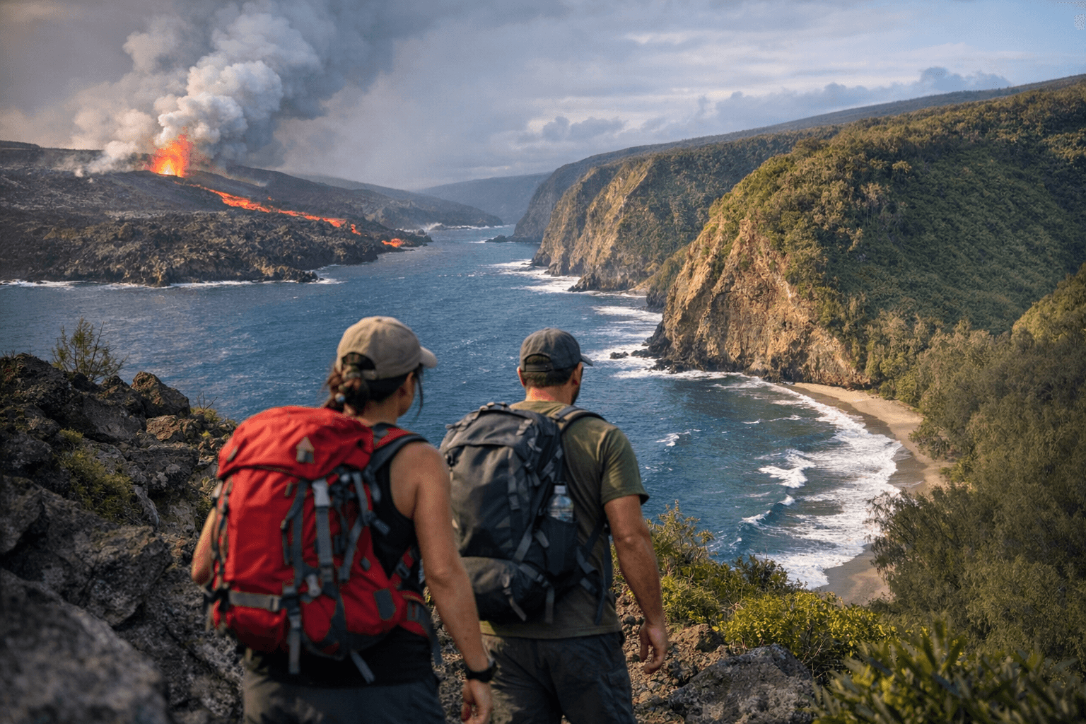
2. Nāpau Trail to Puʻuʻōʻō Overlook, Hawaiʻi Volcanoes National Park
This 14-mile round-trip through the East Rift Zone is the park's most dramatic backcountry day hike, crossing lava flows of multiple ages and passing the Makaopuhi Crater rim before reaching views of the Puʻuʻōʻō cone. A free backcountry permit, available at the Kīlauea Visitor Center, is required before you set out. Carry at minimum 3 liters of water per person; there is no water on the route and volcanic gas (vog and SO₂) levels can spike without warning, so check air quality advisories the morning of your hike.
3. Waipiʻo Valley to Waimanu Valley Trail (Z-Trail), Hamakua Coast
The full route to Waimanu is a 9-mile one-way overnight, but the descent into Waipiʻo Valley itself and the brutal Z-Trail switchbacks above it make a punishing and spectacular 6-mile round-trip day option for strong hikers. The valley trailhead sits at the end of Waipiʻo Valley Road in Honokaa; the road down into the valley is restricted to 4WD vehicles and permitted tour operators, so most hikers park at the overlook and walk down. Waimanu Valley camping requires a permit from the Division of Forestry and Wildlife; day hikers to the Z-Trail switchbacks do not need one.
4. Mauna Loa Summit Trail (Observatory Trailhead), Saddle Road
Starting from the NOAA Mauna Loa Observatory at roughly 11,135 feet, this 13-mile round-trip ascent to the 13,679-foot summit is the most physically demanding day hike on the island and should only be attempted by hikers already acclimated to altitude. The trail crosses barren ʻaʻā and pāhoehoe lava fields with virtually no shade or shelter; afternoon thunderstorms are common from spring through fall, and temperatures can drop below freezing at the summit even in summer. Start no later than 6 a.m. to allow a safe turnaround before weather deteriorates, and file a trip plan with Hawaiʻi Volcanoes National Park before departing.
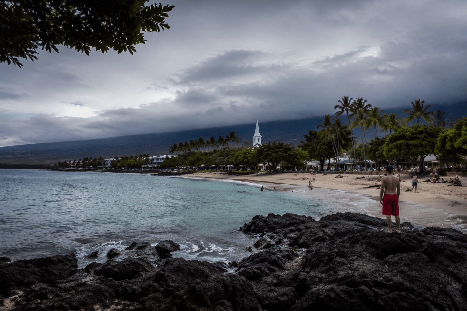
5. Pololu Valley Trail, North Kohala
The 1-mile descent from the Pololu Valley Overlook at the end of Highway 270 drops you onto one of the island's most isolated black-sand beaches, with the option to continue along the coastal trail toward Honokane Nui Valley for a 4-mile round-trip with significant elevation gain on return. No permits are required, but the return climb is steep and exposed; mid-morning sun on the switchbacks hits hard, so an early start is strongly advised. Parking at the overlook is free but limited, and the trailhead fills by 9 a.m. on weekends.
6. ʻAkaka Falls Loop Trail, Hāmākua
At under a mile round-trip on a paved, well-maintained path through bamboo groves and tropical forest, this Hāmākua trail delivers two major waterfalls including the 442-foot ʻAkaka Falls, one of the tallest free-falling waterfalls in the United States. The trailhead is off Akaka Falls Road in Honomu, about 11 miles north of Hilo on Highway 19; a small state park fee applies. The loop is accessible to most fitness levels and is one of the few hikes on this list appropriate after recent rainfall, as the trail is paved throughout.
7. Devastation Trail to Keanakākoʻi Crater, Hawaiʻi Volcanoes National Park
This flat, 2-mile round-trip paved trail cuts through a ghostly landscape of bleached ʻōhiʻa snags left by the 1959 Kīlauea Iki eruption before connecting to the Keanakākoʻi Crater overlook, where the 2018 eruption dramatically altered the crater floor. The trailhead sits on Crater Rim Drive east of the Chain of Craters Road junction; no additional permit beyond park entry is needed. It pairs naturally with Kīlauea Iki as a half-day combination.
8. Puʻu Huluhulu Trail, Saddle Road
Rising from a kipuka (a forested island surrounded by lava) at the Saddle Road junction near the Mauna Kea Access Road, this 3-mile round-trip loop climbs a cinder cone to panoramic views of both Mauna Kea and Mauna Loa. The forest inside the kipuka is a critical refuge for native honeycreepers including the ʻapapane and ʻiʻiwi; brush your boots at the cleaning station at the trailhead to prevent the spread of Rapid ʻŌhiʻa Death fungus. No permit is required and the trailhead parking lot off Saddle Road is free.
9. Kaʻū Desert Trail to Footprints, Hawaiʻi Volcanoes National Park
Stretching 8 miles round-trip from the trailhead on Highway 11 between the park entrance and Pāhala, this hike crosses a stark volcanic desert to reach preserved human footprints entombed in ash from the 1790 Kīlauea eruption. The route is exposed and hot during midday; the National Park Service recommends carrying 2 liters of water per person at minimum and wearing sun protection for the full exposed walk. No permit beyond park entry is required, but the trailhead is easy to miss on Highway 11, so confirm the pullout location on the NPS Hawaiʻi Volcanoes map before driving out.
10. Green Sand Beach (Papakolea) Trail, Kaʻū
The 5.4-mile round-trip across the Kaʻū coastal plain to Papakolea, one of only four green-sand beaches in the world, is flat but exposed and deceptively tiring on loose volcanic terrain. The trailhead begins at South Point (Ka Lae), the southernmost point in the United States, off South Point Road south of Naʻālehu. Swimming at Papakolea is dangerous due to strong surge and rip currents; the beach is best experienced from the rim above the cinder cone rather than at water's edge.
Across all ten routes, a few safety principles apply universally on Hawaiʻi Island: carry more water than you think you need (trail conditions here punish under-preparation faster than most mainland destinations), check volcanic air quality advisories through the USGS Hawaiian Volcano Observatory before any hike near active rift zones, and always tell someone your trailhead, intended route, and expected return time. The trails here range from a 45-minute stroll to a full alpine sufferfest, but every one of them rewards the effort with landscapes found nowhere else on the planet.
This article was produced by Prism’s automated news system from verified source data, official records, and press releases, then run through automated quality and moderation checks before publishing. The system is built and supervised by the people who set the standards it runs under. Read our full AI policy.
Did this article answer your question?