Big Island Residents and Visitors Should Know These Storm Preparedness Steps
Lava zones, flash floods, and hurricane season make storm prep non-negotiable on Hawaiʻi Island; here's what to do before the next storm hits.

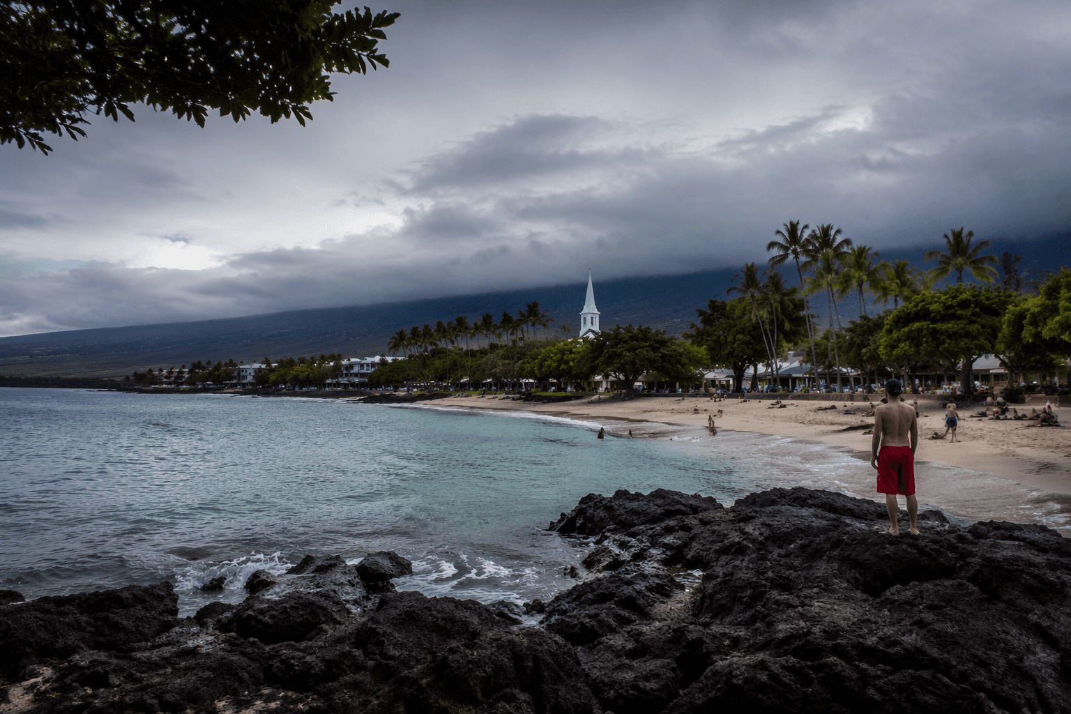
Hawaiʻi Island is not a single landscape but a collection of microclimates, elevation zones, and coastlines that each carry their own weather risks. The slopes of Mauna Kea catch winter snowstorms. The Hāmākua Coast funnels relentless rainfall into stream channels that can surge within minutes. Pāhoa and lower Puna sit in areas where heavy rain compounds ground already destabilized by volcanic activity. Kaʻū's exposed southern shoreline takes the full force of south swells and tropical systems. Nowhere on the island is truly insulated from the need to prepare.
That reality applies equally to kamaʻāina who have lived through multiple hurricanes and to visitors who may have never experienced a flash flood warning. What follows is a practical, place-specific breakdown of how to prepare before a storm arrives, what to do during one, and how to recover safely afterward.
Before the Storm: Build Your Preparedness Foundation
The single most important thing you can do before any storm season is to know your zone. Hawaiʻi County Civil Defense maintains flood zone maps and hurricane evacuation route designations that vary significantly by district. A home in North Kohala sits in a different risk profile than one in Orchidland Estates or along Alii Drive in Kailua-Kona. Pull up your address in the county's hazard maps and confirm whether you are in a designated flood zone, a lava flow zone, or an evacuation corridor.
Once you know your zone, build a supply kit calibrated to what Hawaiʻi Island storms actually demand. Extended power outages are common here because HECO's grid serves geographically isolated communities across long transmission corridors, and restoration after a major storm can take days in places like South Kona or the Kaʻū district. Your kit should include:
- At least seven days of water (one gallon per person per day) stored in food-grade containers
- Non-perishable food that does not require cooking, since propane and gas lines can be disrupted
- A battery-powered or hand-crank NOAA weather radio to receive Civil Defense alerts when cell towers go down
- Flashlights, extra batteries, and at least one portable battery bank for phone charging
- A first aid kit with a two-week supply of any prescription medications
- Cash in small bills, since card readers stop working without power
- Copies of important documents, including insurance policies and medical records, stored in a waterproof bag
Visitors staying in short-term rentals or hotels should ask their host or front desk staff about the property's storm protocols and where the nearest emergency shelter is located. Many visitors assume they are insulated from local weather events by virtue of being in a resort corridor; Kohala Coast properties have been without power and water for multiple days following past hurricane events.
Understanding Hawaiʻi Island's Specific Hazards
Flash flooding is the storm hazard most likely to affect the widest cross-section of Big Island residents. The island's steep topography means that rainfall upstream on the volcanic slopes translates to rapid, powerful stream rises downstream. Streams in Waipiʻo Valley, along the Hāmākua Coast, and in Puna have all risen to dangerous levels within 30 minutes of heavy rainfall beginning miles away. If you are near any stream channel, ravine, or low-lying coastal road during a storm, do not wait for the water to appear before moving to higher ground.
Road closures on Saddle Road (Daniel K. Inouye Highway) and Highway 19 along the Hāmākua Coast are common during severe storms and can effectively cut the island in half logistically. If you depend on reaching Hilo for dialysis, chemotherapy, or other recurring medical care, build a storm communication plan with your provider now, before any storm is in the forecast.
Lava zones in lower Puna, particularly around Leilani Estates and Lanipuna Gardens, present a compounding risk. Ground in areas affected by the 2018 eruption remains uneven and in places unstable. Heavy rain saturates volcanic soil differently than in other areas, and drainage infrastructure in newer residential subdivisions may not be fully built out. Residents in these areas should be especially attentive to county road condition reports during any storm watch.
Staying Informed: Where to Get Reliable Alerts
Cell service on Hawaiʻi Island is inconsistent even in calm weather. During a storm, towers can lose power or become overwhelmed with traffic. Sign up for Hawaiʻi County Civil Defense alerts through the county's official alert system, which can reach you via text, email, and landline. The National Weather Service office in Honolulu issues watches, warnings, and advisories that are specific to Hawaiʻi Island districts; familiarize yourself with the difference between a Flash Flood Watch (conditions are favorable for flooding) and a Flash Flood Warning (flooding is occurring or imminent).
NOAA Weather Radio station KHB-49 broadcasts continuously for Hawaiʻi Island and remains one of the most reliable information sources when internet and cell service fail. A battery-powered NOAA radio is one of the most underrated items in any preparedness kit on this island.
During the Storm: What to Do and What to Avoid
Once a storm is actively affecting your area, the priority is staying put unless you have been ordered to evacuate. Driving through floodwater is the most common cause of storm-related deaths nationally, and it is a documented risk on Hawaiʻi Island roads where water depths across roadways can be deceiving. Just six inches of moving water can knock a person down; a foot of water can sweep a small vehicle off the road.
If you are ordered to evacuate, go early. Evacuation routes on an island with limited road infrastructure can become congested quickly, and certain routes, such as the lower roads through Puna, may close without warning. Know at least two routes out of your neighborhood before any storm season begins.
If you lose power, avoid using generators indoors or in attached garages; carbon monoxide poisoning is a real and preventable risk. Use flashlights rather than candles to reduce fire hazard, and keep your refrigerator and freezer doors closed to preserve food as long as possible.
After the Storm: Recovery and Safety
The period immediately after a storm passes carries its own risks. Do not return to flood-affected areas until Civil Defense has confirmed roads are clear and safe; standing water can conceal washed-out road sections, downed power lines, and debris. In Puna and other areas with cesspools or septic systems, floodwater is likely to be contaminated.
Check on neighbors, particularly kupuna and people with disabilities, who may not have received alerts or may need assistance accessing resources. The Hawaiʻi Island Emergency Management Agency coordinates disaster assistance programs, and recovery centers are typically opened at community facilities across the island's districts following significant storm events.
Preparedness on Hawaiʻi Island is not a one-time checklist but an ongoing practice, renewed each time a storm forms in the Central Pacific and each time the sky over Mauna Loa turns that particular shade of gray that long-time residents know means the rain is coming fast.
This article was produced by Prism’s automated news system from verified source data, official records, and press releases, then run through automated quality and moderation checks before publishing. The system is built and supervised by the people who set the standards it runs under. Read our full AI policy.
Did this article answer your question?