Big Island Shoreline Access Guide: Rights, Rules, and Coastal Stewardship
Twelve access points line Puako Beach Drive alone, yet gates, eroding trails, and vanishing parking are quietly cutting Big Island locals off from shorelines they have a legal right to use.
What you're legally entitled to — and what's quietly shrinking
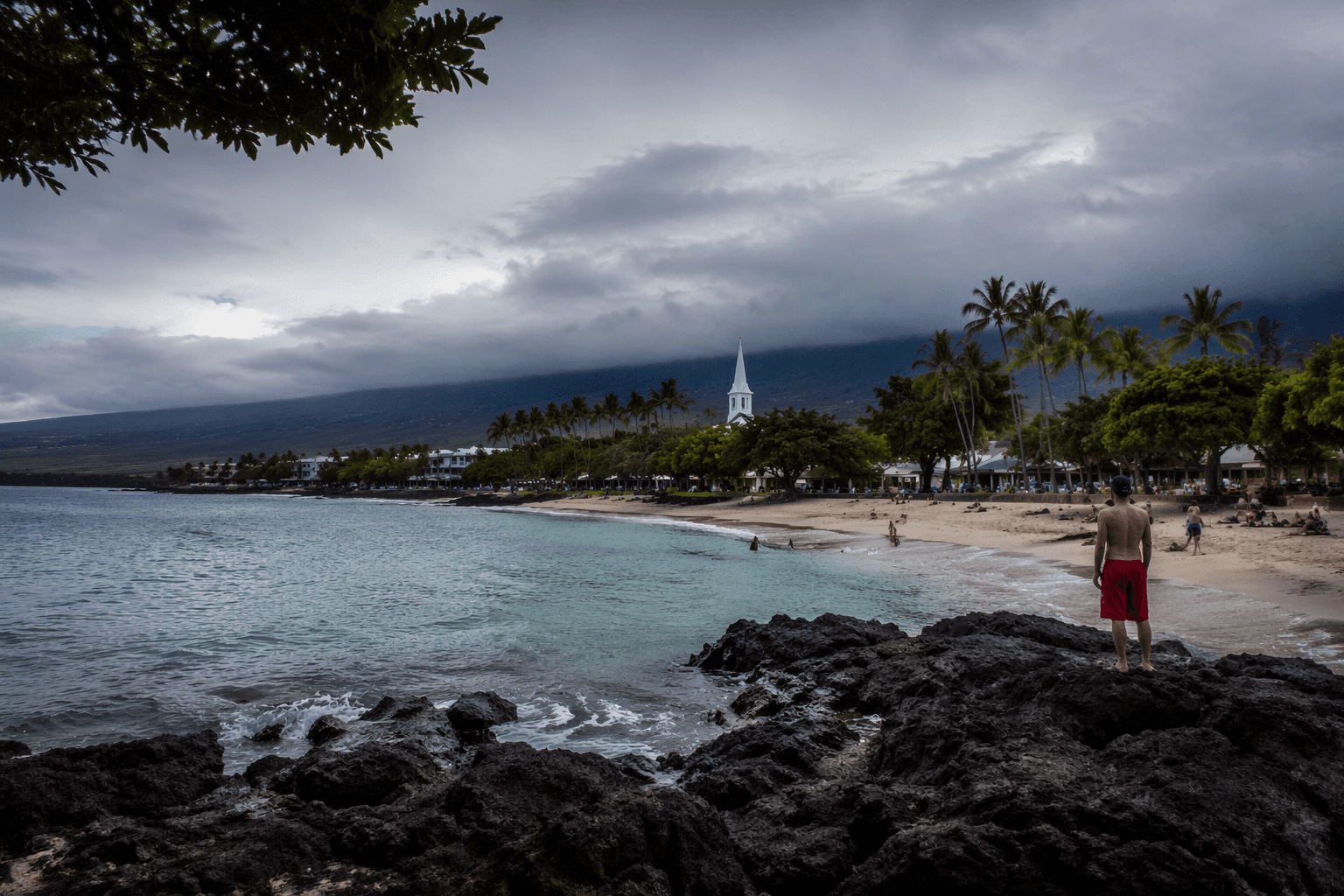
Along Puako Beach Drive in South Kohala, twelve separate public shoreline access points thread between resort properties and private lots, leading to small white-sand beaches and some of the island's most productive tidal pools. Most have no facilities. Several are little more than a narrow corridor between fences. That is legal. What is not legal is a locked gate, a pile of boulders, or landscaping that buries the path entirely. Across Hawaiʻi, county councils have received formal complaints that private landowners are obstructing public rights of way with exactly those methods. On the Big Island, where South Kohala resort development has reshaped miles of coastline and Kailua-Kona's downtown parking squeeze reached a boiling point in late 2024, the gap between access rights on paper and access on the ground is widening in ways many residents may not recognize as illegal.
This guide is built for the people most affected: subsistence fishers who depend on reliable entry points, dive and surf businesses whose livelihoods are tied to predictable coastal access, and community members who simply want to know their rights and how to act on them.
Understanding what "public shoreline" actually means
In Hawaiʻi, the public shoreline is the littoral zone seaward of the shoreline, which is generally defined as the high-wash line or the upper edge of vegetation. State and county definitions can vary, and that ambiguity has historically been used to push the legal line in ways that disadvantage the public. When in doubt, check county maps and posted signage rather than relying on a landowner's markings.
Public access does not require parking, bathrooms, or a paved path. State law under §46-6.5 requires counties to condition subdivision and development approvals on the dedication of pedestrian access corridors from public highways to the high-water mark. That means many access points that exist today were negotiated at the permit stage decades ago and run through what is now private land. You have the legal right to use those corridors; you do not have the right to wander beyond the designated path onto private property.
The landmark 1992 case brought by Public Access Shoreline Hawaii against the Hawaiʻi County Planning Commission reinforced that traditional and customary rights, guaranteed under Section 7 of the Hawaiʻi Constitution, extend beyond bare-minimum physical entry. Subsistence fishing, gathering, and cultural practice along the shoreline carry legal weight that goes beyond recreational use.
Finding your access point before you leave home
The Hawaiʻi County Planning Department publishes a district-by-district shoreline access guide organized by region: North Kohala, South Kohala, North Kona, South Kona, Kaʻū, Puna, and Hilo. The state Division of Aquatic Resources supplements this with fishing rules, marine managed area boundaries, and maps of restricted zones. Visitor centers in Hilo and Kona maintain printed lists of commonly used accesses. The single most reliable field marker is the blue wave logo: Hawaiʻi County uses that sign at designated public access points island-wide, and seeing it means you are at a legally recognized entry point.
Before heading out:
- Cross-reference the county access guide with satellite imagery to confirm the path has not been obstructed since the listing was updated.
- Note whether parking is listed. Puako Beach Drive accesses, for example, do have roadside parking but no facilities, while the unpaved coastal trail from the south end of Puako lots to Pauoa Bay requires you to carry everything you need.
- Check the Na Ala Hele program (reachable at 808-974-4221) for current status of coastal trails in your area.
- Confirm tide times and surf forecasts, especially for lava bench entries in Puna and Kaʻū where high-energy wave surges can appear without warning.
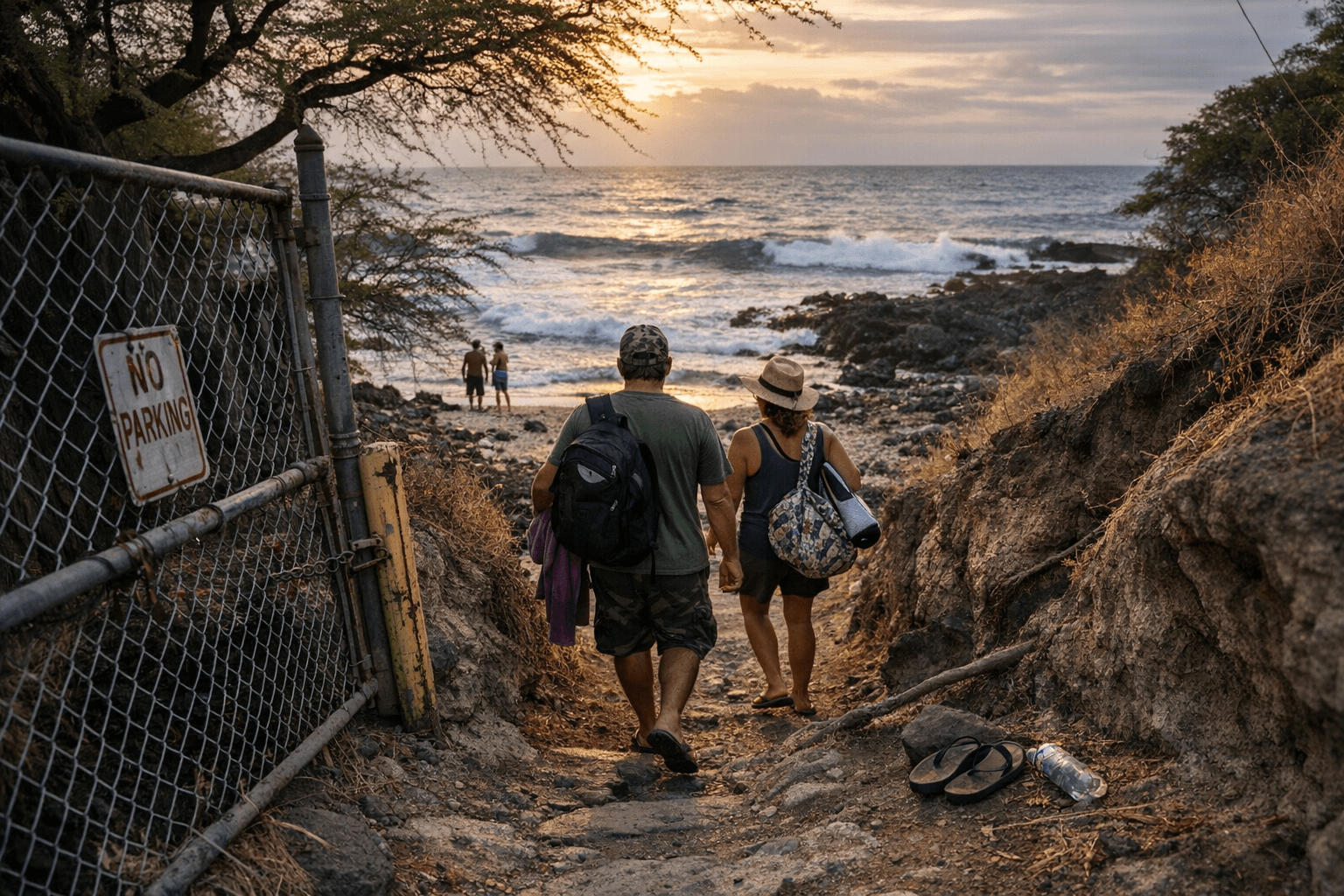
When you find the path blocked
A locked gate where no gate existed, signage claiming private ownership over a mapped public corridor, or a fence that has migrated into the access way are all potential violations. If you encounter a blockage:
1. Document the obstruction with photographs showing the location, the county access sign if visible, and the nature of the barrier. Note the date, time, and GPS coordinates.
2. Do not attempt to remove the barrier yourself. Trespass liability runs both ways, and removing private property without authorization creates legal exposure for you.
3. Contact the Hawaiʻi County Planning Department to report the specific access point by name and district. The department tracks easements and can initiate contact with the landowner.
4. File a concurrent report with the state's Division of Conservation and Resources Enforcement (DOCARE), which has jurisdiction over violations of public access and coastal rules. DOCARE officers are authorized to address barriers on access ways in the same way they address reef and wildlife violations.
5. If the obstruction involves a known public easement, contact your county council member with your documentation. County council resolutions have been used elsewhere in the state to formally direct planning departments to reclaim blocked access, and the same mechanism is available on the Big Island.
Protecting the access you have through how you use it
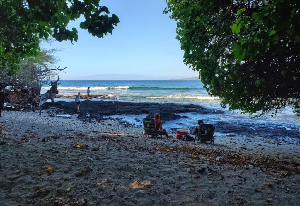
Poorly managed access is the argument landowners use to justify restrictions, and it is the argument that has occasionally succeeded. Along Puako Beach Drive, where tidal pool ecosystems are both ecologically fragile and heavily visited, careless use creates genuine damage that undermines the community's case for keeping access open. The same is true at culturally sensitive coastal sites, including heiau and wahi pana, where disrespectful behavior provides ammunition for closure.
Practical stewardship at every access point:
- Do not stand on coral. The reef systems along the South Kohala coast, already under pressure from warming and runoff, cannot recover from physical trampling.
- Follow all Division of Aquatic Resources rules for the area, including size limits, catch limits, and seasonal closures. Subsistence fishing rights are strongest when they are exercised within the rules.
- Do not remove rocks, move boulders, or disturb dune vegetation. Dune and shoreline plant systems stabilize sand, protect upland property, and support nesting shorebirds. Destabilizing them accelerates the erosion that destroys access points over time.
- Respect posted guidance from cultural practitioners at identified sacred sites. Do not climb on heiau or remove any materials.
- Pack out everything you bring. Trash at access points is consistently cited in complaints that lead to restrictions.
Safety specifics for Big Island terrain
Big Island shorelines span conditions found almost nowhere else in a single county. The calm bays of South Kohala are a different environment from the lava benches of lower Puna, and both are different from the high-surf exposed coasts near Kaʻū. Wear closed-toe footwear on lava and rocky shores; reef walkers or similar soles protect against both cuts and the instability of loose ʻaʻā. Watch for sudden wave surges on benches, particularly around dawn and dusk when light conditions make water movement harder to read. If snorkeling or diving, use a surface float flag when conditions or boat traffic warrant it, and never enter the water alone.
Check the Hawaiian Lifeguard Association's current advisories, the National Weather Service surf forecast for Hawaiʻi Island, and county beach warning signs before entering any unfamiliar water.
How to push for improvements
If a specific access point in your community has deteriorating parking, an eroding trail, or no signage, the path to improvement runs through both the county and the community. Contact the Hawaiʻi County Department of Parks and Recreation, alongside the Planning Department, to ask about the status of any existing easement and whether capital improvement funds can be directed to maintenance. Proposals backed by community letters, photographs showing current conditions, and a documented history of public use carry significantly more weight than individual requests.
Local coastal nonprofits and watershed partnerships can help with grant applications and stewardship programs that the county and state cannot always fund on their own. Coastal trusts with existing relationships with state land agencies have successfully brokered access agreements that formal government channels stalled for years.
Development pressure, major storm events, and shifting tourism patterns make this an ongoing rather than a settled issue. The blue wave signs along Puako Beach Drive and elsewhere represent decades of legal work to keep water within reach of the people who live here. Keeping them meaningful requires using them, defending them, and treating the ecosystems they lead to as worth protecting.
This article was produced by Prism’s automated news system from verified source data, official records, and press releases, then run through automated quality and moderation checks before publishing. The system is built and supervised by the people who set the standards it runs under. Read our full AI policy.
Did this article answer your question?