County moves to buy 1,967 lower Puna coastal acres for conservation
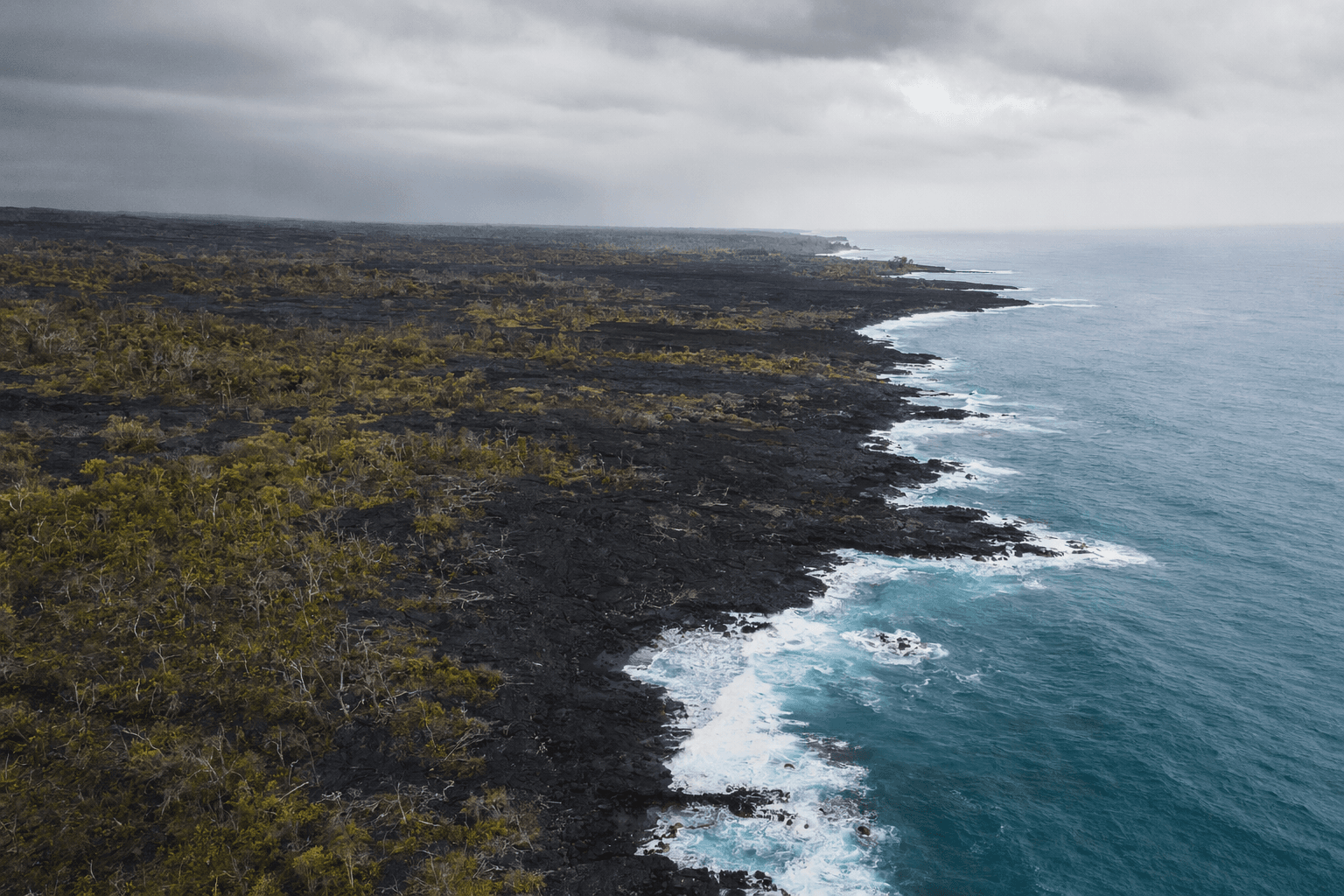
County leaders moved to protect 1,967 Kumukahi acres in lower Puna, a lava-scarred coastline where Kapoho and Vacationland were erased in 2018.

Hawaii County took a major step toward preserving 1,967.96 rocky coastal acres at Kumukahi in Waakula, a lower Puna shoreline reshaped by the 2018 eruption and now poised to become one of the island’s biggest conservation acquisitions.
The Hawaii County Council passed Resolution 516-26, directing the county finance director to negotiate with seven lower Puna landowners for the purchase of the property using the Public Access, Open Space and Natural Resources Preservation Fund, known as PONC. The county’s PONC commission is tasked with building an island-wide prioritized list of lands worth preserving, and the fund is supported by 2% of annual property tax revenues.
County meeting coverage placed Kumukahi at No. 3 in the 2025 PONC Commission report. A meeting summary also said all 14 property owners support the acquisition, with Hauululahui and the Komoo Legacy Foundation expected to handle stewardship if the deal is completed.
For lower Puna, the proposal reaches beyond land transaction. The same coastline once saw lava enter the ocean through Vacationland and Kapoho Beach Lots on June 3, 2018, after the eruption erased Kapoho, Vacationland and hundreds of homes and wiped out a large section of Highway 132. Turning that ground into protected public land would give the county a way to shape the long recovery of an eruption zone that still carries the memory of those losses.
County and PONC rules say properties may qualify for preservation when they provide beach or mountain access, outdoor recreation, education, natural beauty and watershed or other environmental benefits. At Kumukahi, those standards intersect with testimony submitted to the county describing the land as deeply tied to Hawaiian history, ceremonial practice and traditional navigation.
If the acquisition moves forward, the acreage would be held for conservation rather than private development, giving residents a stronger claim to coastal access, cultural stewardship and managed public use. That could also help shield the easternmost point of the Hawaiian Islands from renewed development pressure in a landscape still marked by the 2018 disaster.
The purchase would also fit into broader recovery work already mapped around lower Puna. County records tie Highway 137 reconstruction to a Kumukahi stewardship plan, with completion projected for the third quarter of 2026, while Pohoiki Road restoration is expected to continue through the fourth quarter of 2026.
This article was produced by Prism’s automated news system from verified source data, official records, and press releases, then run through automated quality and moderation checks before publishing. The system is built and supervised by the people who set the standards it runs under. Read our full AI policy.
Did this article answer your question?