New 300-Mile King's Trail Links Big Island's Coastal Pathways
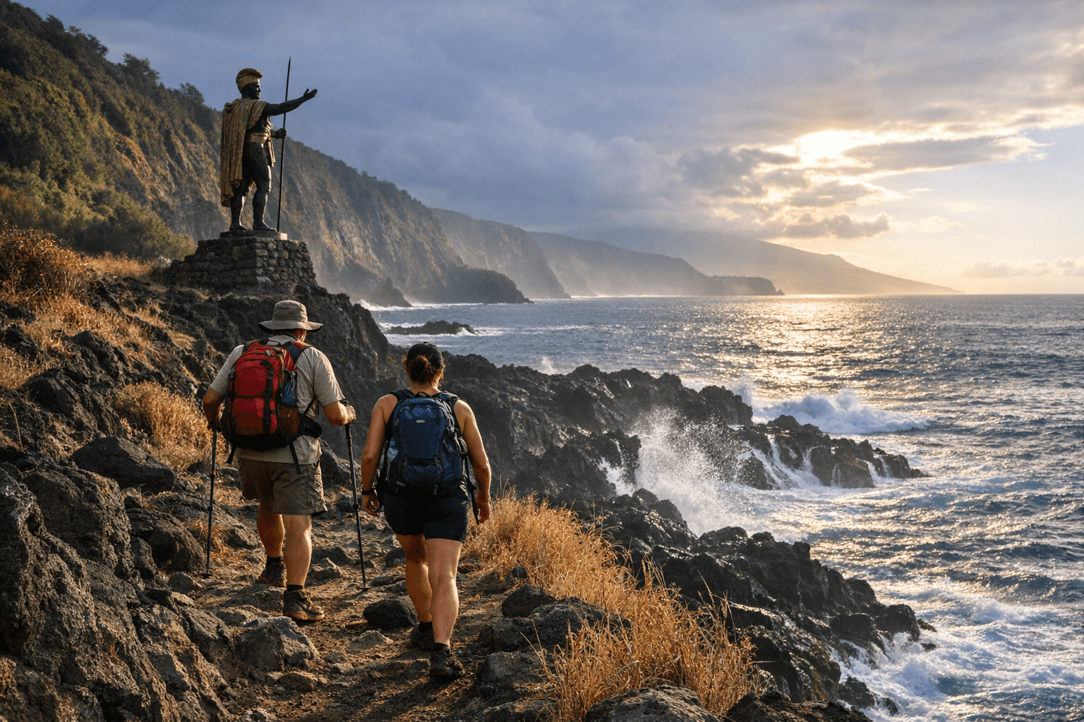
Dr. Chad Waters mapped a 300-mile coastal route linking two King Kamehameha statues, from Kapaʻau to Hilo, that no other trail on Earth can match.
What began as one avid hiker's search for a long, continuous trail on the Big Island has produced something far more ambitious: a documented 300-mile coastal route that threads together ancient pathways, national park corridors, and private land easements into a single traversable circuit connecting opposite ends of Hawaiʻi Island.
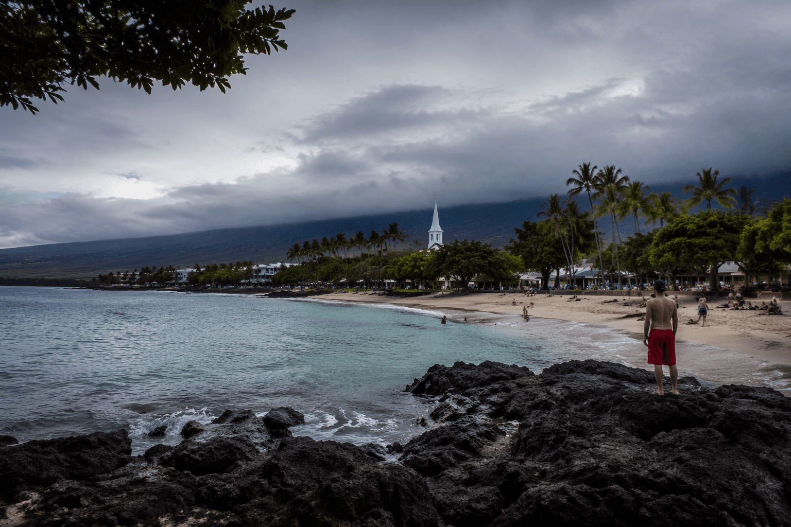
Dr. Chad Waters mapped the King's Trail by assembling the 175-mile Ala Kahakai National Historical Trail Corridor with additional coastal paths, creating a route that runs from the King Kamehameha statue near Kapaʻau in the north to the King Kamehameha statue in Hilo, the island's seat of government, and reaches the eastern boundary of Hawaiʻi Volcanoes National Park. "When I started to put the trail together, I realized that this was the perfect way to honor King Kamehameha I and to bring awareness to the great history and raw beauty of Hawaiʻi," Waters said. "There is no other place that I know of where you can walk 300 miles of coastline."
The route breaks into 18 segments, 16 of them single-day hikes and two requiring overnight stays, designed to be completed across roughly 20 days. Those days are typically spread out rather than consecutive. The trail crosses National Park, state, and county land, as well as private property where access easements exist, and carries no transportation, lodging, or supply infrastructure: it is rated an advanced hike in every sense.
The Ala Kahakai corridor at the trail's core carries roots reaching back to around 500 AD, when the first settlers of Hawaiʻi Island began shaping a coastal network that would eventually be formalized as the Ala Loa, the major land route connecting communities islandwide. Ala Kahakai translates to "trail by the shoreline" in Hawaiian. In 1892, Queen Liliʻuokalani declared all existing trails public highways, and the Ala Kahakai Trail Association has since worked to reconnect Native Hawaiians with those ancient paths. Waters built on that foundation by documenting the trails on a GPS-mapped record for easier navigation.
The impact on residents who grew up dreaming of circling the island is already evident. "Growing up here, it was always a goal of mine to walk around the island, but I knew it would be difficult due to private property and dangerous terrain," said Aue, a Big Island resident. "But I found that there was this new trail that utilized only public access routes and had been mapped out using GPS."
Parts of the trail pass through Kaloko-Honokohau National Historical Park, where the older Mamalahoa Trail, built between 1836 and 1855 by prisoners and local laborers for horse travel, once stretched 32 miles linking the villages of Kailua, Kona, and Puako. Stone shelves cut into both sides of the path were designed to keep horses on course even if a rider dozed off. The name Mamalahoa refers to a law passed by Kamehameha the Great to ensure traveler safety, and also to the elite corps that helped him unify the Hawaiian Islands. One section accessible from Waikoloa Village, just off Queen Ka'ahumanu Highway at Route 19, offers a free trailhead parking area and quickly transitions from pavement to raw volcanic terrain, with petroglyph fields, lava flows, and alternating views of golf courses and mountain ridgelines.
Aric Arakaki, Superintendent of the Ala Kahakai National Historic Trail, oversees the preservation effort alongside park rangers, archaeologists, and community partners. "We, along with the communities we work with, are documenting, preserving, protecting, and, when managed, making trails available to the public," Arakaki said. The corridor the trail follows links four National Park Service units and numerous sacred sites that the National Park Foundation, in a Summer 2024 report by Dan Paley, described as bridging past, present, and future across an island still actively shaped by volcanic activity.
The trail follows ancestral coastal pathways once used by fishermen, families, aliʻi, and warriors. For those planning the full route, some sections have eroded completely, though long stretches allow uninterrupted hiking of 20 miles or more without stopping.
This article was produced by Prism’s automated news system from verified source data, official records, and press releases, then run through automated quality and moderation checks before publishing. The system is built and supervised by the people who set the standards it runs under. Read our full AI policy.
Did this article answer your question?