Dense Fog, High Winds and Snow Impact Buena Vista County Travel
Multiple advisories issued Dec. 27 placed Buena Vista County under dense fog, strong winds and winter weather warnings that created hazardous travel conditions from late Dec. 27 into Dec. 29. The combination of near-zero visibility, gusts up to about 50 mph and 1-5 inches of snow in spots posed risks to motorists, property and power infrastructure across the county.
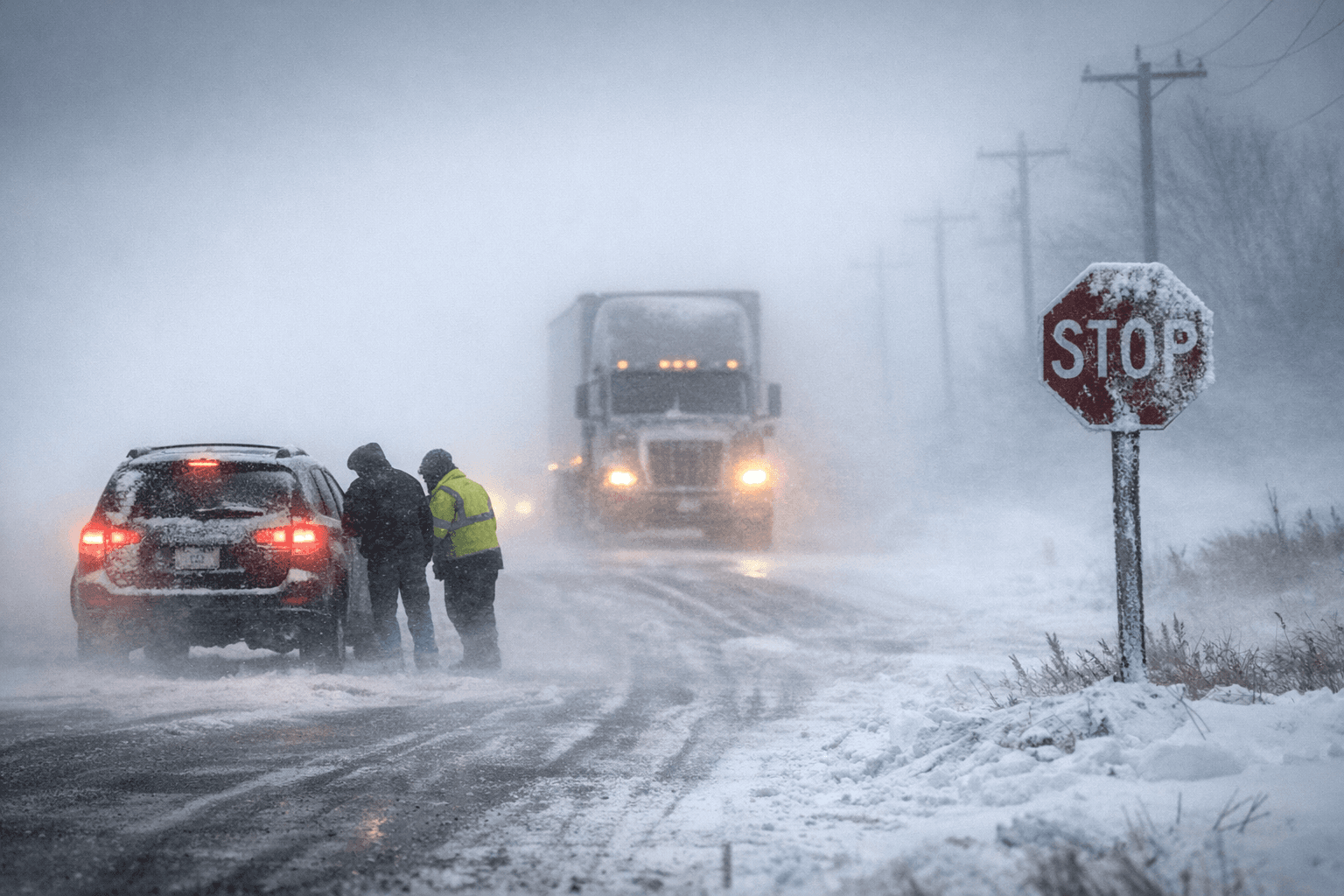
The National Weather Service in Sioux Falls posted a series of warnings beginning Dec. 27 that affected Buena Vista County, with significant implications for overnight and daytime travel. A Dense Fog Advisory was in effect from 6:00 p.m. CST Dec. 27 until 6:00 a.m. CST Dec. 28, with visibility reduced to one quarter mile or less. That advisory signaled hazardous driving conditions overnight into early morning hours.
As fog eased, a Wind Advisory began at 6:00 a.m. CST on Dec. 28 and remained in effect into late night Dec. 28 and into Dec. 29. Forecast northwest winds were 25 to 35 mph with gusts up to around 50 mph in the advisory area. The advisory noted gusty winds could blow unsecured objects, down tree limbs and cause isolated power outages, elevating risk to property and rural infrastructure.
Concurrently, portions of the region that include Buena Vista County were covered by a Winter Weather Advisory active from overnight into Dec. 28–29. That advisory warned of snow and blowing snow with 1-5 inches possible in spots, and gusty winds producing reduced visibility and blowing snow at times. The local forecast page for Storm Lake listed the Dense Fog Advisory and Wind Advisory for Storm Lake and the county and provided a Hazardous Weather Outlook urging caution for travel during these advisory periods.
The timing and overlap of the advisories amplified the local impact. Dense fog reduced visibility during the overnight period when many commuters, delivery drivers and emergency responders were en route to morning shifts. As fog lifted, high winds and fresh snow created new hazards by blowing snow across roadways and increasing the likelihood of downed limbs and localized power interruptions. Rural roads and secondary highways are particularly vulnerable to drifting and fallen debris, increasing the potential for extended travel delays.
For residents and businesses, the episode underscored the importance of checking road conditions and utility outage reports before travel and securing outdoor items that could become wind-borne. Local governments and service providers often prioritize clearing main routes and responding to power outages, but the combination of low visibility and gusty winds can slow response times.
The advisories covered a short, intense period of hazardous weather. Continued attention to forecast updates and road condition information remains the most reliable way for Buena Vista County residents to avoid the greatest risks associated with this sequence of fog, wind and snow.
This article was produced by Prism’s automated news system from verified source data, official records, and press releases, then run through automated quality and moderation checks before publishing. The system is built and supervised by the people who set the standards it runs under. Read our full AI policy.
Did this article answer your question?