How the railroad shaped Buena Vista County towns and growth
Storm Lake’s rail start still shapes Buena Vista County. The county seat, the business core, and the town map all follow railroad-era choices made more than a century ago.
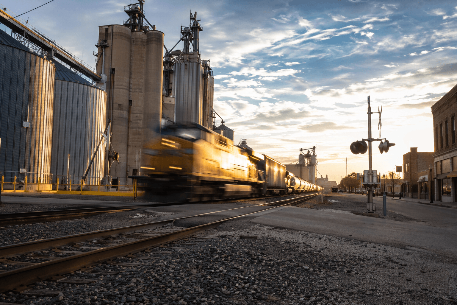
The railroad did more than bring trains to Buena Vista County. It ined where Storm Lake grew, why Newell got a station early, and how the county’s commercial life took shape around tracks, depots, and market access. Those decisions still echo in where people live, where businesses cluster, and why Storm Lake became the county’s lead city.
Why rail mattered in an agricultural county
Buena Vista County grew around farms, so transportation was never a side issue. A rail line meant grain could reach distant buyers faster, supplies could arrive more reliably, and merchants had a reason to build near the depot instead of out on the open prairie. That changed the county’s economics in a direct way: rail access lowered the friction of doing business, and the towns that sat closest to that access gained an early advantage.
Railroads also changed how the county worked as a whole. Before trains, wagon roads made long-distance trade slower and less predictable. Once rail service arrived, rural residents were tied into larger regional networks, and that link helped decide which communities would expand, which would hold their place, and which would remain smaller service points.
Storm Lake became the county’s rail center
Storm Lake’s rise is the clearest example of how a rail line could reshape a county map. Railroad construction reached Storm Lake in 1870, and the line was known then as the Iowa Falls and Sioux City Railroad. The city has described Storm Lake as having been born as a railroad town, and the timeline fits: the town incorporated in 1873, held its first municipal election that spring, and elected S. H. Hobbs as mayor.
The political turning point came in 1878, when Storm Lake became the county seat. A WPA county history calls that move the moment that made Storm Lake Buena Vista County’s leading city. The same history notes that residents had hoped for additional railroad facilities, and on July 6, 1871, Storm Lake Township voted 44 to 15 to help construct the Maple Valley Railroad from Jackson, Minnesota. That vote shows how closely civic ambition and rail access were linked.
Storm Lake’s story helps explain the county’s present geography. County-seat functions, larger commercial corridors, and the strongest concentration of services naturally followed the place with the best transportation link. Even today, Storm Lake sits at the center of a county whose growth was organized around the logic of getting goods and people moving.
Newell shows how rail created town sites, not just stops
Newell’s early history tells a similar story from a different part of the county. In 1869, the Dubuque and Pacific Railroad Company was interested in placing a town in the area, and the first railroad station was built in 1870. The first steam locomotive came through shortly afterward, which gave the new settlement an immediate connection to the broader rail system.
That sequence matters because it shows that the railroad did not simply serve an existing town. In Newell, the railroad helped make the town itself. A station and a passing locomotive brought visibility, traffic, and the kind of commercial logic that encouraged a town site to take hold. In county terms, that meant rail routes were deciding where settlement hardened into a permanent community.
The same pattern helps explain why Buena Vista County does not read like a random scatter of towns on a map. Communities such as Alta, Rembrandt, and Truesdale developed inside a county whose growth was shaped by access, movement, and proximity to rail-connected centers. The railroad era left behind a settlement pattern in which some places became stronger service hubs while others stayed smaller.
What the rail map changed on the ground
Rail lines influenced more than town founding dates. They steered where grain elevators went up, where commercial buildings clustered, and how far a downtown could spread before the edge of town gave way to farm ground. When merchants, farmers, and local officials chose sites near tracks and depots, they were locking in a business geography that still guides modern traffic patterns.
Land values and competition among settlements also followed the railroad. Towns with rail service had a stronger pitch for residents, lenders, and retailers because they could promise easier shipping and better access to markets. That advantage could be decisive in a county where agriculture depended on moving products out and bringing supplies in.
The long-term result is visible in how local space is organized. Buena Vista County’s roads, business districts, and town centers still reflect choices made when the railroad first arrived. The county’s economic winners were often the places that could turn transportation access into permanent civic advantage.
Where to trace the story locally
The best place to follow these county details is close to home. The Buena Vista County Historical Society, which local and state listings identify as a key county-history resource, keeps the kind of material that helps connect rail lines to town growth. Its museum is at 214 W. 5th St. in Storm Lake, putting the county’s rail story in the same city that became the county seat.
The Storm Lake Public Library is another important stop for local history, especially if you want the civic and neighborhood context that maps alone cannot show. Together with county records and historical society materials, those collections help explain how depot locations, town sites, and business corridors were chosen. For a county built around agriculture and trade, that paper trail is the best guide to why the landscape looks the way it does now.
Buena Vista County in the wider Iowa rail story
Buena Vista County was part of a much larger transportation shift across Iowa. The Iowa Department of Transportation says railroads began weaving through Iowa in the late 1840s, and by 1860 the state was already crisscrossed by rail lines. Buena Vista County’s experience came later in that statewide wave, but it followed the same pattern: rail access helped convert open land into organized towns, then turn those towns into durable centers of commerce.
That broader context matters because it shows Buena Vista County was not an exception. It was part of the railroad-driven transformation that shaped much of Iowa, with local geography, population patterns, and business development all bending toward the line. In Buena Vista County, the tracks may be old, but the map they created still sets the terms for the present.
This article was produced by Prism’s automated news system from verified source data, official records, and press releases, then run through automated quality and moderation checks before publishing. The system is built and supervised by the people who set the standards it runs under. Read our full AI policy.
Did this article answer your question?