Storm Lake Municipal Airport Serves Pilots, Community With General Aviation Hub
Three runways, a volunteer commission, and 160 acres three miles southwest of town: Storm Lake's general aviation airport has anchored Buena Vista County flying since 1946.
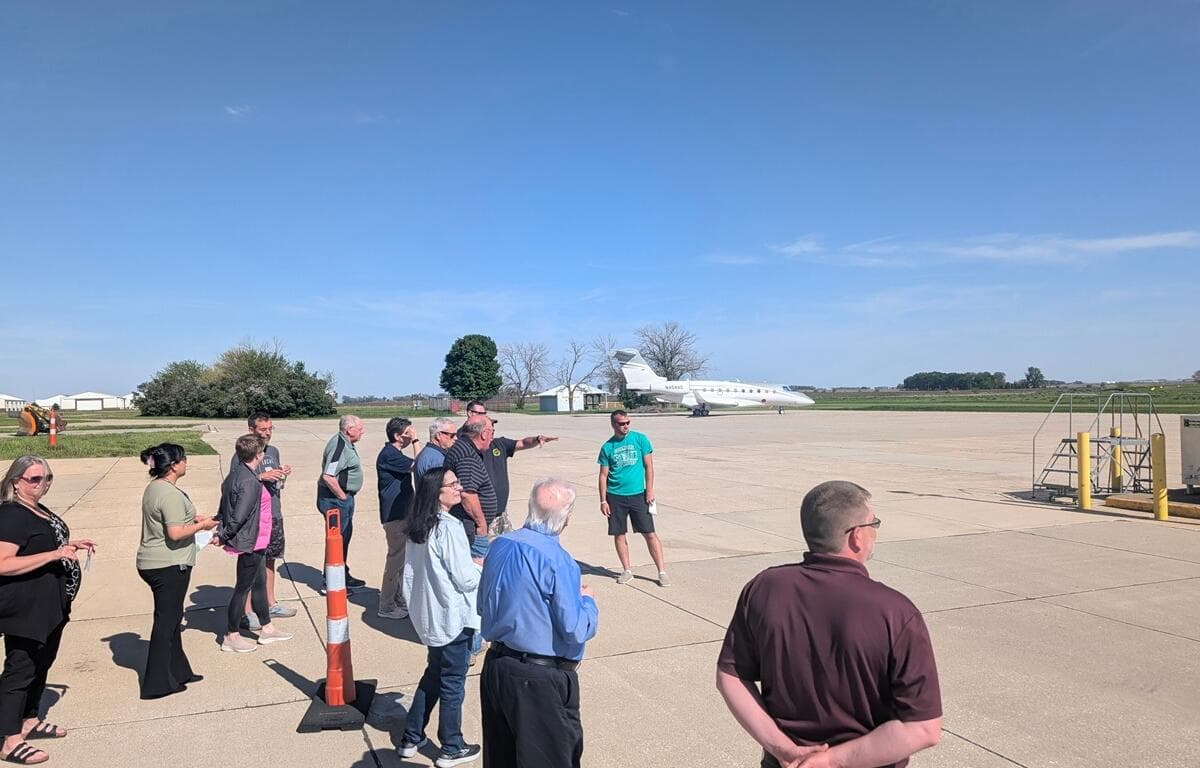
Three miles southwest of downtown Storm Lake, a 160-acre airport has been quietly anchoring general aviation in Buena Vista County since January 1946. Storm Lake Municipal Airport (IATA: SLB, ICAO: KSLB) sits at an elevation of 1,488 feet above sea level, operates entirely without a control tower, and serves the kind of flying life that sustains small-city Iowa: private pilots, agricultural operators, and business travelers who need a capable field without the congestion of a commercial hub.
Ownership, Governance, and Day-to-Day Operations
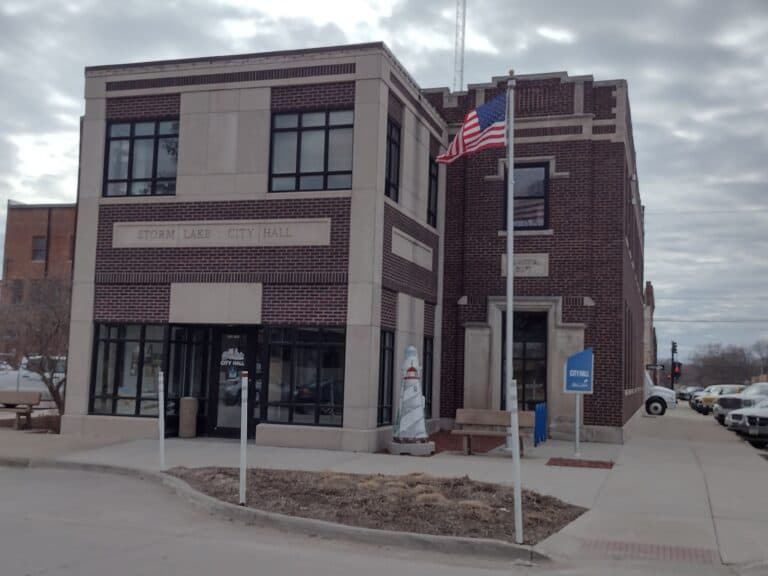
The airport is owned by the City of Storm Lake and governed by the Storm Lake Airport Commission, a five-member volunteer board of commissioners. That board contracts a fixed-base operator (FBO) to handle day-to-day operations, a structure that keeps municipal oversight intact while outsourcing the operational complexity to aviation professionals. The City of Storm Lake maintains ultimate responsibility for the facility, and questions about airport policy or planning can be directed to Storm Lake City Hall at 620 Erie Street (P.O. Box 1086, Storm Lake, IA 50588) or by phone at 712-732-8000 during standard business hours of Monday through Friday, 8 a.m. to 5 p.m. Airport management contacts listed on the city's official site include James Bartholomew and Tyler Gibbins.
Runways and Physical Infrastructure
Storm Lake Municipal operates three runways across its 160-acre footprint, giving pilots meaningful options for wind and aircraft type. The primary runway, 17/35, stretches 5,002 feet by 75 feet on a concrete surface rated in good condition, with a weight-bearing capacity of 30,000 pounds on a single wheel and 38,000 pounds on a double wheel. Runway headings run 171 degrees magnetic (175 true) on the 17 end and 351 degrees magnetic (355 true) on the 35 end, with left-traffic patterns on both sides. A second concrete runway, 13/31, measures 3,035 feet by 50 feet and provides a crosswind option. The third runway, 06/24, is a 1,962-foot by 95-foot turf strip suited to lighter piston aircraft.
Approach and visual aids on the main runway are well-equipped for a general aviation facility of this size. Precision Approach Path Indicators (PAPI) operate continuously on both runway 17 and runway 35, and Runway End Identifier Lights (REIL) are installed on both ends as well. Medium-intensity runway edge lights run on 17/35, while pilot-activated medium-intensity runway lights (MIRL) serve both 13/31 and 17/35 via the Common Traffic Advisory Frequency. A white-green rotating beacon, the standard identifier for a lighted land airport, operates from sunset to sunrise. The airport does not have a segmented circle, but a lighted wind indicator is present.
Communications, Weather, and Airspace
Storm Lake Municipal is an uncontrolled airport, meaning pilots self-announce positions and intentions on the Common Traffic Advisory Frequency of 122.7 MHz, which also doubles as the UNICOM frequency. For weather, an on-field AWOS-3 automated observing station broadcasts continuously on 118.525 MHz; pilots can also reach it by phone at 712-732-2301. A second AWOS-3 station at CKP, located 16 nautical miles to the northwest, broadcasts on 119.225 MHz (712-225-1088) and provides a useful cross-reference for pilots planning approaches in variable northwest Iowa weather.
For flight planning and enroute services, the airport falls under Minneapolis Center for air traffic control purposes and is served by the Fort Dodge Flight Service Station. NOTAM-D service is available under the SLB identifier, ensuring pilots can check current notices affecting the field before departure or arrival.
Fuel, Maintenance, and Services
Jet-A fuel is available at Storm Lake Municipal, making the airport accessible to turbine-powered aircraft. The FBO provides hangar space and tiedown parking for visiting and based aircraft. Notably, the airport offers major airframe and powerplant maintenance service, a significant capability for a county general aviation airport and one that reduces the need for pilots to ferry aircraft to larger cities for repairs. Bottled and bulk oxygen are not available on the field. No specific FBO company name appears in publicly available official records, so pilots seeking current pricing, fuel availability beyond Jet-A, or specific service hours should call the airport attendant directly.

Operating Hours and After-Hours Contact
Staffed attendance at the airport follows a seasonal schedule. From June through September, the airport is attended Monday through Saturday, 8 a.m. to 5 p.m. From October through May, hours shift to 9 a.m. to 5 p.m. on the same days. For operations outside those windows, pilots and visitors can reach an after-hours attendant at 712-732-6301.
Activity and Based Aircraft
According to FAA Form 5010 data cited by Wikipedia, the airport recorded 19,600 aircraft operations over the 12-month period ending May 7, 2009, averaging 54 operations per day. At that time, 37 aircraft were based at the field: 36 single-engine planes and one jet. Those figures are now more than 15 years old, and current based-aircraft counts and annual operations may differ; the FAA's current Airport Master Record would reflect any updates. Even at 2009 levels, the activity volume underscores that Storm Lake Municipal functions as a genuinely active general aviation field rather than a nominal one.
Airport Master Plan and Long-Range Planning
The airport's long-range planning framework rests on two documents: the Airport Master Plan and the Airport Layout Plan. The Master Plan, as described on the city's official site, "evaluates the needs of the existing and future users of the airport over the next 20 years." The last recorded update to that plan was in 1993. The city's own language acknowledges that "FAA standards have changed and there is a need to determine the role the airport will play within the community over the next 20 years," with a stated focus on evaluating runway configuration, completing a comprehensive obstruction evaluation, assessing the building area, conducting a financial feasibility analysis, and involving the public in the process. The Master Plan is described as a joint effort among the Storm Lake Airport Commission, the City of Storm Lake, and the FAA.
The Airport Layout Plan, a companion document, "creates a blueprint for airport development by depicting proposed facility improvements" and provides the guideline by which Storm Lake can ensure development maintains design standards, safety requirements, and consistency with community land use plans. Whether either document has been formally updated since 1993 was not confirmed in available public records as of early 2026, making it a notable open question for anyone tracking infrastructure investment in Buena Vista County.
Accessing the Airport and Local Context
The airport sits at coordinates 42°35′50″N, 95°14′26.4″W, three miles southwest of Storm Lake's city center. For pilots flying in from the region, the facility connects Buena Vista County to the broader northwest Iowa general aviation network. The airport's white-green beacon and lighted wind indicator provide standard orientation for night operations, and the AWOS phone line gives visiting pilots real-time local conditions before committing to an approach.
Storm Lake Municipal has operated continuously since 1946, and its structure, city ownership paired with volunteer commission governance and a contracted FBO, reflects a model common to small Iowa airports that have sustained aviation access through decades of agricultural, business, and personal flying. For a county seat of Storm Lake's size, maintaining major airframe and powerplant service capability alongside three functional runways represents a meaningful infrastructure commitment, one that has kept Buena Vista County connected to general aviation for eight decades.
Know something we missed? Have a correction or additional information?
Submit a Tip