Asheville Launches Monthslong Assessment of Town Branch Stormwater System
Crews will fan out across Asheville's Town "Nasty" Branch watershed starting March 23, inspecting manholes and storm drains in a $900,000 federally backed mapping effort.

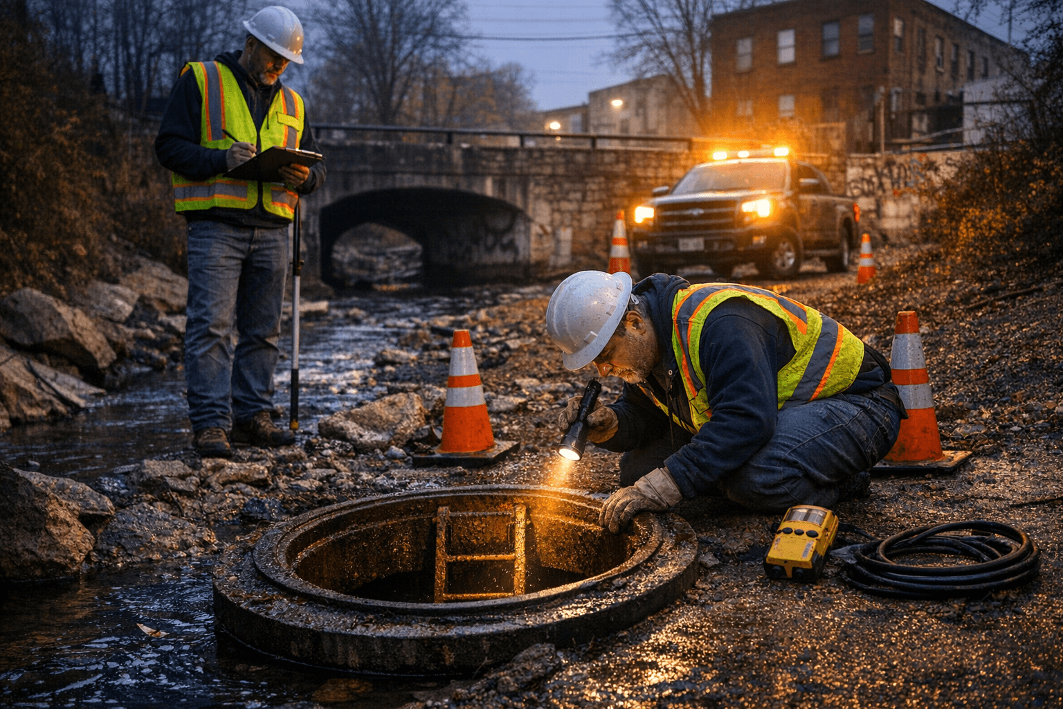
Small crews will begin crawling through the Town "Nasty" Branch watershed this week, peering into manholes and storm drains from Beaucatcher Mountain all the way down to the French Broad River near Lyman Street, as Asheville kicks off the first phase of a monthslong stormwater inventory backed by $900,000 in combined federal and city funding.
Field work is scheduled to start March 23 and run through the end of June. The crews, drawn from the city's contracted partners Ardurra and Colliers Engineering & Design (CED), will inspect storm drains, manholes, inlets and other drainage infrastructure along public rights-of-way, collecting measurements, photographs, video and GPS readings as they go. Workers will be identifiable by high-visibility vests and Ardurra- or CED-branded gear; city staff may accompany them in the field.
The goal is to build what the city describes as "a more complete and reliable map" of a stormwater system whose condition and extent are only partially documented. Beyond mapping, the assessment is designed to identify asset conditions, prioritize maintenance, recommend capital improvement projects, pinpoint areas of localized nuisance flooding and flag erosion zones that need stabilization.
Phase one concentrates entirely on the Town Branch watershed, the drainage corridor that Asheville residents have long called "Nasty" Branch. The study area runs from the branch's headwaters on Beaucatcher Mountain through the city's core and into the French Broad River near Lyman Street, covering a substantial swath of Asheville's older urban neighborhoods.
The $900,000 project is funded through a combination of the city's Stormwater Utility Fee and a grant from the American Rescue Plan Act, the federal pandemic-era relief program. The city has not publicly broken down the share contributed by each source.
Disruption to traffic and daily life is expected to be limited. The city has said some lane closures may be necessary as crews work in roadway rights-of-way, but no full road closures or detours are planned. Residents along the assessment corridor will be asked to avoid parking over storm drains and manholes while work is underway. City staff plan to contact neighborhood groups directly with scheduling updates as specific streets come into scope.
Phase one represents only the opening chapter of a longer undertaking. The city intends to extend the inventory to additional watersheds over several years until a citywide comprehensive stormwater map is complete, though no specific schedules or budgets for those subsequent phases have been announced. The Town "Nasty" Branch assessment will serve as the template for that broader effort.
Know something we missed? Have a correction or additional information?
Submit a Tip

