Buncombe, Madison update hazard plan after Helene landslides
Buncombe and Madison are steering recovery money toward Garren Creek, where engineers will study Helene’s deadliest slide zone over the next 30 weeks.
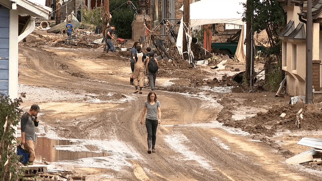
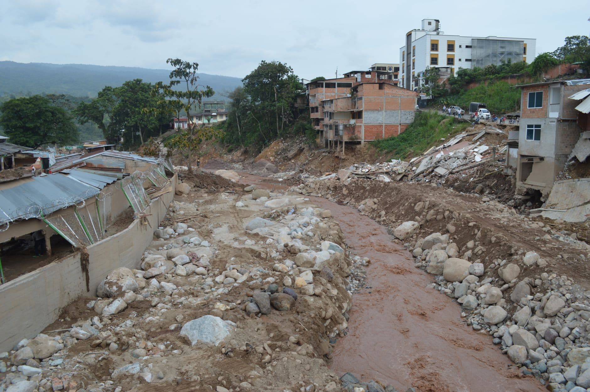
Buncombe and Madison counties are rewriting their storm-safety playbook around Garren Creek, one of Helene’s deadliest landslide sites. The regional hazard plan is meant to show which slopes can be stabilized, which neighborhoods can be protected, and where county governments need to move fastest before the next major storm. In Fairview, that question is tied to eight separate slide areas across a little more than 72 acres, where 13 people died, including 11 members of one family.
At its June 16 meeting, the Buncombe County Board of Commissioners approved a $1.8 million contract with ECS Southeast for geotechnical engineering services connected to the Garren Creek landslide. The work will include site evaluations, aerial lidar mapping, hazard modeling and options for mitigation, and county leaders said the assessment is expected to take about 30 weeks. The contract will be paid for with FEMA public assistance funds and money from North Carolina Emergency Management, putting federal and state recovery dollars directly into the county’s landslide response.

The Garren Creek project is the second of three county landslide mitigation efforts, and county reporting later said the first sites studied in the program would be Grovemont and Garren Creek. County officials said 55 landslides across Buncombe County were initially identified as affecting two or more properties, and 25 met FEMA criteria for engineering and design work. More than 428 residents have already taken the next step through the FEMA-funded Hazard Mitigation Grant Program to reduce long-term risk to their properties, a sign that the county’s mitigation push is reaching beyond one catastrophic site.

The stakes are especially visible in Fairview, where local accounts said the Craig family had owned land near the Garren Creek Fire Volunteer Department station for about 80 years. The 13 deaths in Garren Creek and Craigtown accounted for more than one quarter of Buncombe County’s official Helene fatality count of 42, making the area a central test of whether recovery money can become real protection instead of another planning document.
That test now extends across the county’s broader Helene Recovery Plan, a roadmap of 114 projects developed with Buncombe County’s six municipal partners: Asheville, Biltmore Forest, Black Mountain, Montreat, Weaverville and Woodfin. The plan reaches housing, infrastructure, natural resources, disaster preparedness and long-term resilience, and county leaders are treating the work as regional because storm damage and evacuation routes do not stop at jurisdiction lines. For residents in flood-prone valleys and unstable hillsides, the next 30 weeks will show whether Buncombe and Madison are making the most dangerous ground safer in time for the next hard rain.
This article was produced by Prism’s automated news system from verified source data, official records, and press releases, then run through automated quality and moderation checks before publishing. The system is built and supervised by the people who set the standards it runs under. Read our full AI policy.
Did this article answer your question?