Delta State honors Army analyst Kyle Porto with geospatial scholarship
U.S. Army analyst Kyle Porto won Delta State’s Carlysle Meek Scholarship, spotlighting a geospatial pipeline tied to jobs in mapping, planning and emergency response.
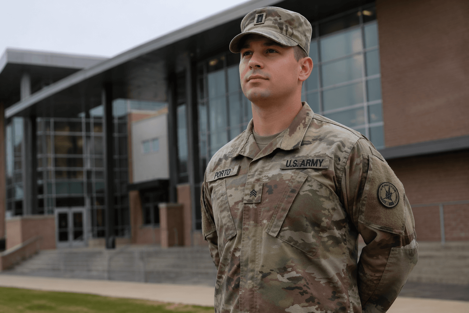
Delta State University named Kyle Porto the latest recipient of the Carlysle Meek Scholarship, one of the Department of Geospatial Information Technologies’ most selective awards, placing a military intelligence analyst at the center of a program built to train the region’s next geospatial workers. The endowed scholarship is offered through the College of Business and Aviation for a student majoring in Geospatial Information Systems, and Delta State says departmental scholarship notices are typically sent July 1 after the regular academic scholarship cycle.
Porto is not a traditional undergraduate. He serves as a Geospatial Intelligence Imagery Analyst in the U.S. Army while working toward a degree in Geospatial Analysis and Intelligence, and Delta State said his record fits the award’s focus on academic excellence, discipline in the field and long-term professional planning. His work supports leadership and intelligence teams with geospatial analysis and imagery intelligence so they can make better decisions on mission planning and operations. The university said he has backed large-scale military exercises and overseas assignments, including work in Poland and South Korea, where he was stationed at Camp Humphreys.
The scholarship also points to a bigger question for Cleveland and the Mississippi Delta: whether Delta State is building the kind of specialized workforce local employers actually need. Geospatial skills are no longer limited to military maps. They are used in agriculture, land-use planning, emergency management and mapping, all areas that depend on precise location data and real-world analysis. Delta State says its geospatial program covers geographic information systems, remote sensing, GPS, spatial analysis, programming and intelligence analysis, and students are required to complete real-world work before graduation. The university says its BAS in Geospatial Analysis and Intelligence is fully online, asynchronous and USGIF-accredited, with a design that fits working professionals and active-duty military personnel. Its companion certificate is a 21-credit-hour online program.

That broader pipeline matters because Delta State’s geospatial center has long worked beyond campus. The university says the center has partnered with the U.S. military, the National Geospatial-Intelligence Agency, the U.S. Marine Corps, the Mississippi Emergency Management Agency and the United Nations. Talbot Brooks has directed the Center for Interdisciplinary Geospatial Information Technologies since 2005, and Delta State says the center’s mission is to provide first-rate education and technical training while pushing technology transfer into Mississippi government and business sectors. Dr. Joseph Childs, dean of the College of Business and Aviation, said Porto reflects the program’s tradition of excellence and the forward-looking mindset the scholarship is meant to recognize.
This article was produced by Prism’s automated news system from verified source data, official records, and press releases, then run through automated quality and moderation checks before publishing. The system is built and supervised by the people who set the standards it runs under. Read our full AI policy.
Know something we missed? Have a correction or additional information?
Submit a Tip