Tennessee River Flooding Hits Perryville Marina Campsites, Boat Docks
Most Perryville Marina campsites are flooded as the Tennessee River hit its 365-foot flood stage threshold, with water reaching structures at Lost Creek Boat Dock.
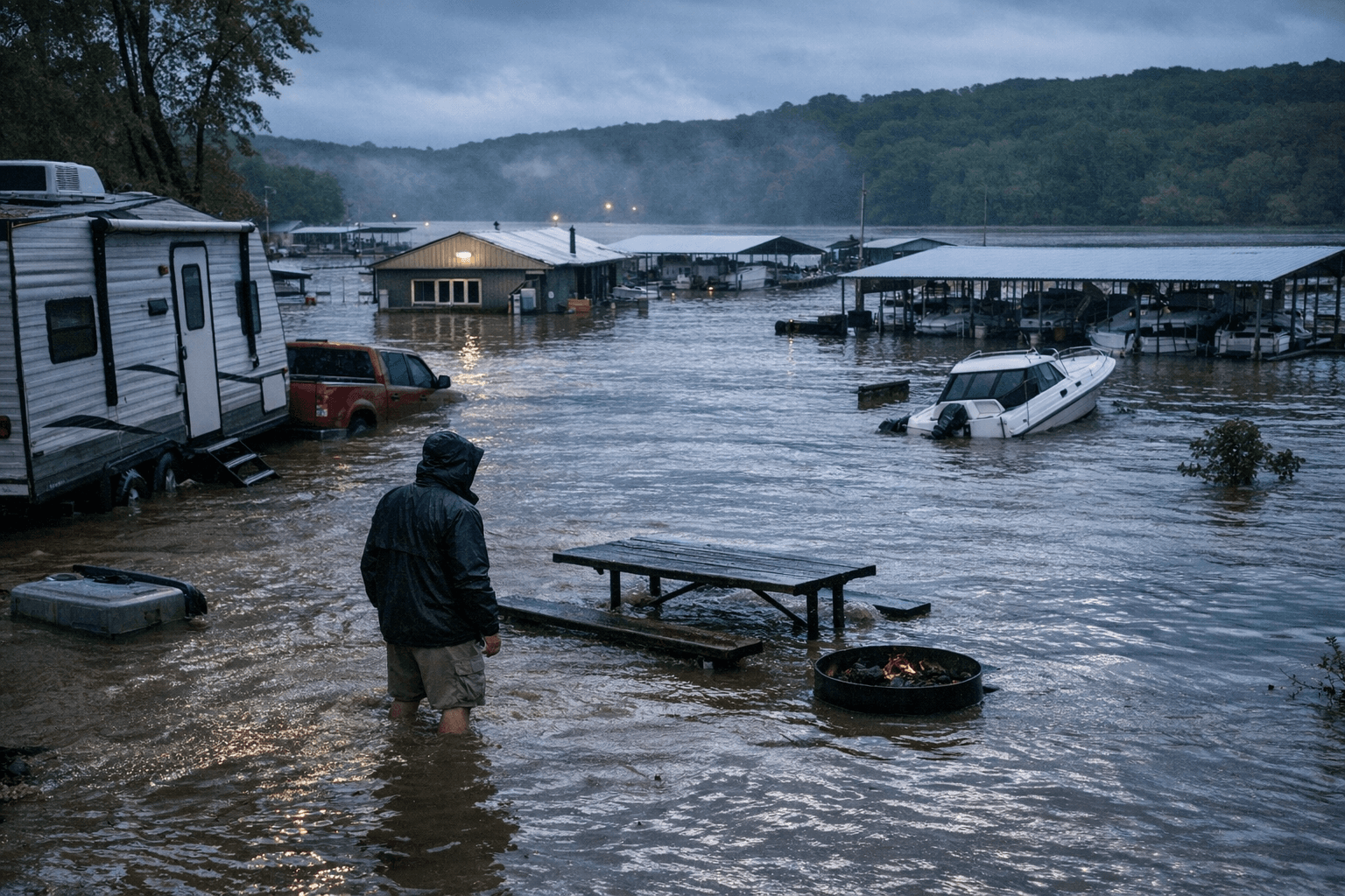
Most campsites at Perryville Marina are underwater this weekend as the Tennessee River pushed to and above the 365-foot flood stage threshold at the Perryville gauge, with NOAA's hourly condition notes confirming water has reached structures at the Lost Creek Boat Dock and Landing just upstream.
The impacts span the roughly seven-mile river corridor accessible via Highway 412 east of Parsons, where Perryville Marina sits at Tennessee River mile marker 135, just south of the Alvin C. York Bridge. Electric and water pedestals, access roads, and picnic infrastructure at flooded campsites should be treated as unusable and potentially energized or submerged. Campers with active reservations should contact the marina directly for relocation options before making the drive out.
The 365-foot mark is the official action threshold at the Perryville gauge, designated PRVT1 by the National Weather Service. Below that level, at 363 feet, the boat launch parking lot at Cherokee Heights floods, the access road to Beech Bend Park boat parking becomes inundated, and water overtops the boat ramp at Gumdale Marina and Fisherdale Landing. With the river at or above 365 feet, those secondary access points remain compromised as well.
Boat owners with vessels docked at Perryville Marina should check dock lines immediately and remove fuel cans, electronics, or other valuables that could be damaged or become floating hazards. Floating debris accelerates significantly during rising stages and can stress cleats, pilings, and hull fittings; anyone planning to run north or south of mile marker 135 this weekend should monitor the NOAA gauge for the forecast crest before departure. Transient boaters approaching Perryville can reach the marina on Channel 16.
Weekend tournament directors and event organizers using the Perryville boat ramps or campground facilities should pull the NOAA gauge reading at water.noaa.gov/gauges/prvt1 on the morning of any event. Stage conditions can change within hours depending on TVA reservoir operations upstream, and rescheduling decisions made the night before may not hold by launch time.
Fuel spills from swamped boats or submerged dock infrastructure represent an environmental hazard that falls under the jurisdiction of the Decatur County Emergency Management Agency, which coordinates with TVA and the Tennessee Wildlife Resources Agency on river-safety incidents. County residents who observe visible fuel sheens or debris jams near marina structures can report them to the Decatur County EMA. The TWRA also fields reports on navigation hazards on Tennessee River waters within the county.
The NOAA gauge at Perryville is updated hourly and includes both numeric stage readings and the text condition notes that specify when named facilities such as Lost Creek Boat Dock and Perryville Marina campsites cross into flood impact territory, making it the fastest way to track whether conditions are rising, holding, or beginning to recede.
This article was produced by Prism’s automated news system from verified source data, official records, and press releases, then run through automated quality and moderation checks before publishing. The system is built and supervised by the people who set the standards it runs under. Read our full AI policy.
Did this article answer your question?