Castlewood Canyon reveals 5,000 years of history and dam ruins
Castlewood Canyon packs 5,000 years of human history, 1933 dam ruins and 12.9 miles of trails into one Douglas County park. The creek corridor still explains why flood control changed the region.
Castlewood Canyon is one of Douglas County’s clearest places to see geology, archaeology and flood history in the same walk. The park covers 2,628 acres in the Black Forest region, and its trail network leads past the visible remains of Castlewood Dam, the structure that failed in 1933 and changed how the region thinks about Cherry Creek.
What makes the canyon worth the trip
The park is more than a scenic detour off Franktown. Colorado Parks and Wildlife describes it as a landscape where the canyon walls, the creek corridor and the surviving dam ruins sit inside a managed preserve acquired by the state in 1978. That purchase was meant to protect part of the Black Forest, portions of the Cherry Creek floodplain and unique plant and wildlife habitat, which is why the park still feels like a place where natural systems and human decisions are layered together.
That mix matters for anyone planning a visit. Castlewood Canyon is not a museum piece frozen behind glass, and it is not only a hiking park either. It is a working outdoor space where the trail system, the historic structures, the event facilities and the visitor center all point to the same reality: this is a place where Douglas County’s land use history is still visible.
Follow the trails to see the park’s best details
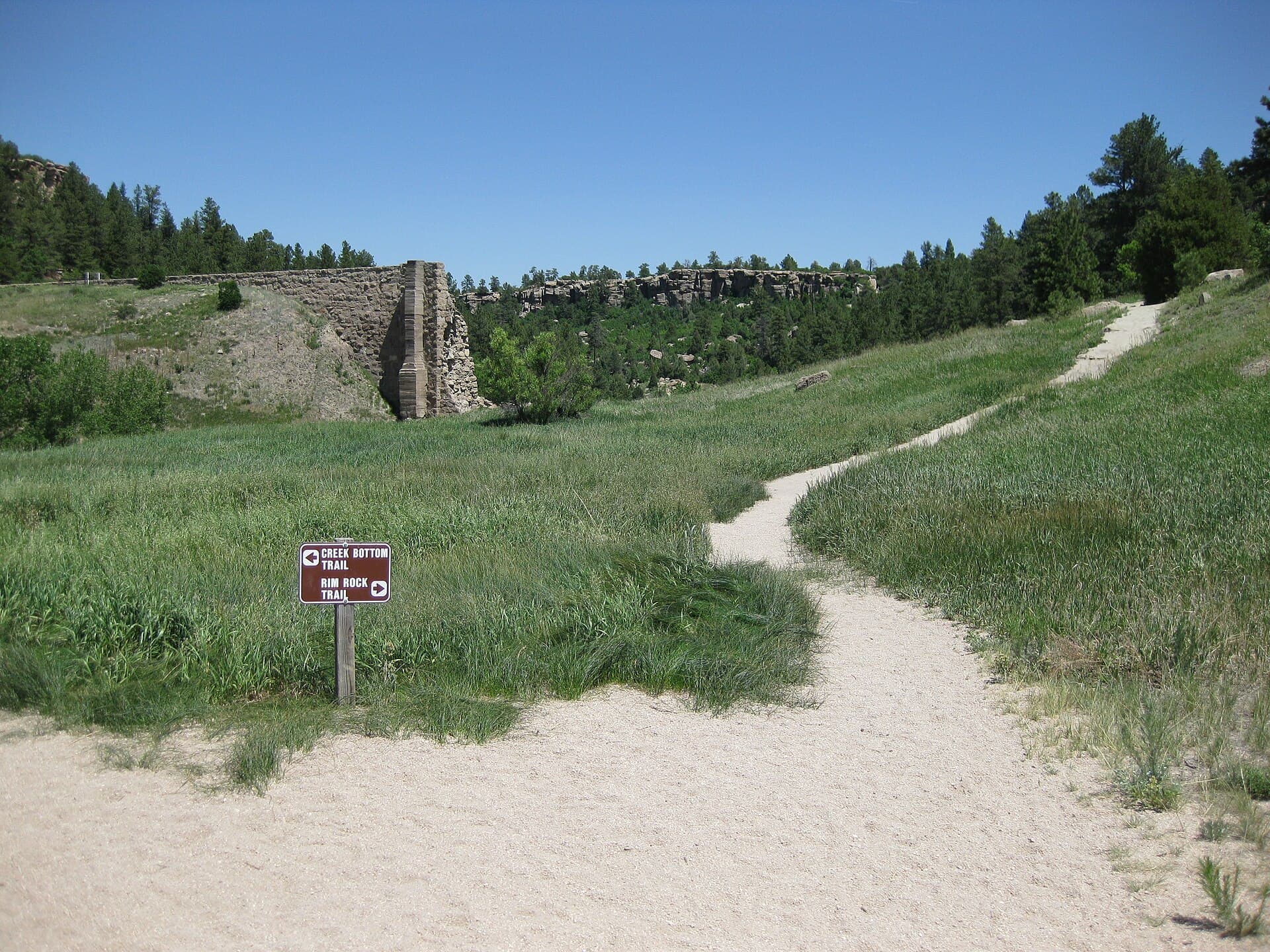
The park has about 12.9 miles of trails, and CPW says roughly 85% of visitors come for those trails. That is the easiest way to understand the site, because the route you choose determines whether you are mainly looking at canyon walls, creekside habitat, historic ruins or climbing faces.
Trail users will notice quickly that Castlewood Canyon is not flat, open prairie. CPW says the climbing walls reach up to 60 feet high, which gives the canyon a steeper, more enclosed feel than many Front Range open spaces. Some sections are better for a relaxed walk, while others run closer to Cherry Creek and make the terrain feel more exposed.
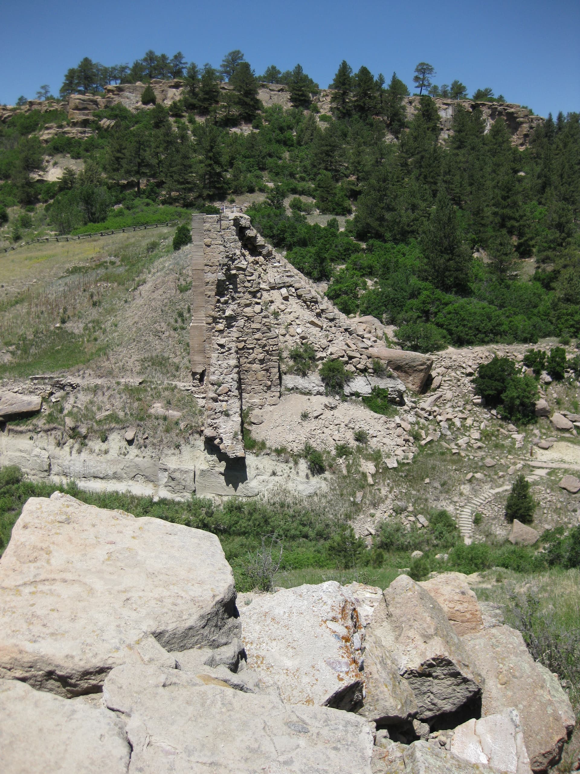
- The ruins of Castlewood Dam, which are still visible to hikers
- The natural amphitheater
- The Bridge Canyon Overlook gazebo
- The visitor center, which helps anchor the park for first-time visitors
A few landmarks help orient the visit:
Those are the places where the park’s history and its scenery meet most directly. The dam remains are the most obvious reminder that the canyon was not only carved by water, but also altered by engineering, failure and later conservation.
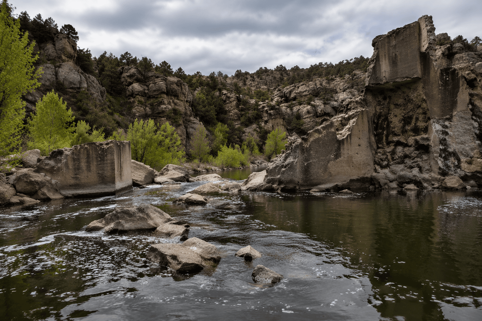
The dam story is the park’s most important warning label
Castlewood Dam was built in 1890 along Cherry Creek south of Franktown to help irrigate Douglas County farms. That origin story matters, because the structure was part of a practical agricultural system before it became a flood legend. When the dam failed in 1933, the break sent a 15-foot-high wave of water into Denver.
The scale of that disaster is still hard to picture until you translate it into volume. Historical records preserved by Denver Public Library Special Collections and Archives say about 1.5 billion gallons of water passed through Denver in about six hours during and immediately after the flood. The event eventually helped push the region toward flood-control infrastructure, including Cherry Creek Dam and Reservoir.
That later project was completed in the early 1950s in Aurora and was designed for flood control. In other words, the canyon’s most famous ruin is not just a relic of local history. It is part of the chain of events that shaped how the metro area managed water downstream from Douglas County.
For visitors, the practical lesson is simple: the creek corridor is where the park’s history is most active. The same low route that made the canyon useful for irrigation also made it vulnerable to floodwater, and that is why the remains feel so striking when you come upon them on foot.
There is older history here than the dam
Castlewood Canyon’s human story did not begin in 1890. CPW says the park’s rock shelters show signs of human presence going back as far as 5,000 years, which makes the site one of the county’s most layered places to read about long-term use of the land. The shelters are a reminder that the canyon served people long before the dam era, likely because water, shelter and game all concentrated in the same landscape.
The homestead history adds another chapter. The Kleinert Homestead dates to 1893 and is recognized as a Douglas County Historical Landmark, placing ranch and settlement history alongside the older archaeological record and the dam remains. A single walk can therefore connect you to prehistoric shelter use, 19th-century homesteading, irrigation development and 20th-century flood control without leaving the same park.
Wildlife still defines the place
Castlewood Canyon is not only about human memory. CPW says the park supports nesting raptors, turkey vultures, deer, elk and the northern leopard frog, a state-listed species. That combination tells you something useful about what to look for while you are there: open sky for birds of prey, brush and creek edges for larger mammals, and wet habitat tied closely to Cherry Creek.
The park’s conservation value is part of the experience, not a separate topic. Its Black Forest setting, floodplain protection and wildlife habitat make the trails feel less like a manicured recreation loop and more like a landscape that is being actively held together. That is one reason the ruins feel so integrated with the natural setting instead of isolated from it.
The park still functions as a community place
Castlewood Canyon also has a civic role that goes beyond sightseeing. CPW says the Friends of Castlewood Canyon State Park is a 100% volunteer nonprofit with more than 100 active members, and a CPW planning document says naturalist-guided hikes reached 4,500 K-12 students in 2019 before pandemic and staffing disruptions reduced participation.
That educational mission fits the facilities already on site. The park has three event facilities, an amphitheater and a canyon overlook, which makes it useful for weddings, outdoor gatherings and interpretive programming as well as day hiking. The result is a park that serves local recreation, school groups and special events without losing the historic landscape that makes it distinct.
The best way to visit is to keep both layers in view. Watch the dam ruins, the canyon walls and the creek corridor, then look up at the rock shelters, the Black Forest vegetation and the bird habitat above you. Castlewood Canyon’s value is that all of those pieces still occupy the same ground.
This article was produced by Prism’s automated news system from verified source data, official records, and press releases, then run through automated quality and moderation checks before publishing. The system is built and supervised by the people who set the standards it runs under. Read our full AI policy.
Know something we missed? Have a correction or additional information?
Submit a Tip

