Douglas County open space plan sets conservation priorities
Douglas County’s open space plan is now steering which farms, floodplains, trails, and heritage sites get first attention, with the Wakarusa corridor next.
The County Commission set Douglas County's open space plan in motion in May 2019, adopting the Open Space Plan Project Charter as the framework for a countywide open space plan and program. The plan is aimed at unincorporated Douglas County, where growth pressure, farming, flood risk, and cultural preservation are colliding in the same landscape.
What the plan is designed to do
The plan that followed gives county leaders a shared vision for conservation, collaboration, and better access to natural and heritage resources, while also identifying existing protected spaces and the county's major land assets.
It is also a decision tool. The plan responds to "unprecedented pressures of increased severe weather patterns and encroaching development," and it is tied to broader planning work through Plan 2040. In practical terms, that means the county is not treating open space as a vague ideal. It is setting the rules for which places rise to the top when staff, partners, and dollars are limited.
The priorities that determine what gets protected
The most important factors include native plant communities, riparian corridors, floodplain and floodways, historic and cultural sites, working agricultural lands and high-quality soils, restoration and stewardship potential, public access or recreational and educational connections, and proximity to existing protected lands and wildlife corridors.
A tract may matter because it buffers a creek, supports farming, connects to a trail network, or sits near other protected land. Another parcel may be left outside the priority map if it lacks those features, even if a nearby neighborhood sees it as open land worth saving.
The results of community engagement will guide how the county prioritizes partnerships and future funding, influencing future county grants, corridor plans, conservation easements, and park improvements.
How public input shaped the plan
The draft plan was released publicly on January 31, 2024, after a long engagement process that ran from April through July 2023. The county collected 950 online and mailed questionnaire responses, heard from 58 focus-group participants, and logged 64 signed-in participants at two public workshops.
That outreach was not limited to formal meetings. County staff also held pop-up conversations at South Park, Free State Brewing Co., Baldwin City, and Lawrence Juneteenth, with focus groups that included landowners, heritage interests, youth, recreation and access users, conservation and land managers, and multicultural groups.
County leaders were already discussing funding options by October 2023, including a possible property or sales tax increase, an Open Space Department, a grant program, and an Open Space Foundation. Officials also stressed that a tax increase was not a foregone conclusion. The commission had already set aside nearly $2.8 million in American Rescue Plan Act funding in August 2022 to support open-space planning implementation, giving the county an initial pool of money to start moving from concept to action.
Where the plan is being implemented first
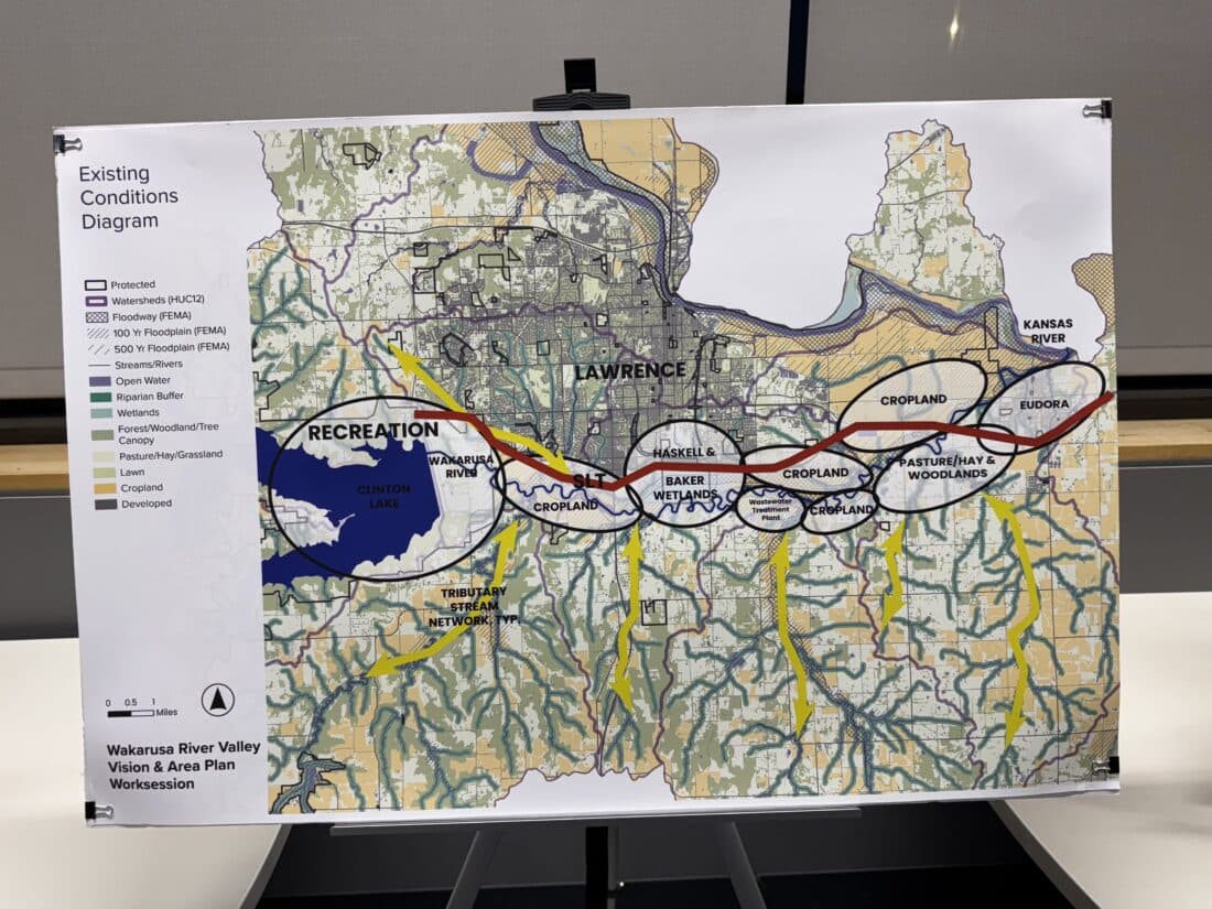
The county's first major implementation step is the Wakarusa River Valley Vision and Area Plan, the first step toward proactively planning for conservation of the Wakarusa River Corridor. That work is being led by Douglas County with Biohabitats, Alta Design, and Hoxie Collective, and it includes a local guiding team with representatives from Douglas County, the City of Lawrence, the City of Eudora, and Haskell Indian Nations University.
The Wakarusa effort will weave together ecology, cultural heritage, infrastructure, land use, and landowner input, with finalization expected by fall 2026.
The county has also identified immediate action areas for ARPA funding, including county park improvements and enhancements, programmatic support for private land conservation at Lone Star Lake, and a land protection pilot focused on the Wakarusa River Valley.
What private landowners can expect
The most direct landowner-facing piece of the plan arrived in December 2024, when Douglas County and the Kansas Land Trust launched the Douglas County Land Protection Program. The pilot is funded by up to $225,000 in ARPA money and is intended to help private landowners cover the costs of conservation easements.
Eligibility is tied to the plan's priorities. Properties must contain at least one open-space feature such as natural resources, historic and cultural importance, agricultural value, or recreation, and the protection must yield a significant public benefit.
Community members raised concerns in a June 2023 public meeting about land ownership and conservation easements, underscoring how voluntary these tools are and how complicated they can be for families trying to protect land while retaining control. Kansas Land Trust has framed permanent conservation as a cost-effective response to current pressures and has also pointed out that Kansas lacks designated state funding for conservation.
Heritage is part of the open-space equation
Douglas County's open space planning is not just about ecology and farm ground. The county's Heritage Conservation Council advises Douglas County and Baldwin City on Black Jack Battlefield Park and on preserving, maintaining, and interpreting broader natural and cultural heritage.
The county has also acknowledged Indigenous stewardship and the history of Native removal in Douglas County.
This article was produced by Prism’s automated news system from verified source data, official records, and press releases, then run through automated quality and moderation checks before publishing. The system is built and supervised by the people who set the standards it runs under. Read our full AI policy.
Did this article answer your question?