Watkins Museum exhibit revisits Lawrence tornado and Kansas River flood
Lawrence’s most destructive weather stories are back on view, with lessons for today’s warning systems, preparedness and neighborhood memory.
Why this exhibit matters now
Lawrence’s most destructive weather stories are back in focus inside the Watkins Museum of History, where *Lawrence in the Path of Destruction* connects a tornado and a flood to the way Douglas County prepares today. The exhibit uses the 1911 Lawrence tornado and the 1951 Kansas River flood to show that severe weather is not just a chapter in the past, but part of the region’s lived experience.
The museum is marking 2026 as a major anniversary year: 115 years since the tornado and 75 years since the flood. Curator Andrew Stockmann says Kansas is known for severe weather, and that these events affected people across Douglas County, not just the blocks that took the heaviest damage. That framing gives the exhibit a practical edge. It is not only about remembering loss, but about understanding how warnings, response plans and community memory still shape safety in Lawrence today.
Two disasters that still define the city
The first disaster on display is the April 12, 1911 tornado, which moved through Lawrence for about 25 minutes. It ripped across downtown, destroyed businesses along Massachusetts Street and damaged homes in West and North Lawrence. Two Lawrence residents were killed, and the storm caused about $200,000 in property damage, with newspaper estimates putting repairs at $133,950.
The second disaster is the July 1951 flood, remembered as Black Friday. In some parts of the Kansas River basin, as much as 18.5 inches of rain fell between July 9 and July 13, 1951. The flood affected 116 cities and towns, forced 85,000 people to evacuate, flooded more than 1 million acres, killed 28 people and caused more than $725 million in losses across the Kansas River Basin and in Kansas City, Missouri, and Kansas City, Kansas.

Those numbers matter because they show scale. The tornado hit with sharp, concentrated force; the flood spread far wider, taking in entire communities and river corridors. Together, they explain why Lawrence still treats extreme weather as a civic issue, not just a memory exercise.
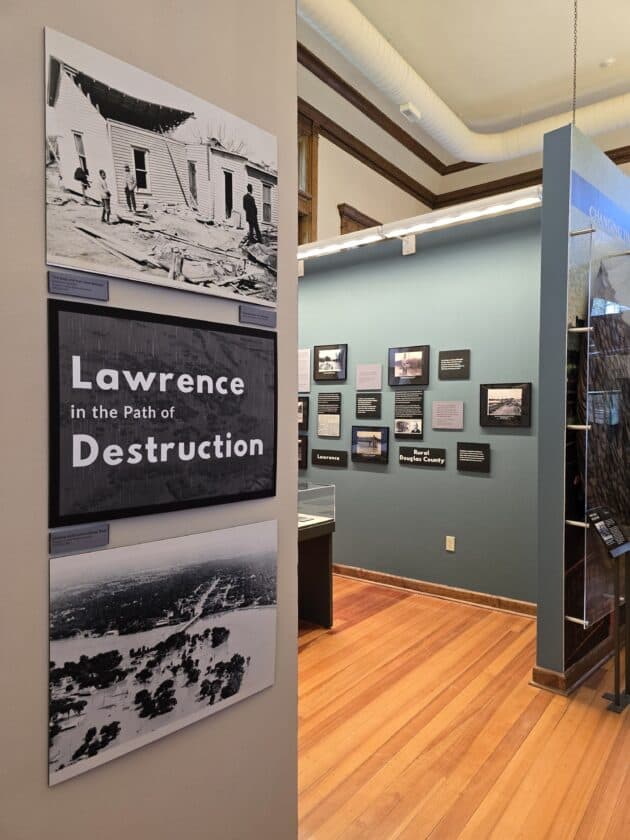
What visitors will see on the third floor
The exhibit is on the third floor of the Watkins Museum of History and draws heavily on photographs from the museum’s collection. It also includes newspaper accounts and survivors’ quotes, giving the story both visual evidence and human perspective. That mix helps visitors see how the disasters looked on the ground and how residents described what they endured afterward.
Museum materials also tie the exhibit to the wider culture of Kansas, where severe weather has long been part of public life and public imagination. The state’s storm history has become part of a broader regional identity, one that reaches from local archives to familiar cultural references such as *The Wizard of Oz*. In Lawrence, that history is especially vivid because the damage touched the city’s core and its neighborhoods, not just open land outside town.
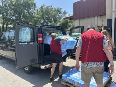
The exhibit is also accessible in a practical sense. The museum is free, and its downtown location makes it easy to reach for families, educators and anyone who wants to bring local history into a wider conversation about safety.
A history exhibit with a public safety purpose
What sets this exhibit apart is its attention to preparedness. Alongside the photographs and historical accounts, the museum is including severe-weather awareness tips and historical forecasting information. Daniel Reese, a meteorologist with the National Weather Service in Topeka, helped with that part of the project, and the museum credits both the National Weather Service branch office in Topeka and Douglas County Emergency Management for assistance.
That matters because the exhibit is doing more than preserving artifacts. It is making a case that the lessons of 1911 and 1951 still apply in a county where storms, river levels and emergency alerts remain part of daily planning. For Lawrence residents, the point is not to treat these events as sealed-off tragedies, but to see them as part of the same chain that includes current warning systems, evacuation planning and neighborhood readiness.
University of Kansas sources help explain why the flood story remains so prominent. Lawrence sits at the confluence of the Kansas and Wakarusa River floodplains, a geography that has made the city vulnerable again and again. KU also notes earlier catastrophic floods in 1844, 1903, 1908 and 1944, which shows that the 1951 event was part of a longer pattern rather than an isolated outlier.
A free June 12 preparedness talk
The exhibit’s public-facing educational piece continues on June 12, when the museum and Douglas County Emergency Management are planning a free public event focused on severe weather and preparedness. The museum’s calendar says experts from the National Weather Service and Douglas County Emergency Management will take part.
That gives the exhibit a direct community benefit. Families can hear how warnings are issued, educators can connect local history to classroom lessons, and longtime residents can compare present-day readiness with the ways earlier generations coped with sudden disaster. The format also reinforces the exhibit’s central point: memory is useful when it helps people act faster and smarter the next time severe weather threatens.
Why the story still lands in Lawrence
The power of *Lawrence in the Path of Destruction* lies in how it folds history into present-day responsibility. The tornado and flood were different in scale and in how they struck, but both forced Lawrence to rebuild, reassess and remember. That is why the exhibit feels current. It places old photographs, old headlines and survivor testimony beside the modern tools of preparedness that still matter in Douglas County.
For a city built along floodplains and shaped by repeated storms, that is not just museum work. It is civic work.
This article was produced by Prism’s automated news system from verified source data, official records, and press releases, then run through automated quality and moderation checks before publishing. The system is built and supervised by the people who set the standards it runs under. Read our full AI policy.
Did this article answer your question?