Army Corps Works to Retain Water as Lake Lanier Drops Below Normal
Lake Lanier is five feet below its usual spring level, and the Army Corps is working to hold onto every drop as dry conditions stretch into late March.
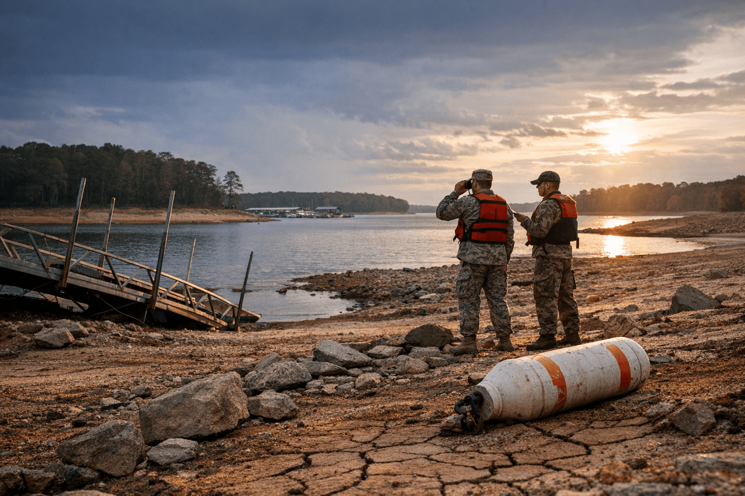
Standing at the edge of Little Ridge Park last Friday, the waterline told the story: Lake Lanier has dropped roughly five feet below its usual level for this time of year, and the U.S. Army Corps of Engineers is working to hold onto every inch it can.
The lake's full pool sits at 1,071 feet above mean sea level, the congressionally authorized operating level established when Buford Dam was built on the Chattahoochee River. USGS gauge readings currently place Lanier at approximately 1,066 feet, a gap that is visible at parks and boat launches across Forsyth and Hall counties. The lake is also tracking more than five feet below the recent seasonal average for late March, meaning the deficit runs deeper than a simple comparison to full pool suggests.
The Corps said it is keeping a close eye on conditions and actively working to retain as much water locally as possible amid dry conditions. That posture, which centers on managing outflows from Buford Dam, represents the Corps' primary tool for stabilizing the reservoir short of issuing public water-use restrictions, which have not been announced.
For boaters, the math is direct: Lanier's 76 boat ramps each carry a minimum launch elevation, and a five-foot deficit begins pushing the lowest-rated ramps toward the edge of usability. The Army Corps maintains a boat ramp elevation map that lets boaters check whether a specific launch point is functional before heading out.
Historically, Lanier has weathered far steeper declines. In past drought cycles, levels have fallen as much as 20 feet before recovering, at times forcing coordinated water-use reductions across three states. Georgia, Alabama, and Florida all hold downstream water rights tied to the reservoir's outflows, which limits how aggressively the Corps can curtail releases even when conservation is the priority.
The lake spans Hall, Forsyth, Dawson, Gwinnett, and Lumpkin counties, with Hall holding roughly 60 percent of the reservoir's acreage and Forsyth about 30 percent, making conditions at Lanier a direct concern for hundreds of thousands of residents who rely on it for recreation, water supply, and the tourism economy built around its 692 miles of shoreline.
Forsyth residents are being urged to stay informed as the Corps continues its assessment. The critical variable heading into April is whether precipitation resumes or the lake extends its downward trend into the peak of boating season, when every additional foot of loss translates into more ramps shuttered and more businesses along the shoreline absorbing the hit.
Know something we missed? Have a correction or additional information?
Submit a Tip

