Forsyth County Greenway offers 16-mile multi-use trail with six trailheads
Six trailheads and 16 miles make Big Creek Greenway a daily-use corridor, not just a park path. Closures near Fowler Park and Bethelview Road still shape how people get on.
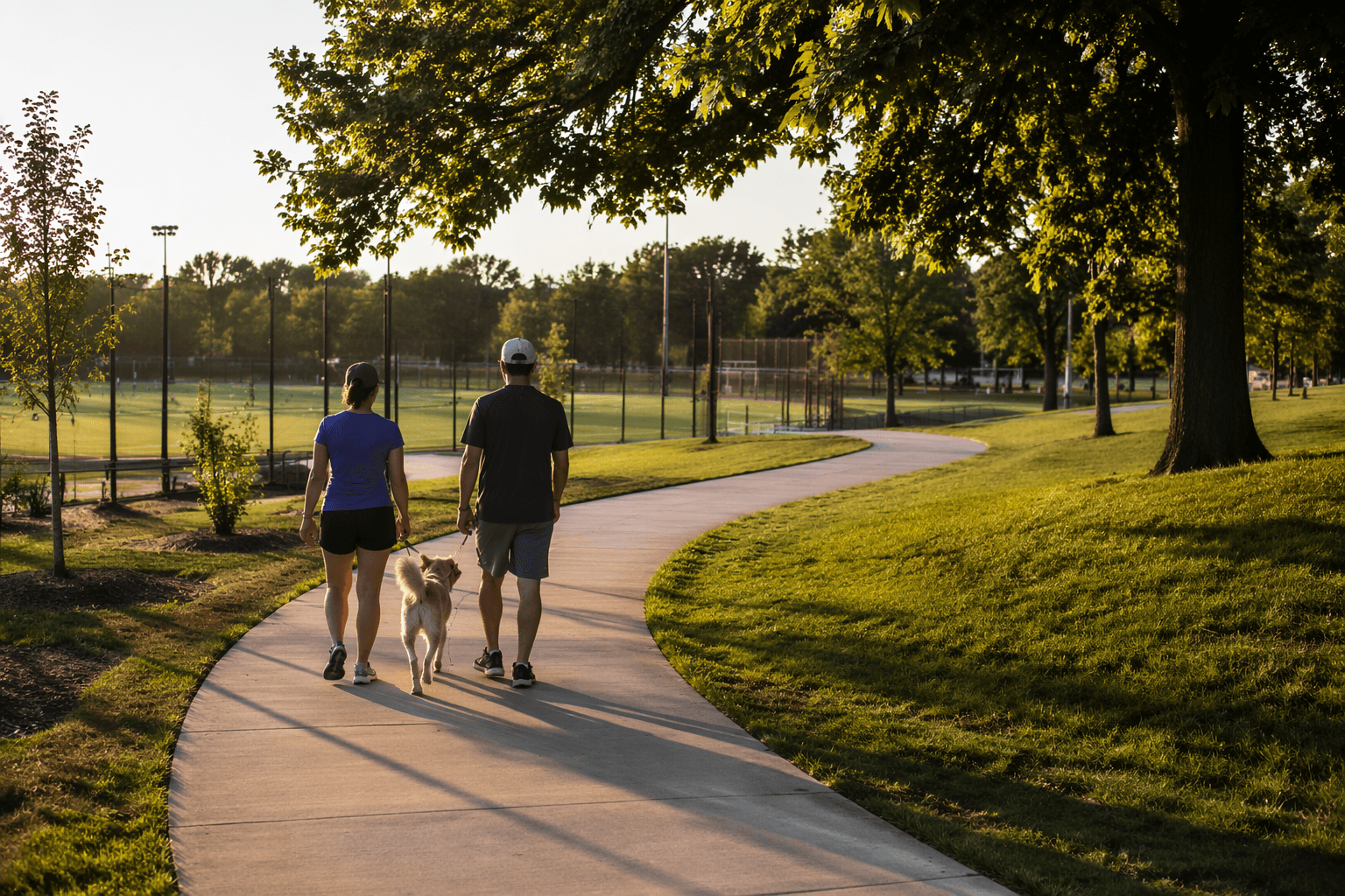
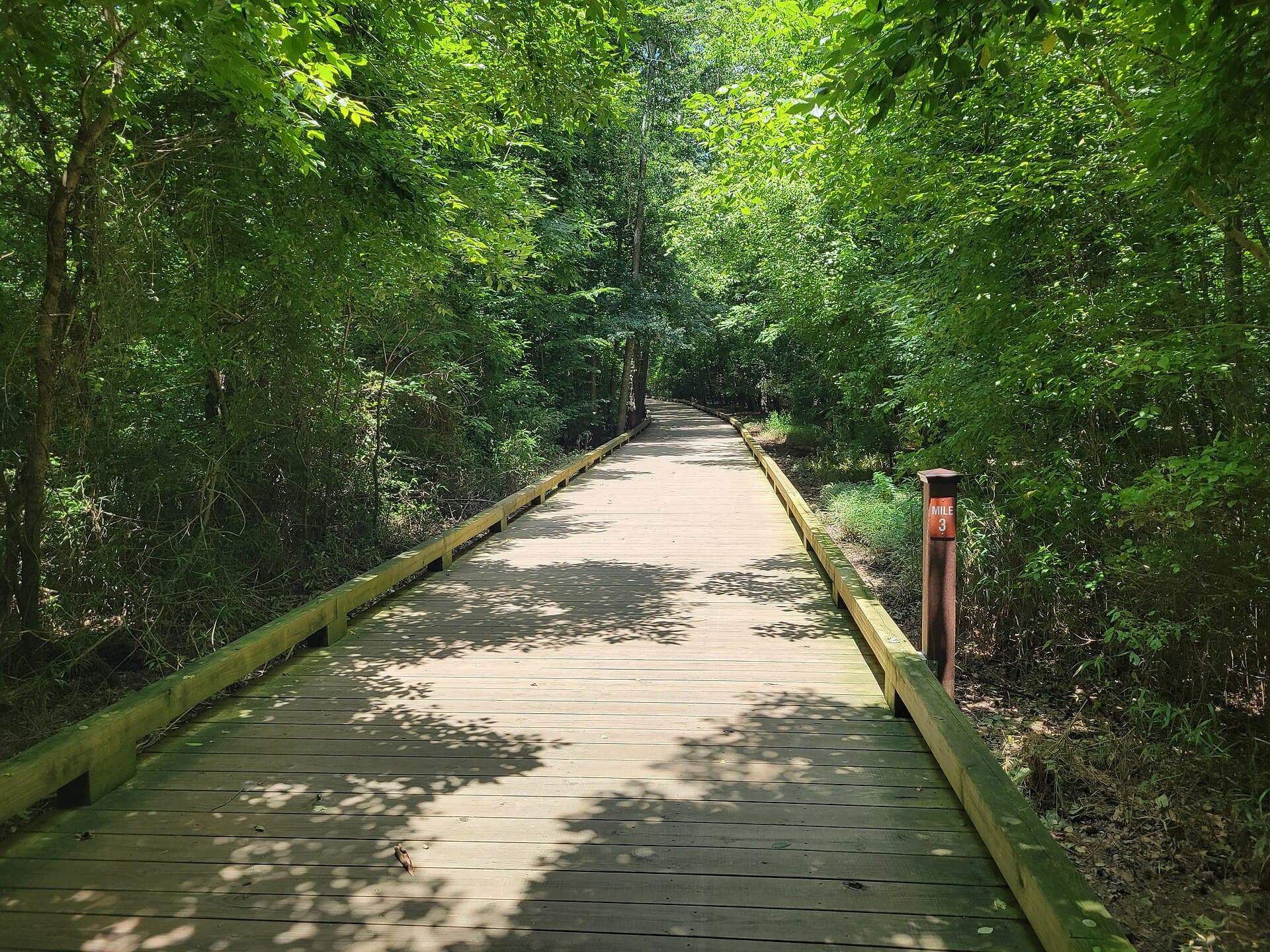
Big Creek Greenway runs 16 miles through Forsyth County on a 12-foot-wide multi-use trail with six trailheads, each with parking and bathrooms. Its hours stretch from early morning into the evening for much of the year, making it part of daily movement as well as recreation for walkers, runners, cyclists and skaters.
A corridor built for everyday use
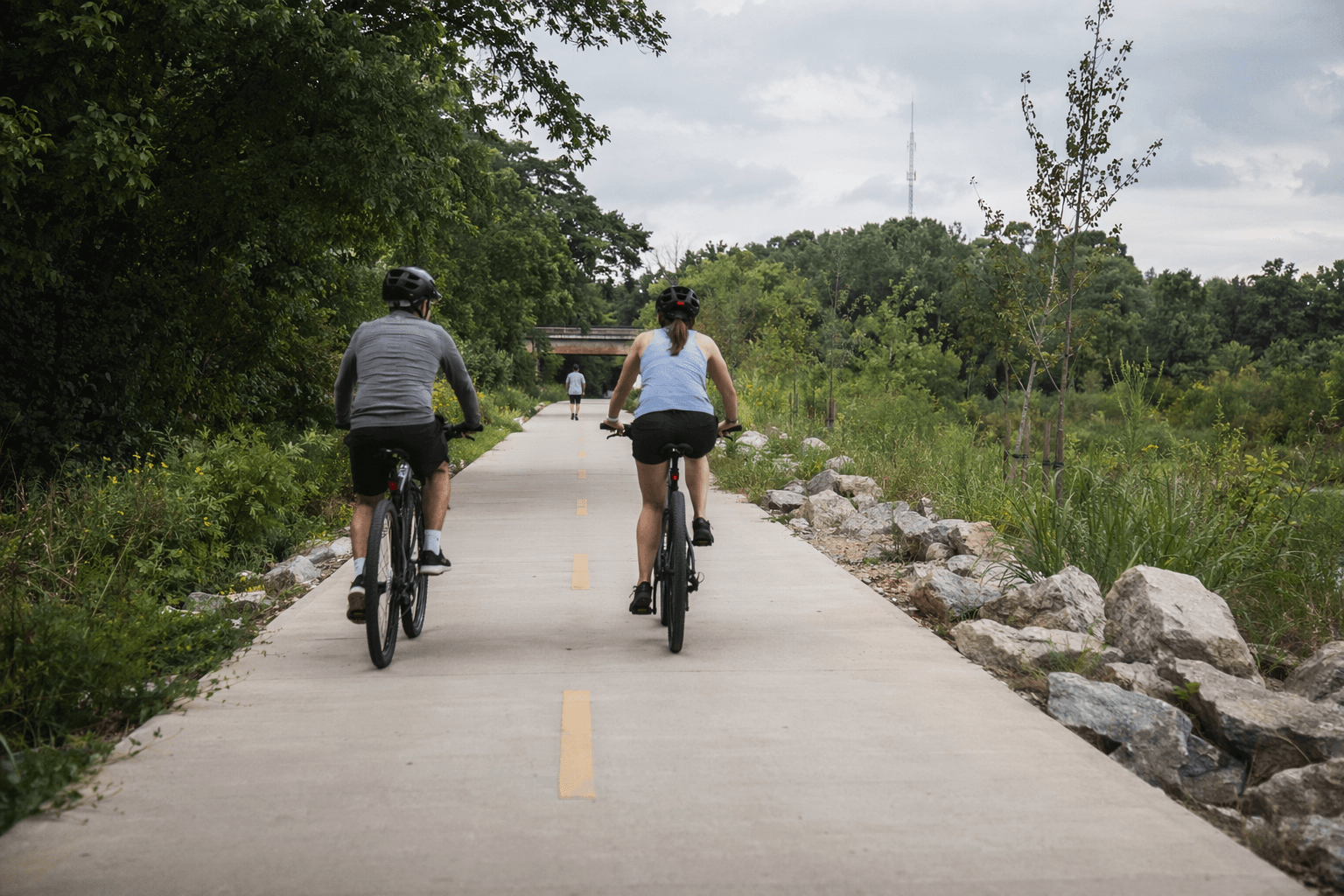
The Greenway is a multi-use trail for walking, jogging, biking and inline skating. A greenway is a linear park centered on conservation, recreation, environmental education and alternative transportation, putting the Big Creek corridor in the same category as other community infrastructure. In a fast-growing county, a safe, separated route can change how families move, how long a run or bike ride can be, and how much pressure falls on roads and parking lots.
The trail’s design invites different users at different speeds, which is why the Greenway works best when people expect a shared space. A 12-foot-wide path gives room for mixed use, but it also means the busiest sections near trailheads and boardwalk areas can feel tighter than the map suggests. A parent with a stroller, a cyclist training for distance and a runner looking for a repeatable loop can all use the same county-built line through the woods and neighborhoods.
Where to get on the trail
The Greenway’s six trailheads each have parking and bathroom facilities. That makes the trail unusually practical for errands, workouts and family outings, especially when a group needs a place to meet without guessing where to leave a car.
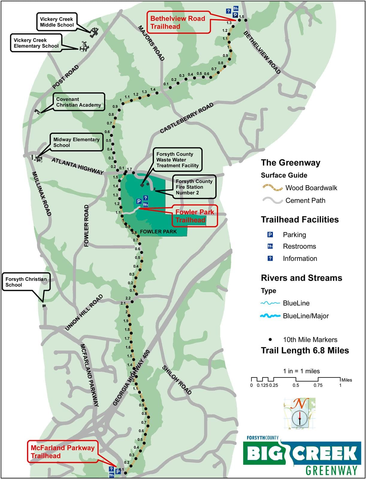
The trailheads listed on the county map are:
- Sawnee Mountain Preserve Trailhead, 4075 Spot Road
- Canton Highway Trailhead, 1605 Canton Highway
- Bethelview Road Trailhead, 5120 Bethelview Road
- Fowler Park Trailhead, 4110 Caroline Way
- Union Hill Trailhead, 5259 Union Hill Road
- Halcyon Trailhead, 6265 Cortland Walk
Those access points give the Greenway a map-minded advantage that many trails lack. A resident near Sawnee Mountain Preserve can use one end of the system, while someone coming from the Halcyon area has another clear entry point farther south. For people who want a shorter outing, the trailheads make it easy to choose an out-and-back walk without committing to the full length of the route.
Hours, traffic and trail etiquette
The county’s current map sets the trail hours at 6 a.m. to 9:30 p.m. from March through October and 6 a.m. to 7 p.m. from November through February. In warmer months, that schedule makes room for early runs and after-work trips; in winter, the window is shorter but still flexible.
Because the trail is shared by walkers, joggers, bikers and inline skaters, etiquette is part of what keeps the corridor usable. Predictable movement matters most on a narrow, busy path where speed differences can create conflict quickly. Use the space with awareness, especially near trailheads, boardwalks and other pinch points where the line of travel is tighter.
Renovation work and the current bottleneck
The biggest access issue now is not the number of trailheads but the sections under renovation. Forsyth County closed Phase 4 in fall 2024 because of safety concerns tied to the aging boardwalk structure, and in February 2026 it closed the section from Fowler Park north to the Bethelview Trailhead as the next renovation phase began. County officials say the work is meant to improve safety, durability and the overall user experience.
Even when a section is shut down, trailheads remain open during temporary closures, so parking and access do not disappear entirely. The Union Hill to Fowler Park section had already been closed since May 2020 for ground-up renovations, including upgraded decking on about one mile of existing boardwalk, before reopening.
Parks & Recreation Director Kirk Franz and Capital Projects Director John Jefferson have given public renovation updates.
How the trail grew into a countywide asset
The present-day Greenway grew out of a much smaller buildout. Phases 1, 2 and 3 opened in 2009. A county annual report put those first three phases at approximately 6.8 miles from McFarland Parkway to Bethelview Road. A separate county release from that year put the completed portion known as Phases 2 and 3 at approximately 2.94 miles from SR 9 to Bethelview Road.
The financing came from multiple public sources. The expansion was funded by the Parks, Recreation and Green Space Bond approved by voters in 2008, and later Phase V work also drew from SPLOST. A large portion of Phase 1 was funded by state and federal funds.
The next pieces are already mapped. Phase 4 is approximately 2.8 miles and runs from Bethelview Road along Big Creek, then parallel to Kelly Mill Road, ending at Johnson Road. Phase V will add 5.7 miles from Kelly Mill Road to the Sawnee Mountain Preserve Visitor Center, bringing the full Big Creek Greenway to just over 16.5 miles when complete.
This article was produced by Prism’s automated news system from verified source data, official records, and press releases, then run through automated quality and moderation checks before publishing. The system is built and supervised by the people who set the standards it runs under. Read our full AI policy.
Did this article answer your question?