Forsyth County woman says surveys have taken pieces of her land
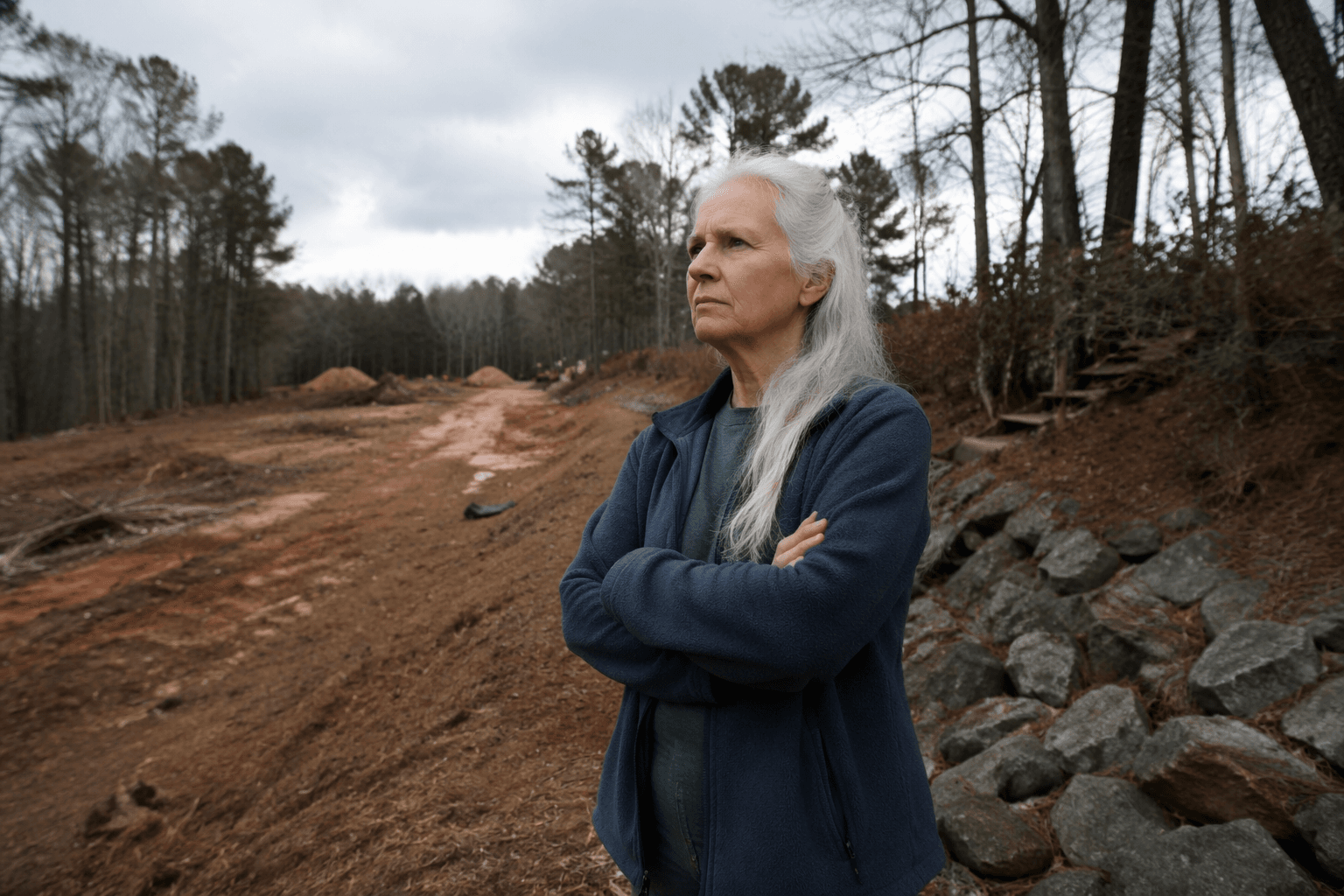
A longtime Forsyth County resident says repeated surveys have carved away parts of her property, sending her into decades of court fights as neighbors rally online.

A longtime Forsyth County resident says survey lines have repeatedly cut into her land, turning one property into a 30-year fight over where her boundaries really are. The claim has spread on social media, where calls for community support have framed the dispute as more than a private quarrel and more like a test of how well land records protect homeowners.
In Forsyth County, those fights usually turn on the paper trail. The Clerk of Superior Court records and indexes deeds, plats, condominium floor plans, UCC filings, lien filings, military discharges and other real estate records, while Forsyth County Planning and Community Development offers GIS mapping, an online customer self-service portal, the Unified Development Code, eSearch and property records tools. That matters because a boundary dispute can rise or fall on what appears in the deed history and on the recorded plat.
Georgia’s plat system is built for that kind of review. Through the Georgia Superior Court Clerks’ Cooperative Authority, plats can be searched by county, book and page, with images of plat pages available to view and print. In practice, that is often where a dispute gets sorted out: one survey says a line runs one way, another says it runs another, and the record history shows whether a lot line was ever where an owner believed it to be.
Legal references on Georgia property disputes say those conflicts commonly stem from conflicting surveys, deed interpretation or disagreements over the exact location of a lot line. That is the kind of issue that can force landowners into court when surveyors, neighbors and the recorded documents do not match. For property owners, the process can be technical and expensive, even before a judge gets involved.
The Forsyth case is landing in a county already sensitive to land-use conflict. Commissioners recently faced backlash over a plan to run 3,000 feet of sewer through the Pugh family farm for a Toll Brothers development. Appen Media described Chuck and Lynn Pugh’s farm as having nurtured aspiring growers for almost 20 years, underscoring how quickly a land dispute can become a broader fight over development, property rights and local oversight.
For Forsyth landowners, the lesson is clear: boundary disputes are not settled by opinion or social media pressure, but by deeds, plats, surveys and, when necessary, the courts. In a county where the records are public and the stakes are personal, every line on the map can carry real consequences.
This article was produced by Prism’s automated news system from verified source data, official records, and press releases, then run through automated quality and moderation checks before publishing. The system is built and supervised by the people who set the standards it runs under. Read our full AI policy.
Know something we missed? Have a correction or additional information?
Submit a Tip