Goochland Launches Interactive Historic Map Viewer for Community Planning
Goochland County announced a new interactive Historic Map Viewer that lets users overlay current digital maps with historic county maps dating to 1820. Built through a public-private partnership between the county GIS Department and the Goochland County Historical Society, the tool expands access to land-history data that can inform planning, preservation and public engagement.

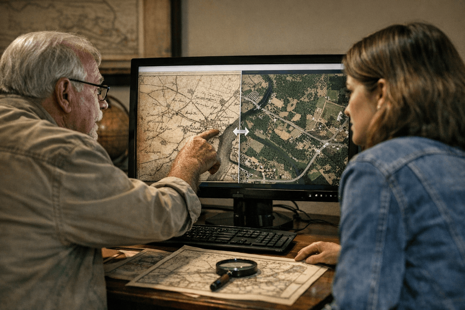
Goochland County has rolled out an online Historic Map Viewer that allows residents, property owners, planners and local officials to compare contemporary mapping with historical map layers spanning 1820, 1863, 1880, 1919 and 1932. The county describes the project as a public-private partnership between the Goochland County GIS Department and the Goochland County Historical Society and directs users to the Historic Map Viewer experience on ArcGIS Online.
The viewer aggregates digitized historic map sheets and places them in a modern geospatial environment so users can toggle layers, inspect changes in roads, property lines and landscape features, and trace the evolution of settlement patterns. For municipal decision-makers, the tool offers a readily available reference when weighing land-use and preservation issues; for residents the resource provides clearer historical context for property boundaries, family histories and community landmarks.
Institutionally, the partnership highlights a model of shared responsibility between a government GIS office and a local historical organization. The collaboration leverages county mapping infrastructure and historical expertise to make archival materials broadly accessible. Making these layers public also advances transparency in local governance: planners and the public can review the same visual evidence when discussing rezonings, development proposals or preservation nominations before the Planning Commission and Board of Supervisors.
The availability of historic spatial data can affect civic engagement and local political conversations. Community members preparing testimony, candidates addressing land-use policy, and neighborhood organizations tracking development trends will have a common reference point. That shared access can strengthen public debate by grounding claims about change and continuity in visible, verifiable maps.
At the same time, officials and users should be attentive to technical limits. Historic map sheets often require georeferencing and may vary in scale or accuracy; clear metadata and documentation from the county will be important for users relying on the layers in formal proceedings or legal contexts. County managers responsible for GIS and archives will face ongoing choices about updating layers, adding new material and ensuring long-term access.
Residents can access the viewer through the county’s announcement page, which links to the ArcGIS Online experience: . As local debates over land use and preservation continue, the Historic Map Viewer provides a new tool for informed participation and oversight of county development decisions.
This article was produced by Prism’s automated news system from verified source data, official records, and press releases, then run through automated quality and moderation checks before publishing. The system is built and supervised by the people who set the standards it runs under. Read our full AI policy.
Did this article answer your question?