Blizzard Warning: Traverse City Faces Up to 48 Inches of Snow This Week
Up to 48 inches of snow could bury Traverse City starting Sunday, making this one of the most significant winter storms in recent Great Lakes history.

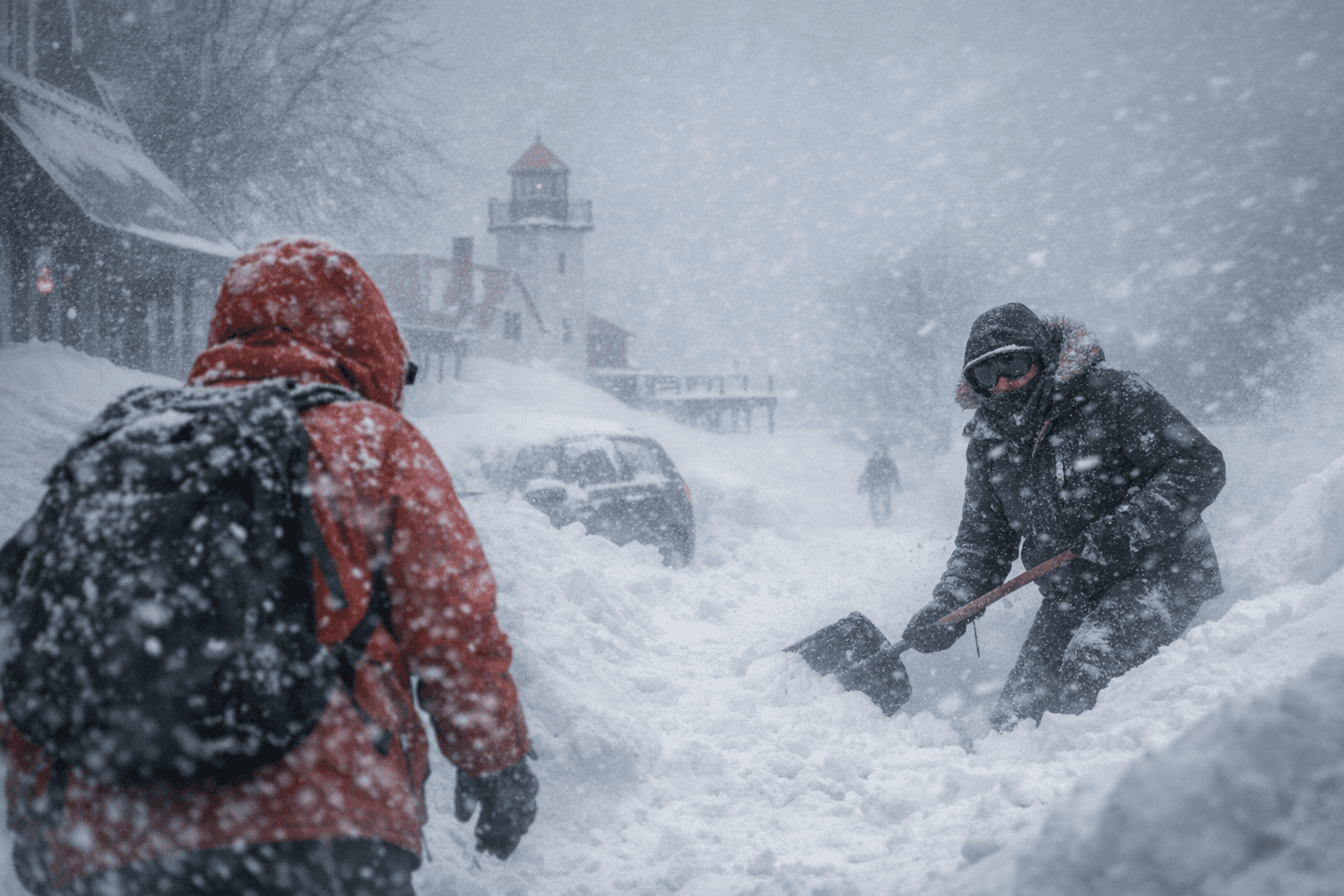
Up to 48 inches of snow is bearing down on Traverse City and Grand Traverse County, with meteorologists warning that an epic blizzard set to begin Sunday could deliver one of the most punishing winter wallops the region has seen in years.
The forecast puts the Great Lakes squarely in the crosshairs of a system forecasters are calling monumental. Accumulation totals between 30 and 48 inches are projected across the region, a range that reflects both the storm's intensity and the uncertainty that comes with events of this magnitude. The Upper Midwest corridor stretching from Green Bay through the Upper Peninsula is bracing for 2 to 3 feet of accumulation over the course of the week, with Grand Traverse County sitting within that zone of heaviest impact.
For context, Traverse City's average annual snowfall runs roughly 75 to 80 inches, meaning this single storm could dump more than half a season's worth of snow in a matter of days. Even the lower end of the forecast range, 30 inches, would rank among the most significant single-storm totals in recent memory for the area.
The timing compounds the challenge. A Sunday start means the storm will move through during a full workweek, affecting commutes along U.S. 31, M-72, and other key arteries that serve the county's communities from Acme to Kingsley. Schools, businesses, and emergency services across the county should expect prolonged disruption rather than a single difficult day.
March storms in northern Michigan carry their own particular hazard: wet, heavy snow that snaps tree limbs, downs power lines, and strains rooftops at a rate that lighter winter powder does not. Snowfall of this scale in mid-March, when temperatures hover closer to freezing than in January, tends to produce exactly that kind of dense, damaging accumulation.
Residents should finalize storm preparations before Sunday, including stocking supplies, checking backup heat sources, and confirming that vehicles are equipped for extended low-visibility conditions. The blizzard warning itself signals sustained winds alongside heavy snow, meaning drifting will likely render some roads impassable well before total accumulation reaches its peak.
This article was produced by Prism’s automated news system from verified source data, official records, and press releases, then run through automated quality and moderation checks before publishing. The system is built and supervised by the people who set the standards it runs under. Read our full AI policy.
Did this article answer your question?


