Bomb Cyclone Brings Lake-Effect Snow and High Winds to County
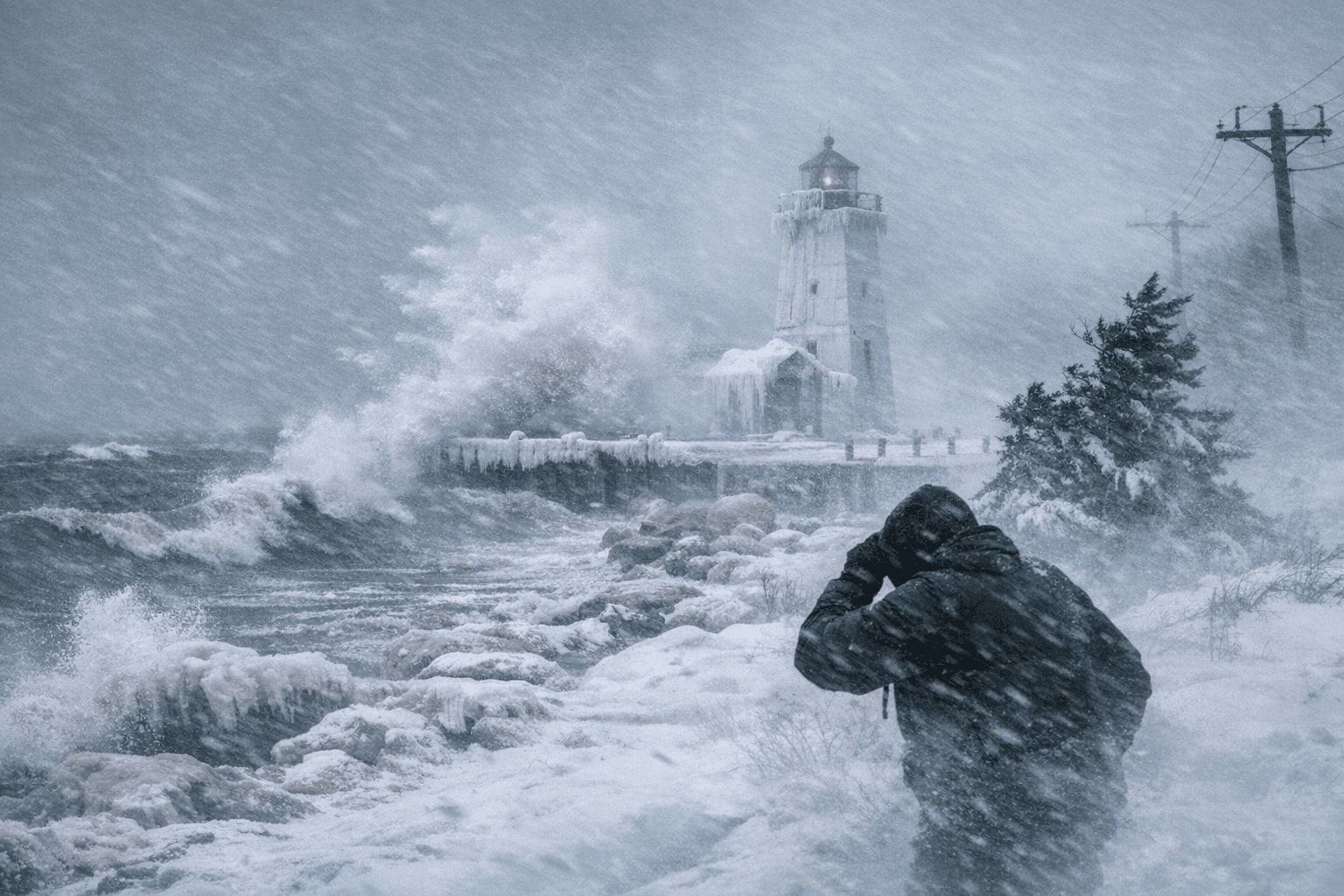
A powerful late-December low-pressure system produced lake-effect snow and strong winds along Grand Traverse County’s Lake Michigan shore, prompting Winter Storm Warnings and hazardous-travel alerts for the Dec. 29–30 overnight period. The storm’s high winds and blowing snow raised risks of whiteout conditions, downed limbs, and scattered power outages, creating travel and service challenges for residents and local institutions.
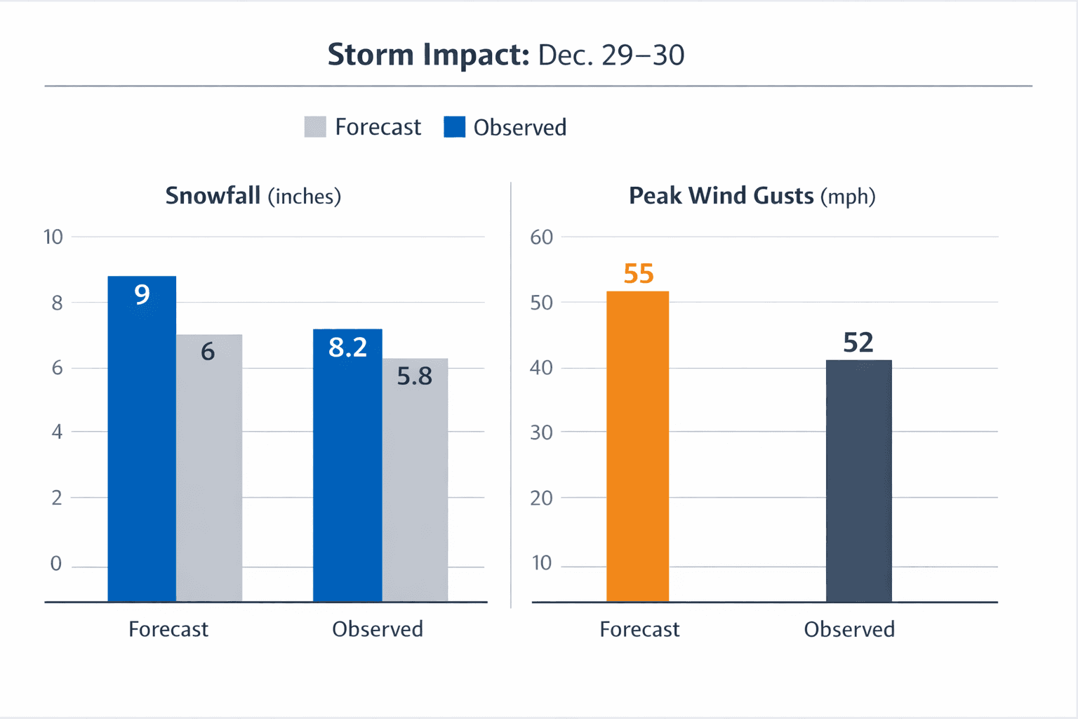
A late-December low-pressure system described in regional coverage as a bomb cyclone moved through western and northern Michigan on Dec. 28, triggering Winter Storm Warnings that emphasized the greatest impacts would fall along the Lake Michigan coastline, including Traverse City. National Weather Service guidance forecasted roughly 6 to 9 inches of snowfall on the lakeshore and wind gusts approaching 55 mph during the overnight period of Dec. 29–30.
The combination of lake-effect snow and strong onshore winds produced localized whiteout conditions and significant blowing and drifting snow, reducing visibility for drivers and creating hazardous travel conditions on county roads and state highways. The NWS outlook maps and social posts highlighted the possibility of downed tree limbs and scattered power outages as likely consequences of the wind and heavy, drifting snow.
For residents, the storm translated into immediate, practical concerns. Limited visibility and drifting snow increase the risk of multi-vehicle collisions and make travel slower and less predictable. Falling limbs and scattered outages can interrupt household heat, water systems that depend on electric pumps, and communications, complicating emergency response and daily routines. Residents who needed to travel for work, medical appointments, or other essential reasons during the Dec. 29–30 period faced elevated risk and the potential for delays.
The storm also underscored the operational roles of local institutions. County road crews, township public works departments, emergency management, and utility providers carry primary responsibilities for keeping roads passable, responding to downed limbs, restoring power, and communicating updates to the public. Winter Storm Warnings place a heightened expectation on those agencies to coordinate road treatment, prioritize life-safety routes, and relay timely information to residents about closures or service impacts.
Looking ahead, the event serves as a reminder for individuals and civic leaders to maintain readiness for severe winter storms. Drivers should prepare for limited visibility and icy, drifting conditions, plan travel conservatively, and monitor National Weather Service updates and local emergency announcements. Local officials should document response actions taken during the storm to improve future coordination and ensure accountability for critical services. The Dec. 28 bomb cyclone demonstrated how rapidly evolving lake-effect conditions can amplify hazards along the lakeshore and tested the county’s weather preparedness going into the new year.
This article was produced by Prism’s automated news system from verified source data, official records, and press releases, then run through automated quality and moderation checks before publishing. The system is built and supervised by the people who set the standards it runs under. Read our full AI policy.
Did this article answer your question?


