Bomb Cyclone Brought Heavy Lake-Effect Snow to Grand Traverse County
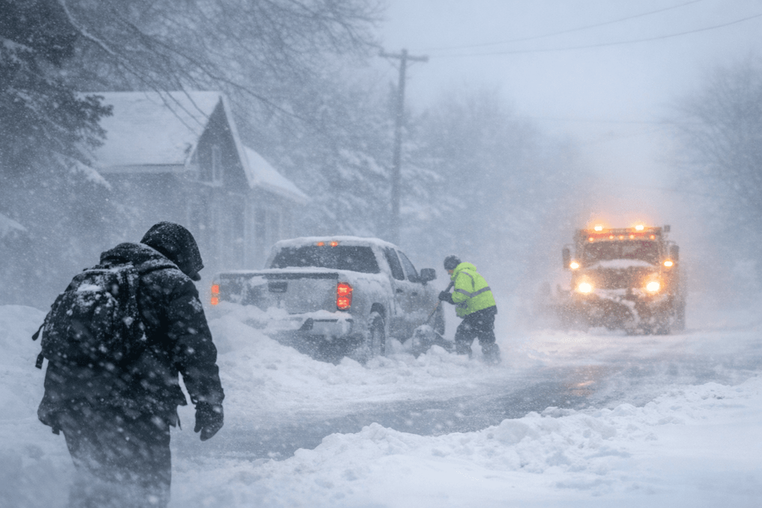
A powerful low-pressure system the National Weather Service and local outlets described as a "bomb cyclone" moved through northern Michigan Dec. 28-29, prompting winter storm warnings on the Lake Michigan coast and advisories across much of northern and western Lower Michigan. The event produced lake-effect snow, strong winds and hazardous travel conditions that highlighted vulnerabilities in local infrastructure and emergency response planning for Grand Traverse County.

A fast-deepening low-pressure system struck northern Michigan at the end of December, triggering winter storm warnings for coastal Lake Michigan counties including the Traverse City area and winter weather advisories for much of northern and western Lower Michigan. Warnings were in effect from the early hours of Monday, Dec. 29 through early Dec. 30, with forecast snowfall where warnings applied roughly 6 to 9 inches and lesser amounts farther inland.
The Grand Rapids office of the National Weather Service warned of heavy lake-effect snow along and west of US-131, localized whiteout conditions, and sustained high winds with gusts up to about 55 mph. Blowing and drifting snow reduced visibility to less than a quarter mile at times, creating hazardous travel and raising the risk of scattered power outages and downed limbs.
For Grand Traverse County residents the immediate impacts centered on mobility and public safety. Road conditions deteriorated rapidly in areas downwind of Lake Michigan, increasing demands on municipal plowing and emergency response. While specific closures were not universally reported, the combination of heavy localized snow, reduced visibility and high winds elevated the likelihood of stranded vehicles, delayed emergency response and interruptions to commuter and commercial traffic.
The storm exposed policy and institutional questions that county leaders and utility providers will need to address. Repeated episodes of lake-effect snow and high-wind events increase pressure on winter maintenance budgets, call for review of vegetation management around power lines, and test coordination among Grand Traverse County Emergency Management, the county road commission and regional utilities. Officials will face decisions about funding for snow-removal equipment, mutual-aid agreements, and investments in grid resilience and tree-trimming programs to reduce outage risk during severe winter weather.
Beyond immediate infrastructure concerns, severe storms carry civic implications. Weather-driven travel disruption can suppress turnout for in-person public meetings and local elections, and can complicate access to county services. County commissioners and election officials should factor extreme weather into scheduling and contingency planning to preserve civic participation.
Residents should monitor updates from the National Weather Service and county emergency channels, exercise caution on affected roads, and review household emergency plans for power outages or stranded travel. The late-December bomb cyclone reinforced the need for ongoing investment in preparedness and infrastructure to protect public safety and maintain essential services during increasingly volatile winter weather.
This article was produced by Prism’s automated news system from verified source data, official records, and press releases, then run through automated quality and moderation checks before publishing. The system is built and supervised by the people who set the standards it runs under. Read our full AI policy.
Did this article answer your question?


