Greensboro Targets Deadliest Roads With Engineering, Enforcement, and Outreach
Greensboro has ranked as North Carolina's most dangerous city for drivers three straight years. Now the city is targeting a handful of corridors responsible for most of the carnage.
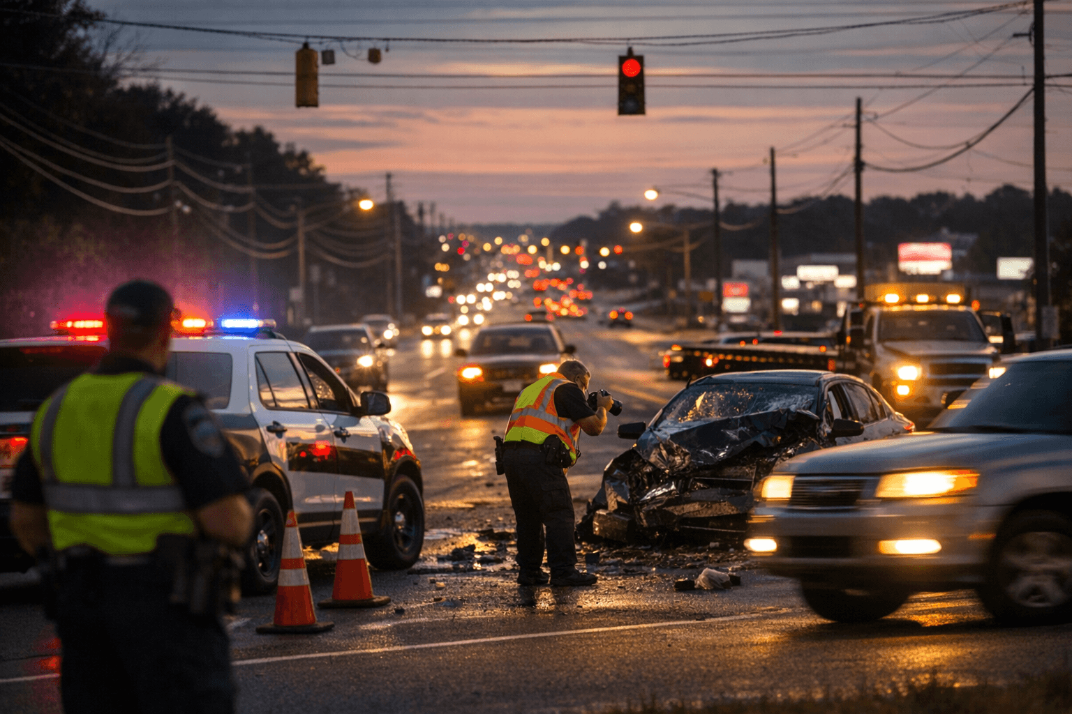
Three hundred eleven people were killed and another 425 seriously injured on roads across the Greensboro metropolitan area between 2017 and 2023, a pace averaging more than 50 deaths and 70 serious injuries every year. Those figures help explain why North Carolina's third-largest city has ranked as the state's most dangerous for drivers three consecutive years, and why city officials are pressing a coordinated strategy targeting the corridors where crashes cluster most severely.
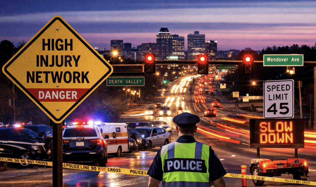
The critical geography is concentrated. Planners have identified what they call a High Injury Network, a relatively small portion of the street system that accounts for a disproportionate share of fatalities and serious injuries. Wendover Avenue, Gate City Boulevard, Market Street, Elm-Eugene Street, and US 29 rank among the most dangerous corridors on that list.
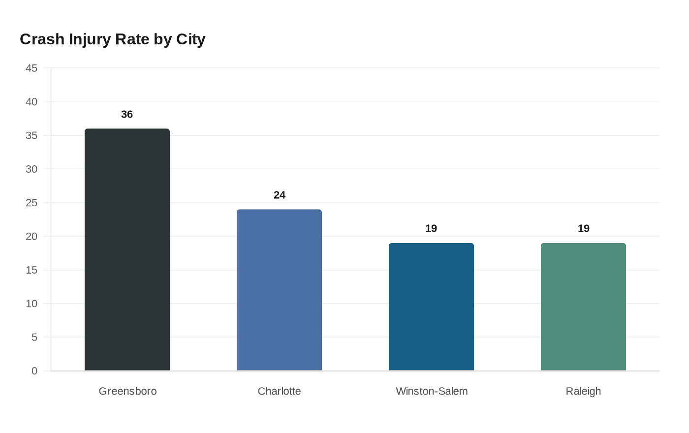
A central premise of the city's approach, rooted in what transportation planners call the Safe System model, holds that road design itself bears significant responsibility for dangerous speeds. Wide lanes and long, straight corridors encourage drivers to travel faster than posted limits regardless of signage, a dynamic that shifts part of the analysis away from individual behavior and toward how infrastructure shapes risk. The numbers reinforce the urgency: nearly 36 percent of Greensboro crashes produced injuries between 2020 and 2023, compared to less than 19 percent in Winston-Salem and Raleigh and 24 percent in Charlotte.
Greensboro's Neighborhood Traffic Management Program, run through the city's Department of Transportation, gives residents a direct route to flag problems. The program connects neighborhood associations and property owners with city engineers, who develop tailored plans to reduce vehicle speeds in residential areas. But demand for projects, combined with the political and fiscal complexity of larger capital improvements, means city staff and elected leaders face persistent pressure to decide what gets funded and what waits.
The broader Greensboro MPO Comprehensive Safety Action Plan, developed with the North Carolina Department of Transportation, frames the work in terms of sustained, data-driven intervention rather than single-point responses. The plan builds on Vision Zero Greensboro, an initiative the Department of Transportation launched after 42 people were killed on city streets in 2017, the highest single-year toll in recent memory.
What the current effort emphasizes is that sustained results require all three elements working together. Targeted enforcement sweeps and standalone signage changes have shown limited staying power in corridors where crash patterns are systemic. Whether engineering improvements follow depends largely on choices Greensboro's elected officials make as they navigate a capital and maintenance budget that Guilford County's broader fiscal pressures continue to shape.
This article was produced by Prism’s automated news system from verified source data, official records, and press releases, then run through automated quality and moderation checks before publishing. The system is built and supervised by the people who set the standards it runs under. Read our full AI policy.
Did this article answer your question?