Guilford County moves to annual aerial imaging to update tax rolls
Guilford County commissioners were expected to approve a three year, $837,300 sole source agreement to expand annual aerial photography for property tax oversight. The program is intended to identify unreported buildings and improvements and could affect property assessments while the county stresses staff verification before any changes are made.

Guilford County moved this month to deepen its use of aerial imagery as a tool for maintaining an accurate property tax base. On December 18 the Board of Commissioners was expected to adopt a three year agreement authorizing Pictometry International Corporation to provide annual countywide aerial photography at a cost of $837,300. County staff say no additional county funds are required because the expense was approved in the reappraisal budget process.
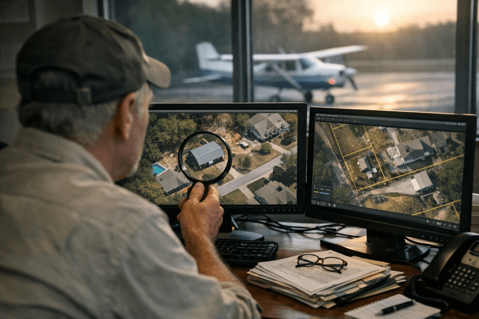
The system relies on winter flights when leaves are off trees, producing high resolution photographs of every parcel. Images capture rooftops, additions, accessory buildings, pools, garages and other improvements. Specialized software compares the newest images with prior years to flag changes that may indicate new construction or additions so county staff can focus on verification and valuation rather than manual discovery.
Tax Department materials for the December 18 meeting say the effort is intended to capture new buildings and improvements more effectively and ensure the tax base accurately reflects the built environment across Guilford County. Pictometry was recommended as a sole source because its Eagleview software integrates exclusively with the Farragut North Carolina Property Tax System that the county uses for property tax administration. North Carolina law allows a sole source purchase when a needed product is available from only one supplier, and officials contend the integration reduces duplicated effort and the need for custom programming.
The move builds on a broader shift in the Tax Department toward technology driven administration. The office frequently posts a collection rate above 99 percent and often ranks in the state top ten for collections. Supporters say automated change detection promotes fairness by ensuring similar properties are taxed similarly and by reducing complaint driven enforcement that can produce uneven outcomes across neighborhoods.
Critics in other jurisdictions have raised concerns about privacy and over reliance on automated data. County officials have stressed aerial imagery will be used as a discovery tool, and that staff verification is required before any amendments are made to tax records. If adopted as expected the agreement would take effect for three years and allow staff to monitor changes more quickly, addressing potential tax base changes closer to when they occur. For homeowners, that means additions such as sheds, workshops, garages or pools that were not reported may be identified sooner, prompting valuation and verification rather than immediate adjustment without human review.
This article was produced by Prism’s automated news system from verified source data, official records, and press releases, then run through automated quality and moderation checks before publishing. The system is built and supervised by the people who set the standards it runs under. Read our full AI policy.
Did this article answer your question?