Harris County Residents Can Check Flood Risk With These Local Resources
Four agencies track flood risk across Harris County, and the map that sets your insurance rate may already be outdated. Here's where to find the most current data.
Harris County has invested heavily in detention basins, subsurface drainage systems, and named projects like the Lauder Basin expansion and Meyergrove to push back against a flooding pattern that has reshaped neighborhoods across the region. But those capital investments only protect a property if residents know where the infrastructure stands — and whether their address falls inside or outside its reach. Four local, state and federal agencies maintain the overlapping data layers that answer those questions, and knowing how to use each one is the most practical flood-preparedness step any homeowner or renter in the county can take.
The agencies behind Harris County's flood data
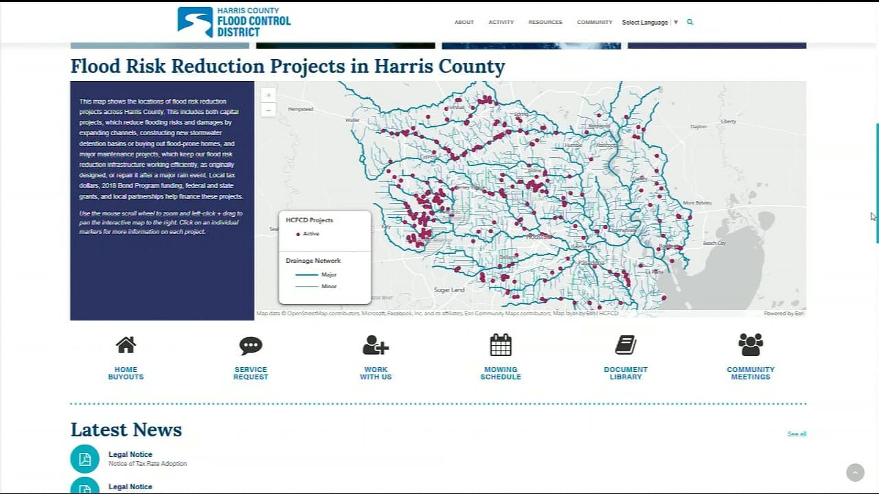
No single office holds the complete picture. The Harris County Flood Control District, known locally as HCFCD, is the primary local authority: it designs and constructs large drainage infrastructure, manages detention basins, and publishes detailed information about ongoing and completed flood projects. Its mapping tools reflect current engineering models, making it the most locally specific starting point for any address-level research.
Houston Public Works and municipal engineering departments operate at the city level, handling drainage permitting and smaller-scale projects that affect neighborhoods within city limits. Their records matter especially when a property sits near a drainage feature that falls under city, rather than county, jurisdiction.
At the federal level, the Federal Emergency Management Agency publishes Flood Insurance Rate Maps, universally called FIRMs. These are the regulatory documents that lenders, insurers, and local permitting offices use to classify risk. Zone designations such as Zone AE and Zone X determine whether federally backed mortgage holders are required to carry flood insurance.
The Texas Water Development Board rounds out the picture by coordinating statewide water data and providing financing mechanisms for some mitigation programs. Its role is less visible to individual property owners but directly influences the funding streams that support buyout and elevation grants at the county level.
How to find your flood risk, step by step
Start with HCFCD's interactive maps
The Harris County Flood Control District's online mapping portal allows any user to search by street address and see whether a property sits within a mapped floodplain, which drainage basin it belongs to, and whether nearby infrastructure projects are active or planned. Because HCFCD's models incorporate newer engineering data than federal maps sometimes reflect, this is the right first stop for understanding current local conditions rather than regulatory status alone.
Cross-reference with FEMA's Flood Map Service Center
Once you have a sense of local conditions, check FEMA's Flood Map Service Center by entering your street address or property coordinates. The result will show your official FIRM designation — the zone classification that drives insurance requirements and building code decisions. Keep a critical eye on the date of the map panel for your area. FIRMs are regulatory tools used for insurance and permitting, and they can lag behind the most recent hydrological modeling, particularly in a county where drainage conditions shift as new detention capacity comes online.
Review county GIS parcel data
County GIS portals layer additional detail onto the regulatory baseline. These platforms often display FEMA base flood elevations alongside building footprints, infrastructure boundaries, and records of which streets and properties experienced flooding during recent storm events. This third layer is particularly useful when a neighborhood has seen new construction or major drainage work in the past several years, either of which can alter local flood dynamics in ways that a static FIRM does not yet capture.
Use nonprofit and university community tools
Several nonprofit organizations and university research groups publish neighborhood-level analyses that go beyond regulatory classifications. These tools typically track repeated flooding incidents over time and calculate vulnerability indices that reflect not just the regulatory zone but the actual history of water intrusion in a given area. They add essential context, especially for streets that flood regularly despite carrying a lower-risk zone designation.
What to do if your property is flood-prone
Buy flood insurance before you need it
Standard homeowner's insurance policies do not cover flood damage, a gap that catches many property owners off guard in the aftermath of a storm. A policy through the National Flood Insurance Program, administered federally, is the most common option; private flood insurance carriers also operate in Texas and may offer different coverage terms. Properties in higher-risk zones, particularly those with Zone AE designations, face the greatest financial exposure without coverage in place.
Harden your property against water intrusion
Physical mitigation measures can meaningfully reduce damage even when flooding does occur. Elevating utilities such as electrical panels, water heaters, and HVAC equipment above likely inundation levels protects critical systems. Installing backflow prevention valves or devices reduces the risk of sewer water entering a home during heavy rain events. Using flood-resistant building materials in crawl spaces, garages, and lower floors limits the cost of repairs when water does enter.
Renters carry their own set of responsibilities. Keeping critical documents, medications, and irreplaceable items stored above likely water lines, and maintaining a clear evacuation plan tied to local alert systems, provides a meaningful safety margin that requires no capital investment.
Apply for mitigation grants
Harris County and several municipalities within it administer mitigation programs funded largely through FEMA Hazard Mitigation Grants. These programs can finance home elevation projects or property buyouts for structures in repeatedly flooded areas. Eligibility criteria and application timelines vary significantly by program cycle and funding availability. The county mitigation office and local emergency management contacts are the appropriate entry points for learning whether a specific property qualifies and when application windows open.
Stay current on infrastructure changes
Large detention basin projects — including the ongoing expansion of Lauder Basin, Meyergrove, and other county investments — change local drainage patterns as they come online. During construction phases, some projects temporarily alter water flows in surrounding areas. Subscribing to local alert systems, monitoring National Weather Service forecasts through the Houston-Galveston office during storm events, and following county communications about active construction schedules keeps residents informed of conditions that no static map can reflect.
Where to turn for hands-on help
For most residents, the right sequence is: start at the HCFCD website for local project and floodplain data, consult FEMA's map portal for the regulatory zone designation, and then contact the Harris County emergency management office or county floodplain engineers with specific parcel questions. City permitting offices handle technical questions about properties subject to city drainage codes rather than county jurisdiction.
Nonprofit organizations and neighborhood associations serve a different but equally valuable function. Many have direct experience helping residents navigate flood insurance claims, interpret denial letters, and submit mitigation grant applications — processes that can be procedurally complex even for properties with clear eligibility.
Flood maps as a starting point, not a final answer
A FIRM designation tells you how regulators classified your risk at the time of the last map update. It does not tell you how your street performed during the Tax Day flood, Harvey, or any storm since. Combining the regulatory baseline with HCFCD's current project data, county GIS flood history layers, and neighborhood-level analyses from research organizations produces a far more accurate picture of actual risk than any single source provides. That combined view, cross-referenced against the mitigation options available through county and federal programs, is the most reliable foundation for making insurance choices, evaluating buyout offers, and deciding whether to invest in structural improvements. In a county where the drainage landscape continues to change with each new basin project, staying current with all four data sources is not a one-time task but an ongoing part of responsible property ownership.
This article was produced by Prism’s automated news system from verified source data, official records, and press releases, then run through automated quality and moderation checks before publishing. The system is built and supervised by the people who set the standards it runs under. Read our full AI policy.
Did this article answer your question?