Thousands of Harris County homes removed from FEMA flood maps
Removing a home from FEMA flood maps can cut insurance costs and reshape risk, and 6,556 Harris County homes won that change through appeals.
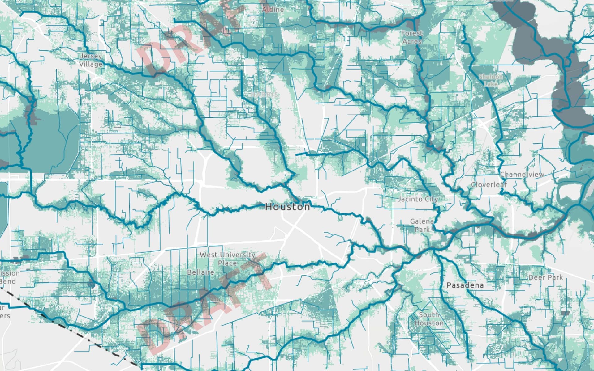
At least 6,556 Harris County homes have been removed from FEMA floodplains over the past decade, a change that can alter insurance costs, financing and how a property is judged by buyers. Those removals came through 456 appeal cases, with the biggest concentration in newer subdivisions and wealthier pockets near Katy, Cypress, Humble and Tomball.
The cases ran through FEMA’s Letter of Map Amendment process, which applies when a structure or parcel sits on naturally high ground, and the Letter of Map Revision Based on Fill process, which applies when land was raised with added dirt. FEMA allows an owner, renter or lessee to submit mapping and survey information to request an official change, but flood-policy experts have said the process can be expensive and time-consuming because it often requires a surveyor or engineer.
That cost barrier matters in Harris County because the stakes are immediate. FEMA says the Special Flood Hazard Area is where floodplain regulations are enforced and where mandatory flood-insurance purchase rules apply. Homes and businesses in high-risk flood areas with government-backed mortgages are required to carry flood insurance, and FloodSmart says most homeowners insurance does not cover flood damage. A property removed from the floodplain can therefore move out from under those requirements, even as it still sits in a county where flooding remains a defining threat.
The appeal pattern also suggests that money and expertise played a role in who could challenge the maps successfully. The typical home removed from the floodplain was worth about $100,000 more than the median single-family home in Harris County, pointing to a process used disproportionately by homeowners with more resources. The changes were not spread evenly across the county; they clustered in places where new development has pushed outward and where homeowners have been able to document that a lot or house no longer met the floodplain threshold.
The removals sit alongside a larger fight over how Harris County is mapped. The Harris County Flood Control District says FEMA’s MAAPnext effort reflects changing conditions in the county, including more than a 30% increase in rainfall rates, updated topography and advanced modeling. After major storms between 2015 and 2017, including Hurricane Harvey, the district said it became clear old maps were not fully reflecting flood risk.
That backdrop makes the latest map battles even more consequential. In February, draft FEMA maps were projected to require flood insurance for about 170,000 more Harris County homes, while Harris County scored a perfect 100 on FEMA’s hurricane-risk ranking. As FEMA redraws broad areas of exposure, thousands of individual homeowners have already used the federal appeals process to push their own properties out of mapped floodplains, parcel by parcel.
This article was produced by Prism’s automated news system from verified source data, official records, and press releases, then run through automated quality and moderation checks before publishing. The system is built and supervised by the people who set the standards it runs under. Read our full AI policy.
Did this article answer your question?