Tornado watch issued for Spring Hill, Weeki Wachee as shelf cloud rolls in
A tornado watch covered Spring Hill and Weeki Wachee until 6 p.m. as a shelf cloud pushed in from the Gulf, with 65 mph gusts and quarter-size hail possible.
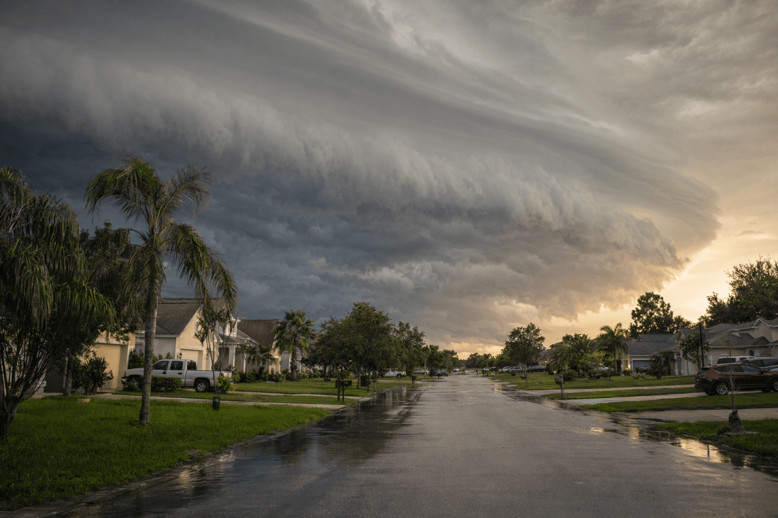
Residents in Spring Hill, Weeki Wachee and across Hernando County had until 6 p.m. EDT to be ready for a Tornado Watch that carried the risk of tornadoes, 65 mph gusts and quarter-size hail. The same storm line that sent a massive shelf cloud rolling in from the Gulf could disrupt school pickup, afternoon commutes, outdoor plans and power reliability as storms swept through the county.
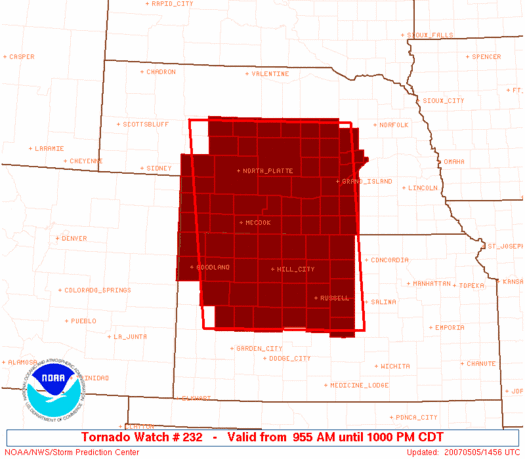
The National Weather Service said a tornado watch means conditions are favorable for tornadoes to develop in and near the watch area. A warning is different and more urgent: it means a tornado has been sighted or indicated by radar, and people should move to shelter immediately. For Hernando County, the watch included communities such as Spring Hill, Brooksville, Weeki Wachee, North Weeki Wachee and Shady Hills, all of which sit inside the Tampa Bay and Nature Coast weather zone watched by the NWS Tampa Bay office.
The Gulf-facing Weeki Wachee area drew particular attention as the shelf cloud advanced inland. The Weeki Wachee River runs west from the community to the Gulf of Mexico, and a dark, fast-moving cloud wall coming off the Gulf was a dramatic visual sign of the storm’s strength. In a county where severe thunderstorms can already bring damaging winds and hail, a line capable of producing 65 mph gusts raised the stakes well above a routine rainy afternoon.
The threat also fit a broader severe-weather pattern. The Weather Service says severe thunderstorm watches can include winds of 58 mph or higher and hail 1 inch or larger, which made the quarter-size hail risk and the stronger gust potential especially notable. That kind of wind can snap limbs, scatter debris and leave some neighborhoods without electricity, a particular concern for mobile homes, older housing and anyone trying to move quickly during the late-day rush.
Florida has a long tornado history, and NOAA’s national tornado records reach back to 1950, underscoring why even a short-lived watch can matter in Hernando County. If the watch were upgraded to a warning, the safest move would be immediate shelter in a pre-designated safe place, especially for anyone in a vehicle, mobile home or other vulnerable structure.
This article was produced by Prism’s automated news system from verified source data, official records, and press releases, then run through automated quality and moderation checks before publishing. The system is built and supervised by the people who set the standards it runs under. Read our full AI policy.
Did this article answer your question?