Holmes County’s Legacy Point Park turns landfill into trail destination
Legacy Point Park is more than a converted landfill: its parking, hitching rail and mapped loops show Holmes County planning for walkers, riders and everyday trail traffic.
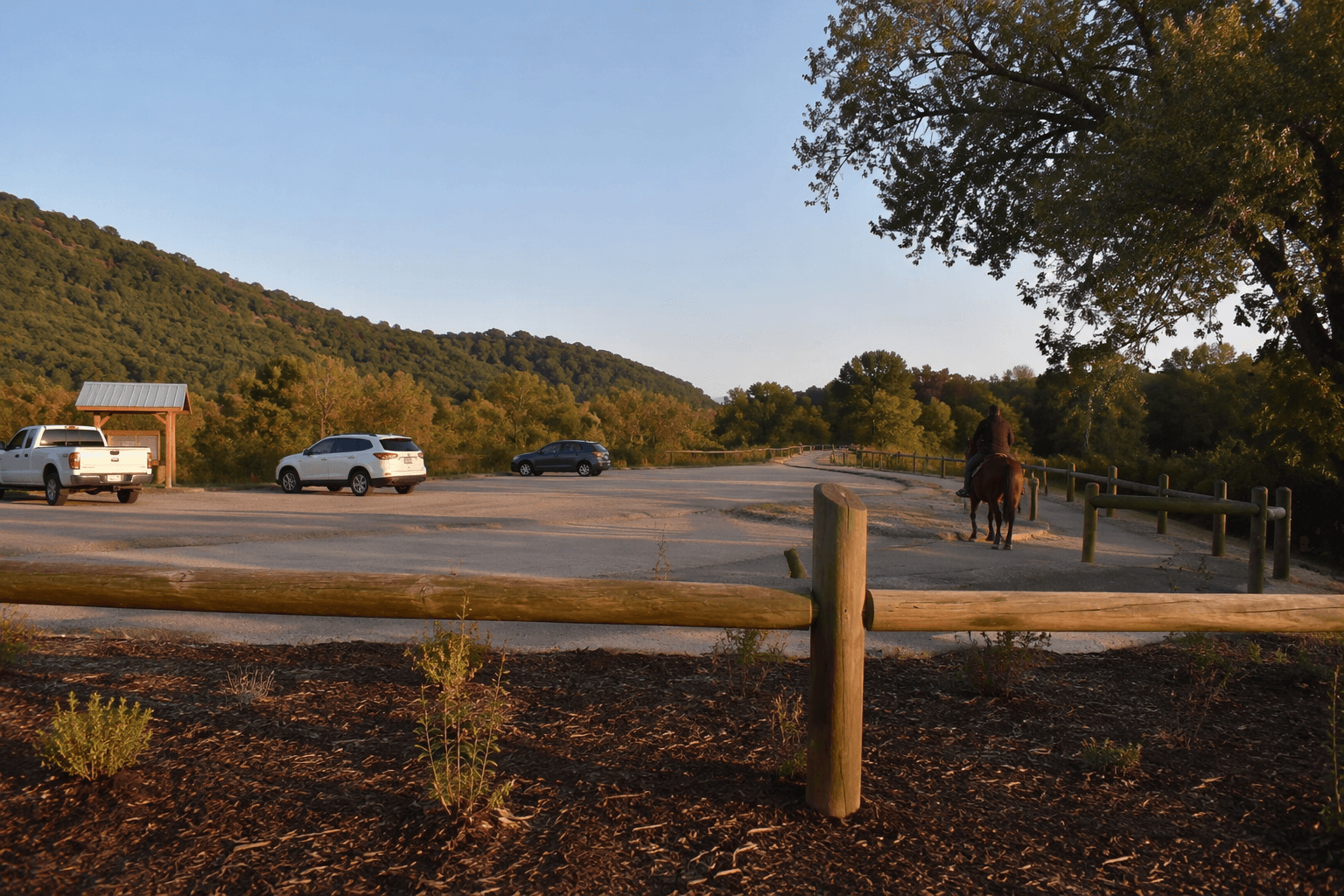
A map for Legacy Point Park in Millersburg shows parking, a kiosk, a restroom, a bike rack and a hitching rail, pointing to a site meant for families, school groups, hikers and horseback riders using the same reclaimed landscape.
A landfill turned into a trail destination
Legacy Point Park sits at 6601 Township Rd. 326 in Millersburg. It is the Holmes County Park District’s “newest park” with “primitive hiking trails.” The former Holmes County Landfill has been reworked into trail corridors and overlooks; by early January 2025, the conversion was nearly complete, and the district called it a park with multiple trails and an “incredible view.”
Jason Biltz, the park’s land manager, put the transformation plainly when he called it “turning trash into treasure.”
The map shows who the park is for
The strongest clue to Legacy Point’s purpose is the trail layout itself. The map identifies two parking areas, P-1 and P-2, which suggests the county expects different entry points and varied traffic rather than a single short loop. It also marks a bike rack and a hitching rail, a combination that reflects Holmes County’s unusual mix of visitors, from cyclists and walkers to riders arriving on horseback.
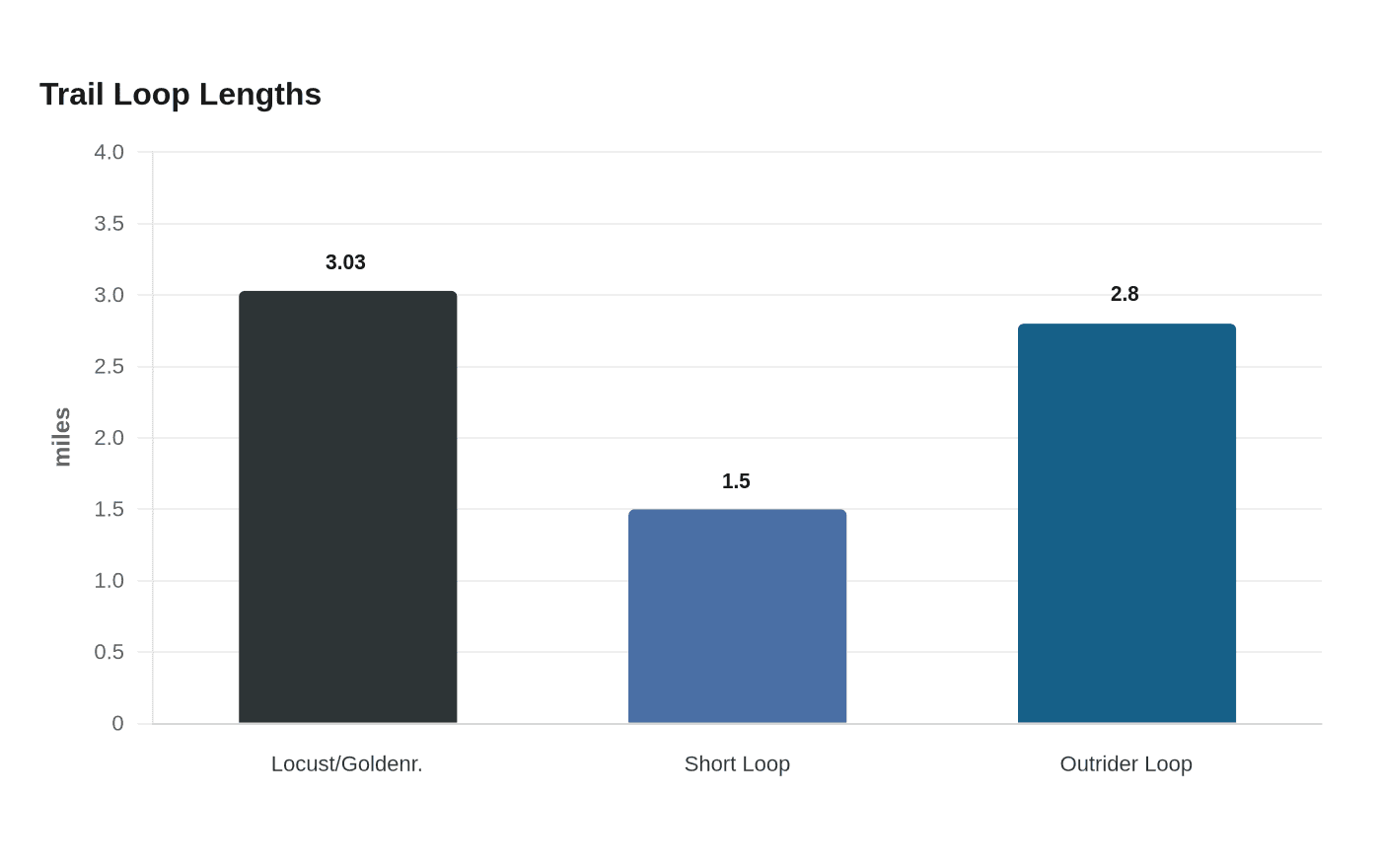
The named routes, Stairway to Heaven Gateway, Shale Pack, Locust Loop and Goldenrod, break the park into distinct use patterns instead of one undefined trail web. The hiking and walking loop using Locust Loop and Goldenrod is listed at 3.03 miles, while the shorter hiking and walking loop measures 1.50 miles. The Outrider Equestrian Loop, which uses Shale Pack and Gateway, is listed at 2.80 miles. At the top of the cap, the map shows an elevation of 1,227.00 feet.
The 1.50-mile route gives school groups, families and casual visitors a manageable walk. The longer loops create enough distance for people who want a fuller outing, while the hitching rail and equestrian loop make clear that horses are not an afterthought. Even the kiosk and restroom or portajon support on-site use.
How Legacy Point fits the county trail network
Legacy Point is not being built in isolation. The Holmes County Trail offers more than 26 miles of paved scenic pathways used by bicyclists, pedestrians, horseback riders and buggies. The new four miles of trail between Glenmont and State Route 520 are open, extending the county’s trail network beyond the park boundary and making Legacy Point part of a larger recreation and transportation system.
Trail design in Holmes County has to accommodate multiple forms of travel at once. Buggies, horses, bikes and foot traffic all share public space. The new park helps fill in that network with a site designed around trails first.
Plan a visit around the rules and the county office
The trail may only be used during open hours of 5 a.m. to 10 p.m. Motorized vehicles are prohibited except for emergency vehicles, maintenance vehicles, class 1 and 2 e-bikes, and electric wheelchairs used by people with a documented disability. The map is informational only, and users assume all risk.
Jen Halverson is the county contact. The district office is at 1 Trail Dr. Suite A, Millersburg, OH 44654, with phone number (330) 674-3353 and fax (330) 674-9535. Office hours are 8:30 a.m. to 4:30 p.m. Monday through Friday.
This article was produced by Prism’s automated news system from verified source data, official records, and press releases, then run through automated quality and moderation checks before publishing. The system is built and supervised by the people who set the standards it runs under. Read our full AI policy.
Did this article answer your question?