Holmes County's Updated Plat Book Offers Improved Mapping and Property Data Tools
The 2026 Holmes County Plat Book is $25 at OSU Extension in Millersburg, with LiDAR 3D aerial maps, seven municipality layouts, and digital SmartMap and eBook options now available.
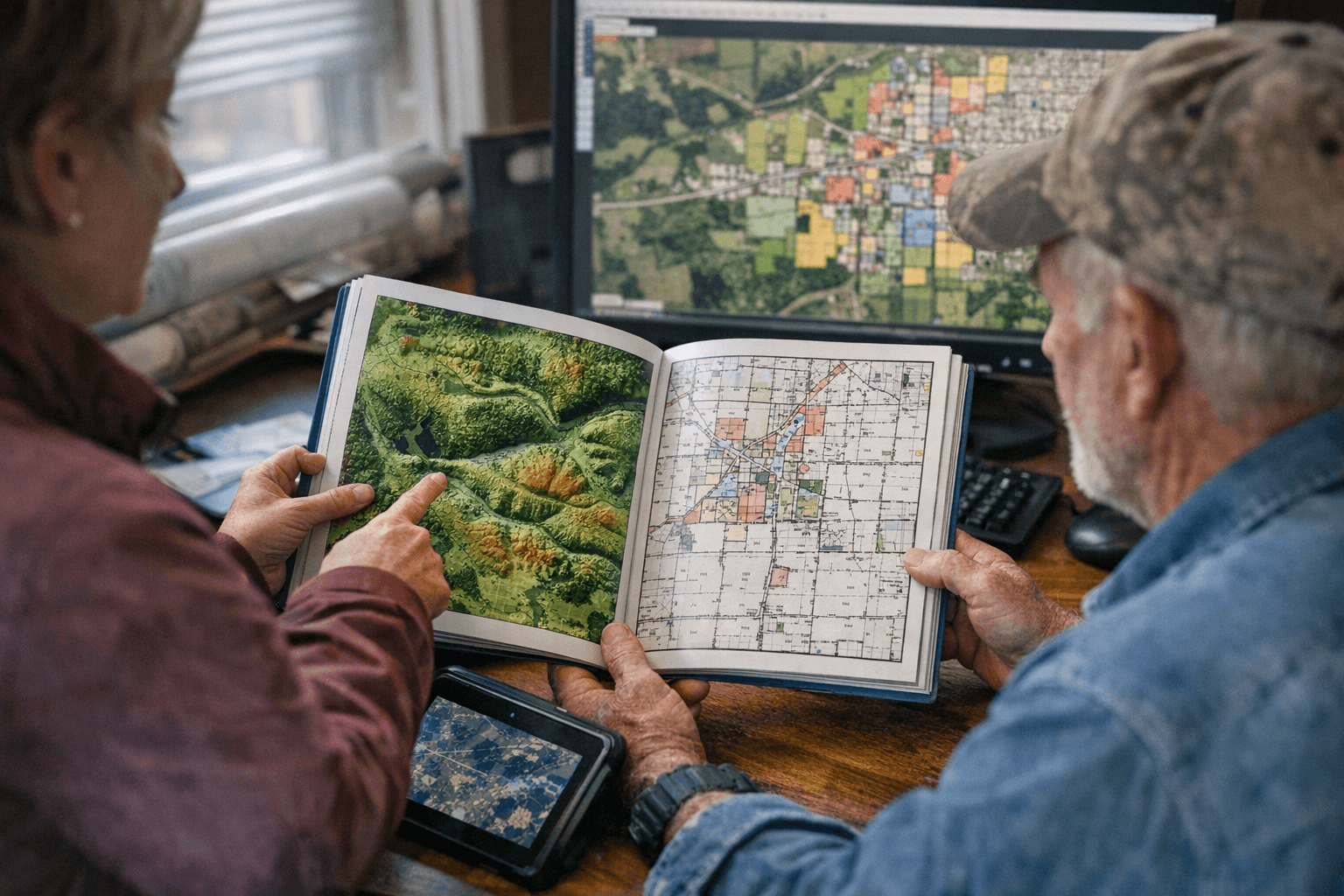
The 2026 Holmes County Plat Book is on shelves now at the OSU Extension Holmes County office, 111 E. Jackson St. in Millersburg, priced at $25. Produced jointly with Mapping Solutions, the spiral-bound, full-color volume covers every rural parcel in the county with current owner names, acreage figures, and property boundaries mapped across all townships and ranges.
This year's edition adds LiDAR aerial imagery paired opposite each standard landownership page. Those maps use elevation data from the USGS National Elevation Dataset to generate a 3D topographic rendering of local terrain, giving anyone sorting out a fence line, scouting timber, or comparing acreage on a potential purchase a ground-level read of the land before ever setting foot on it. The book also includes a watersheds map, a county road map, a full road index, a landowner index, and individual municipality maps for Berlin, Glenmont, Holmesville, Killbuck, Millersburg, Nashville, and Walnut Creek.
Two digital formats extend the book beyond the printed page. The SmartMap, built for smartphones and tablets, taps the device's GPS to display the user's real-time position on the map and supports distance and area measurement, points of interest, and photo notes in the field. An eBook version delivers the same content for tablets, laptops, or desktop computers. Premium wall maps and both digital formats are available through Mapping Solutions at mappingsolutionsgis.com.
Buyers who register are entered for a chance to win a free premium wall map or a SmartMap. Drawings are scheduled for May 15. To order a copy by mail, call 330-674-3015; mailed orders carry an additional fee beyond the $25 base price.
The landowner and road indexes together allow quick cross-referencing of an owner's name against a specific section and township, a practical shortcut for anyone working through a boundary question, a property sale, or an access dispute across Holmes County's mix of Amish farmland and rural acreage.
This article was produced by Prism’s automated news system from verified source data, official records, and press releases, then run through automated quality and moderation checks before publishing. The system is built and supervised by the people who set the standards it runs under. Read our full AI policy.
Did this article answer your question?

