Cal Fire Urges Caution After Dozens of Crashes in Humboldt, Del Norte
Cal Fire warned after a mid-February storm brought rain, hail and pockets of low-elevation snow, spawning dozens of crashes across Del Norte and Humboldt counties and prompting Del Norte‑Humboldt unit responses.
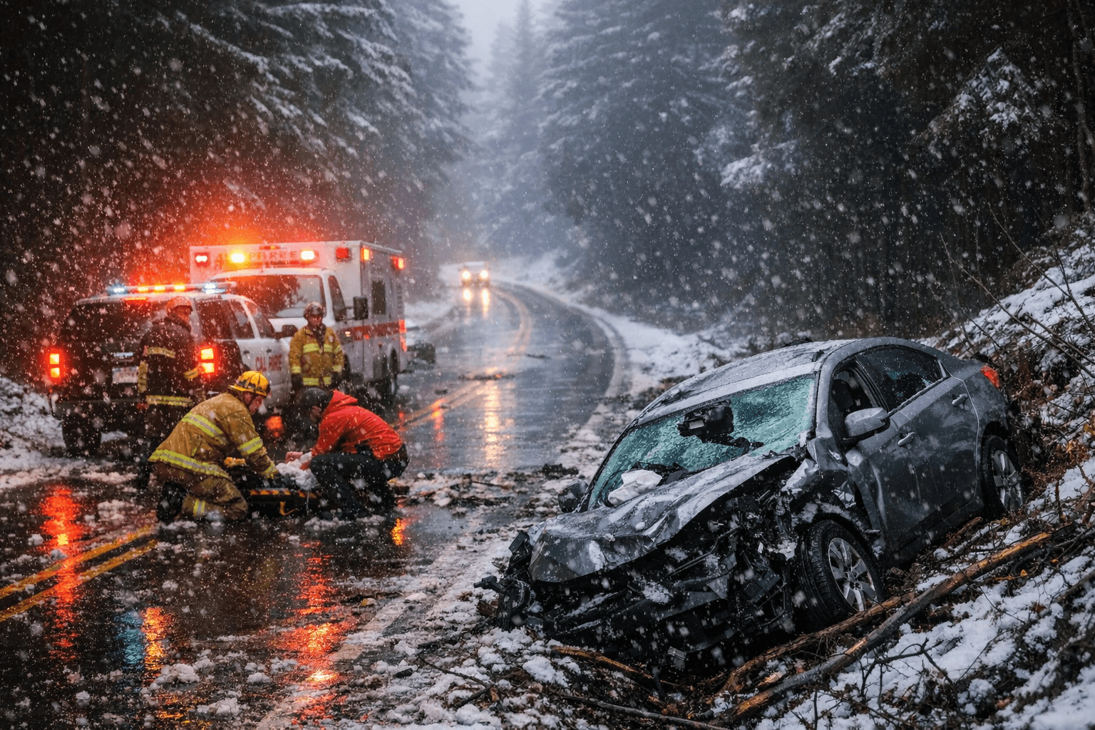
Cal Fire public information for the Del Norte‑Humboldt unit urged caution after a mid‑February weather event that brought rain, hail and pockets of low‑elevation snow to the North Coast and, officials said, spawned dozens of crashes across Del Norte and Humboldt counties. State and local fire officials reported a sharp uptick in weather‑caused traffic incidents, and in a two‑day span officials said crews in the Del Norte‑Humboldt unit responded to that spike in collisions.
The initial advisory from local and state fire agencies did not include a detailed incident-by-incident count or an injury total in the notice released with the unit alert; the advisory instead emphasized hazardous road conditions tied to rain, hail and isolated low‑elevation snow. The Del Norte‑Humboldt unit is the Cal Fire organizational area covering both counties and coordinates with California Highway Patrol and county fire departments on roadside rescue and traffic management.
Across the Plains, federal forecasters issued a separate string of warnings that underscored the mid‑February contrast in hazards nationwide. The National Weather Service issued red flag warnings across counties in Colorado, Kansas, New Mexico, Wyoming, Texas and Nebraska, and forecasters warned that conditions combining high winds, warmer temperatures and low humidity were elevating wildfire risk. "The warning means that critical fire weather conditions are either occurring now, or will shortly, forecasters said, and that the threat of fire is high in those areas and people should be both alert and proactive."
On Feb. 17 the Storm Prediction Center escalated outlooks for the central and southern High Plains, issuing its highest‑level Extremely Critical Fire Weather Outlook as a storm system moved out of the Rockies. That pattern produced hurricane‑force wind gusts, single‑digit humidity and volatile fire behavior potential, and multiple National Weather Service offices posted Red Flag Warnings with Particularly Dangerous Situation designations in several areas. NOAA/SPC graphics for Feb. 17 showed the most acute threat stretching from eastern New Mexico into the Texas and Oklahoma Panhandles and western Kansas.
Forecasters noted fuel conditions were already primed in the Plains because "poor overnight recoveries left fine fuels, dormant grasses, and surface litter, ready to ignite," and a National Interagency Coordination Center outlook issued on Feb. 2 had forecast above‑normal significant fire potential across much of the southern and central Plains and the northern Front Range of Colorado during February and March. A second day of heightened fire danger was forecast to follow on Wednesday, Feb. 18.
For people in areas under red flag warnings, officials listed clear precautions: "Do not burn outdoor fires," "Never leave a fire unattended," "Do not toss cigarettes on the ground," "Do not drive through dry vegetation," and "Keep grass and vegetation short and watered." Locally, Cal Fire's Del Norte‑Humboldt unit asked drivers to treat roadways as hazardous following the storm while crews completed crash responses and clearance operations. Federal forecasters continue to monitor the Plains threat into Feb. 18 even as North Coast crews address the wet‑weather impacts in Del Norte and Humboldt counties.
This article was produced by Prism’s automated news system from verified source data, official records, and press releases, then run through automated quality and moderation checks before publishing. The system is built and supervised by the people who set the standards it runs under. Read our full AI policy.
Did this article answer your question?